The North Cascades Highway is one of Washington’s most scenic mountain drives. It runs through North Cascades National Park, connects western and eastern Washington, and offers forests, waterfalls, alpine viewpoints, and high mountain passes along a single route.
- What is the North Cascades Highway?
- Why is this route famous?
- When should travelers drive it?
- How long does the drive take?
- What are the main stops?
- Newhalem and Diablo Lake
- What should drivers know about road conditions?
- What elevation and geography define the drive?
- What is the history of the highway?
- How should travelers plan a trip?
- What kind of trip does it support?
- Why does it matter for Washington travelers?
- What makes this drive evergreen?
- What should first-time visitors remember?
- Why is it a top Washington road trip?
What is the North Cascades Highway?
The North Cascades Highway is State Route 20 in Washington, a mountain road that crosses the North Cascades and links forested lowlands, alpine terrain, and the Methow Valley. It serves both as a transportation corridor and as a scenic travel route.
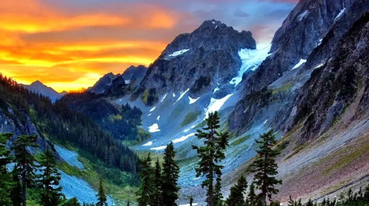
The highway covers one of the most dramatic landscapes in Washington. It passes through rugged peaks, deep valleys, river corridors, and high-elevation forest. Travelers use it to cross the state, but many drive it mainly for the scenery, trail access, and mountain viewpoints.
Why is this route famous?
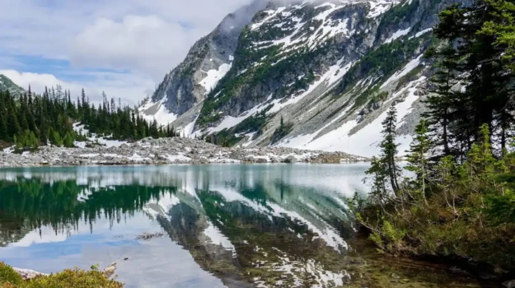
The route is famous because it compresses Washington’s mountain scenery into one drive. Travelers see waterfalls, glaciers, lakes, forest, and steep peaks without leaving the highway for long.
The road is known for its visual variety. One stretch can move from thick forest to open mountain overlooks in a short distance. That makes it especially popular with road trippers, photographers, hikers, and travelers looking for a classic Pacific Northwest experience.
When should travelers drive it?
The best time to drive the North Cascades Highway is when the road is open in spring, summer, and fall. Winter closure is common because of snow, ice, and avalanche risk.
Seasonal access is a major part of planning. The road does not stay open all year, and closure timing changes with weather. Travelers should treat the drive as a seasonal mountain route rather than a permanent east-west shortcut.
How long does the drive take?
A nonstop crossing takes about an hour, but most travelers need much longer because the road rewards frequent stops. A half-day or full-day trip is common.
The highway is not meant to be rushed. The best parts of the drive include scenic pullouts, short walks, overlooks, and visitor stops. Travel time grows quickly once you stop for photos, viewpoints, or nearby trails.
What are the main stops?
The main stops include the North Cascades Visitor Center, Newhalem, Gorge Creek Falls, Diablo Lake Overlook, Happy Creek Forest Walk, and Ross Lake overlooks. These stops cover education, short walks, waterfalls, and major scenic views.
Each stop adds something different to the trip. The visitor center provides background on the park. Newhalem offers history and easy access. Gorge Creek Falls gives a quick nature stop. Diablo Lake Overlook is one of the signature viewpoints on the route because of its bright blue-green water and mountain backdrop.
Newhalem and Diablo Lake
Newhalem is a useful stop for travelers who want services and short scenic walks near the highway. Diablo Lake Overlook is one of the most photographed places on the route because the lake color and surrounding peaks create a dramatic view. Together, they represent the mix of convenience and scenery that defines the highway.
What should drivers know about road conditions?
Drivers should expect a mountain road with weather changes, narrow sections, and seasonal closures. Checking road status before leaving is essential.
Conditions can change quickly in the North Cascades. Snow, ice, fog, and avalanche danger all affect travel. Even in the open season, drivers should allow extra time and stay alert, especially in higher elevations and on winding sections.
What elevation and geography define the drive?
Washington Pass is the highest point on the highway and one of the route’s defining landmarks. The drive rises into high mountain country and then drops into the drier eastern side of Washington.
That elevation shift explains the route’s scenery. The western side is wetter and more forested. The high pass brings alpine views. The eastern side opens into broader, sunnier landscapes. This contrast is a major reason the highway feels so memorable.
What is the history of the highway?
The highway’s history is tied to travel across the Cascades and the development of the North Cascades as a major recreation area. Its current identity combines transportation, recreation, and conservation.
The road became important because it created a practical way to cross a difficult mountain region. Over time, it also became known as one of Washington’s signature scenic drives. Today, it functions as both a state highway and a gateway into the North Cascades landscape.
How should travelers plan a trip?
Travelers should plan for fuel, food, weather, and time. A full tank, a flexible schedule, and an early start make the drive easier and safer.
Services are limited in mountain regions, so preparation matters. It is smart to bring water, snacks, layers, and a backup plan. Travelers who stop often get more value from the drive than those who try to move through it quickly.
What kind of trip does it support?
The route supports day trips, photography drives, hiking access, and longer Washington road trips. It works well for travelers who want mountain scenery without a complicated backcountry plan.
The highway is flexible. Some travelers use it for a simple scenic crossing. Others build a full day around viewpoints, short trails, and lakeside stops. That range makes it useful for families, couples, solo travelers, and regional road trippers.
Why does it matter for Washington travelers?
The North Cascades Highway matters because it connects two very different parts of Washington and gives travelers direct access to one of the state’s most dramatic landscapes.
For western Washington travelers, it offers a route into high alpine country. For eastern Washington travelers, it creates access to forested mountain terrain. For all travelers, it delivers one of the clearest examples of Washington’s natural range in a single drive.
Explore More Things to do
3-Day Olympic Peninsula Road Trip Itinerary for Washington Travelers
Seattle to Mount Rainier Road Trip Guide for Washington Travelers
What makes this drive evergreen?
This drive guide stays relevant because the road, the scenery, and the seasonal closure pattern remain consistent year after year. The main planning points do not change much, even though road status does.
That makes the topic ideal for long-term travel content. The important facts are stable: it is a mountain highway, it crosses a national park, it has major scenic stops, and it closes seasonally. Those core details keep the guide useful over time.
What should first-time visitors remember?
First-time visitors should remember three things: check road status, allow extra time, and stop at the main viewpoints. Those habits cover the biggest practical issues and the biggest scenic rewards.
The highway is at its best when treated as a scenic journey instead of just a route between destinations. Travelers who stop at the major overlooks and plan for mountain conditions usually get the strongest experience.
Why is it a top Washington road trip?
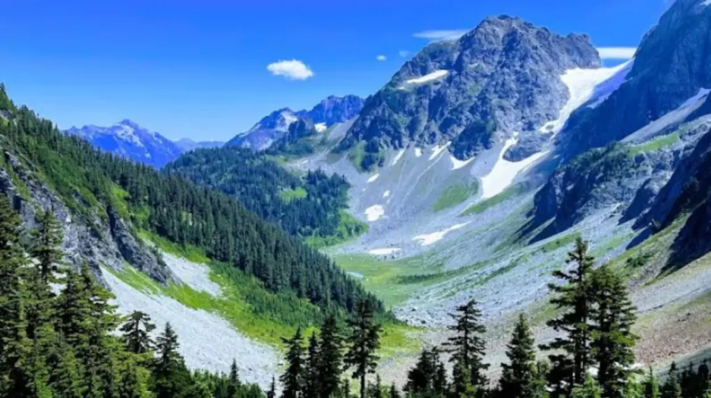
It is a top Washington road trip because it combines accessibility, national park scenery, and strong visual variety in one corridor. Few drives in the state offer so much mountain scenery so efficiently.
The road is also easy to understand and easy to market as a travel experience. It has a clear identity, strong landmarks, and broad appeal. That makes it one of the most dependable scenic drive topics for Washington-focused travel content.
Where is the North Cascades Highway located?
The North Cascades Highway is Washington State Route 20 (SR 20). It runs through the North Cascades region, connecting western Washington with eastern Washington across the Cascade Range.