Key Points
- Warm Finish to the Workweek: Western Washington will experience sunshine and temperatures rising into the mid-80s through Friday afternoon under high-pressure conditions.
- Seafair Cooldown: A weather front moving inland late Friday into Saturday brings cooler air, increased cloud cover, and scattered showers over the Seafair weekend.
- Coastal and Regional Impact: Rain chances are highest along the Washington Coast and Olympic Peninsula, though light scattered showers and a potential Puget Sound Convergence Zone may affect central Puget Sound.
- Breezy Conditions and Cascade Thunderstorm Risk: Saturday will bring southerly wind gusts of 20 to 25 mph across lowland areas, alongside a minor possibility of isolated thunderstorms near the North Cascades.
- Elevated Wildfire Danger East of the Cascades: Increased winds, low humidity, dry vegetation, and potential lightning have prompted a Fire Weather Watch across Central and Eastern Washington for Saturday.
- Rapid Early-Week Rebound: High pressure returns on Sunday, initiating a warming trend that will push temperatures back into the 80s and near 90 degrees by early next week.
Seattle (Evening Washington News) July 31, 2026 – Sunshine and warm summer temperatures are dominating Western Washington to conclude the workweek, but a shifting weather pattern will introduce cooler conditions, cloud cover, and a chance of showers across Puget Sound just as major Seafair weekend outdoor events get underway. According to meteorologist forecast reports from FOX 13 Seattle and KING 5 News, a Pacific weather system is tracked to push inland late Friday evening, replacing high pressure with an onshore flow that will reduce high temperatures from the mid-80s into the upper 60s and lower 70s through Saturday and Sunday. While light rainfall is not expected to significantly derail Seafair festivities, event organisers and attendees across King County will encounter markedly cooler and windier weather compared to the dry heat recorded earlier in the week.
- Key Points
- What Is the Detailed Forecast for Seattle Through Friday and Seafair Weekend?
- Where Will Rain and Thunderstorms Be Most Likely Across Washington?
- Why Is a Fire Weather Watch Issued East of the Cascades?
- How Quickly Will Warm Weather Return Next Week?
- Background of the Development
- Prediction for Affected Audiences
What Is the Detailed Forecast for Seattle Through Friday and Seafair Weekend?
As detailed by Meteorologist Claire Anderson of FOX 13 Seattle, high pressure remains firmly in control across Western Washington through Friday afternoon, maintaining dry conditions, minimal cloud cover, and afternoon peak temperatures climbing into the mid-80s.
Overnight low temperatures are forecast to drop comfortably into the upper 50s and lower 60s, providing natural night-time cooling across urban lowlands.
However, atmospheric dynamics will shift late Friday night into Saturday morning. As reported by Meteorologist Abby Acone of FOX 13 Seattle, an incoming upper-level trough pushing across the Pacific Northwest will drive cooler marine air inland.
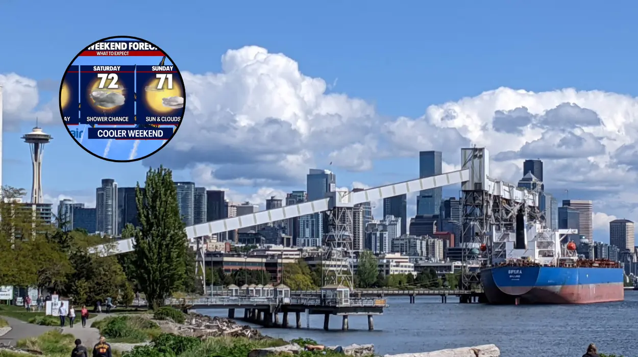
This maritime push will result in increased cloudiness, lower atmospheric heights, and a drop in daytime highs to around 71 degrees Fahrenheit on Saturday, August 1, and 69 degrees Fahrenheit on Sunday, August 2.
As noted in regional reports from the KING 5 Weather Team, Saturday morning will mark the transition point where cloud cover thickens along the coast before progressing into the interior valleys. Although the chance of measurable precipitation in central Seattle remains modest, localized shower activity cannot be ruled out during peak afternoon hours.
Where Will Rain and Thunderstorms Be Most Likely Across Washington?
Precipitation distributions will vary substantially depending on geographic proximity to the Pacific Coast and major mountain ranges.
As stated by Meteorologist Claire Anderson of FOX 13 Seattle, the most consistent rainfall amounts will be concentrated along the Washington Coast and across the Olympic Peninsula, where marine moist air first makes landfall.
For the Puget Sound lowlands, meteorological models indicate the potential development of a Puget Sound Convergence Zone on Saturday.
This microclimate phenomenon occurs when westerly winds are split by the Olympic Mountains and collide over Snohomish or Northern King counties, creating concentrated bands of clouds, localized showers, and slightly heavier precipitation over specific neighbourhoods while adjacent areas remain dry.
Furthermore, as highlighted in weather bulletins by FOX 13 Seattle, atmospheric instability associated with the passing trough will generate a slight chance of isolated afternoon thunderstorms over the North Cascades on Saturday.
While lowlands are expected to remain free of lightning, mountain hikers, campers, and recreationists are advised to remain vigilant regarding sudden cloud development and localized convective activity at higher elevations.
Why Is a Fire Weather Watch Issued East of the Cascades?
While Western Washington benefits from marine air and dampening showers, areas east of the Cascade Mountains will face contrasting environmental challenges. As reported by FOX 13 Seattle weather analysis, a Fire Weather Watch has been officially issued for most Central and Eastern Washington counties for Saturday.
The arrival of the cold front will enhance pressure gradients across the state, generating gusty winds through mountain passes and eastern valleys. When combined with low relative humidity levels, dry fuels, and the potential for dry lightning from isolated high-based storms, wildfire risk increases dramatically across Central and Eastern Washington.
Local emergency management agencies have urged residents and visitors in affected eastern counties to exercise extreme caution with outdoor flammable materials and campfires.
How Quickly Will Warm Weather Return Next Week?
The weekend weather system represents a brief interruption to summer weather patterns rather than a permanent seasonal shift.
As detailed by Meteorologist Abby Acone of FOX 13 Seattle, high pressure is projected to build rapidly back over the Pacific Northwest starting Sunday afternoon, initiating a steady clearing trend and clearing out residual cloud cover.
Temperatures will begin climbing on Sunday, reaching near 70 degrees, before recovering significantly into the mid-70s on Monday, August 3.
By Tuesday, August 4, and Wednesday, August 5, daytime highs across Western Washington are forecast to return to the mid-to-upper 80s, with inland thermal troughs potentially bringing temperatures near 90 degrees Fahrenheit in warmer lowland locations.
Background of the Development
Seafair is Seattle’s premier summer festival, a multi-week celebration dating back to 1950 that culminates annually during the first weekend of August.
The flagship weekend events center around Lake Washington and Genesee Park, featuring the Boeing Seafair Air Show—headlined by the U.S. Navy Blue Angels—alongside the hydroplane boat races and large-scale public outdoor gatherings.
Weather conditions historically play a critical role in the logistical execution and attendance figures of Seafair weekend. Clear skies and high visibility are required for full high-altitude flight demonstrations by military jet teams, while wind speeds and water surface choppy conditions directly affect hydroplane race safety and timing.
Seattle’s late-July and early-August climate is typically the driest period of the calendar year, making sudden marine pushes and convergence zone shower activity notable operational factors for event organisers, maritime spectator fleets, and municipal public safety teams.
Prediction for Affected Audiences
The forecast shifts over Seafair weekend will directly impact several key demographic groups and public sectors across the Puget Sound region:
- Festival Attendees and Outdoor Spectators: Thousands of spectators attending air shows, boat races, and community parades will experience significantly cooler surface temperatures and gusty winds, particularly along the Lake Washington shoreline on Saturday. Attendees will need to prepare for variable cloudiness and carry light rain gear, though widespread event cancellations remain improbable.
- Aviation and Maritime Operators: Flight demonstration teams, including the U.S. Navy Blue Angels, may adjust flight profiles from high-altitude routines to low-altitude “flat” shows if cloud ceilings drop significantly during peak Saturday shower activity. Similarly, boaters anchored on Lake Washington will encounter choppier water conditions and gusty southerly winds up to 25 mph, necessitating increased anchor vigilance.
- Agricultural and Emergency Services East of the Cascades: Fire response agencies in Eastern and Central Washington will operate under heightened operational readiness due to the Fire Weather Watch. Reductions in humidity combined with gusty frontal winds elevate the potential for rapid wildfire spread, impacting agricultural operations and rural land management through the weekend.