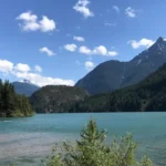
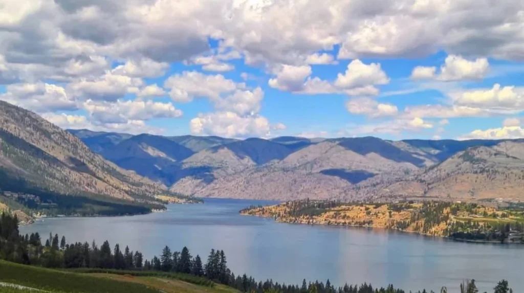
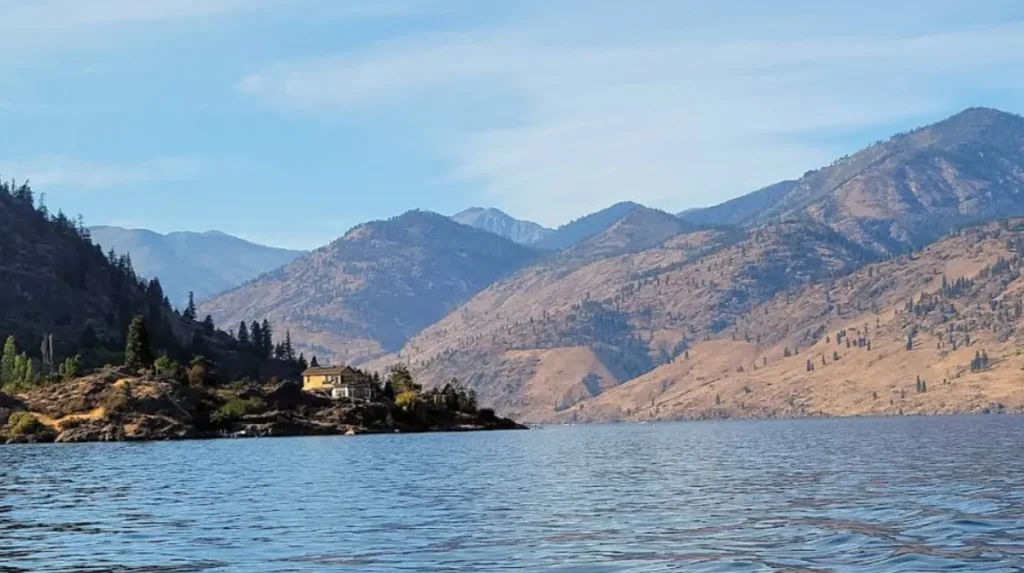
Lake Chelan is a glacially carved, ultra-deep freshwater lake located in north-central Washington within Chelan County. This body of water occupies a narrow, steep-sided trough stretching 50.5 miles from the high alpine wilderness of the Cascade Range down to the arid, sun-drenched terraced benches of the Columbia River Valley. The lake spans an average width of 1.3 miles and plunges to a maximum depth of 1,486 feet, establishing it as the third deepest lake in the United States and the 25th deepest lake globally.
- What Is the Geological and Historical Origin of Lake Chelan?
- How Does the Lake Chelan Basin Function Hydrologically?
- What Makes the Lake Chelan Wine Terroir Unique?
- What Aquatic and Wilderness Adventures Shape the Upper Lake?
- How Is the Lake Chelan Region Navigated and Scheduled throughout the Year?
- What Are the Environmental Challenges and Future Preservation Initiatives facing Lake Chelan?
The geographic position of Lake Chelan creates an ecological and climatic intersection where two distinct geographical regions converge: the rugged North Cascades wilderness and the agricultural shrub-steppe interior of eastern Washington. This spatial transition enables two primary economic and recreational industries to thrive concurrently within a single geographic basin: high-performance aquatic recreation and cold-moderated, high-latitude viticulture. The surrounding area comprises a 24,040-acre federally designated American Viticultural Area (AVA) that operates in tandem with a multi-tiered tourism infrastructure focused on watersports, backcountry aviation, and wilderness trekking.
Understanding the structural, historical, and geological framework of the Lake Chelan basin requires analyzing the natural and anthropogenic processes that transformed a deep mountain chasm into a nationally recognized destination for enotourism (wine tourism) and aquatic adventure.
What Is the Geological and Historical Origin of Lake Chelan?
Lake Chelan originated from repetitive Pleistocene glacial cycles over the past one million years, where converging continental and alpine ice sheets over-deepened a structural mountain valley. The region was historically managed by the Interior Salish Chelan people before 19th-century settlement.
The structural basin of Lake Chelan is an over-deepened glacial trough carved out of metamorphic and igneous bedrock formations, primarily gneiss and migmatite belonging to the Chelan Complex. During the last glacial maximum approximately 17,000 to 14,000 years ago, the Skagit Lobe of the Cordilleran Ice Sheet advanced southward from western Canada into the north-central region of modern Washington. Simultaneously, high-elevation alpine glaciers advanced from the crest of the Cascade Range down through the Stehekin Valley.
These two massive ice bodies converged near an area known as The Narrows, a structural constriction where the lake narrows to 0.35 miles wide. The Skagit Lobe ice sheet reached a thickness exceeding 1 mile, exerting immense hydrostatic pressure and grinding force onto the valley floor. This process excavated the bedrock floor of the upper basin to an absolute depth of 436 feet below sea level, a phenomenon known as glacial over-deepening. When the glaciers retreated approximately 10,000 years ago, they left behind a terminal moraine (a dam of rock debris and glacial till) at the southeastern terminus, which naturally impounded the meltwater to form the modern lake.
Following the glacial retreat, the first human populations established permanent settlements along the shorelines. The indigenous inhabitants were the Chelan people, an offshoot band of the Wenatchi Tribe who spoke a distinct dialect of the Interior Salish language. The indigenous name for the water body was Tsill-ane, which translates directly to “deep water” or “deep notch.” The Chelan people operated a primary year-round winter village named Yenmusi Tsa (meaning “rainbow robe”) at the natural outlet of the lake, where the modern city of Chelan stands.
The Chelan population developed a seasonal, mobile subsistence strategy based on three distinct resource gathering practices: harvesting root crops and river fish in the spring, picking montane huckleberries in the subalpine zones during late summer, and hunting large ungulates (such as mule deer and mountain goats) using complex brush-fence drive systems in the autumn. They utilized the 50.5-mile waterway as a navigable highway, paddling dugout cedar canoes to the head of the lake to access high-altitude mountain passes for trans-cascade trade with coastal tribes like the Skagit people, exchanging interior mountain goat wool for marine shells and dried coastal clams.
Euro-American contact began between 1811 and 1813 when fur trapper Alexander Ross explored the area for the Pacific Fur Company. The late 19th century brought rapid anthropogenic modification driven by three successive economic booms: hard-rock mining for copper, gold, and silver in the northern Holden and Stehekin areas, commercial logging of old-growth conifers, and the establishment of irrigated agriculture.
The federal government executed an Executive Order under President Rutherford B. Hayes in 1879 establishing the Columbia Reservation for Chief Moses and his followers, which included the north shore of the lake. However, intense lobbying by non-tribal miners and homesteaders forced the dissolution of the reservation in 1884. The land officially entered the public domain for white settlement on May 1, 1886.
Pioneers like William Sanders, Henry Domke, and Ignatius Navarre quickly established homestead claims and constructed the first commercial water-driven sawmills. To facilitate the transport of ore, timber, and agricultural goods across the 50-mile aquatic expanse, operators launched the first commercial steamboat, the Belle of Chelan, in 1888. This initiated the modern era of lake commerce and tourism.
How Does the Lake Chelan Basin Function Hydrologically?
The hydrology of Lake Chelan is defined by a two-basin system fed primarily by alpine glacial meltwater through the Stehekin River. The lake contains 4.66 cubic miles of water and exhibits an average water residence time of 10.6 years.
The total watershed of Lake Chelan encompasses a drainage basin of 924 square miles, with more than 90 percent of the catchment area consisting of protected, high-elevation alpine forest lands within the Okanogan-Wenatchee National Forest and North Cascades National Park. The lake contains an estimated water volume of 4.66 cubic miles (approximately 15.8 million acre-feet) and maintains a surface elevation of approximately 1,100 feet above sea level.
Hydrologically and bathymetrically, the lake is divided into two distinct sub-basins separated by an underwater bedrock sill at The Narrows:
- The Lucerne Basin: This is the upper, northwestern basin. It measures 38 miles in length, features an average depth of 1,148 feet, and holds 92 percent of the lake’s total water volume. It contains the maximum depth of 1,486 feet.
- The Wapato Basin: This is the lower, southeastern basin. It measures 12 miles in length, features a maximum depth of 400 feet, and holds 8 percent of the total water volume.
An average annual inflow of 2,200 cubic feet per second enters Lake Chelan. The hydrological input relies almost entirely on snowpack melt and glacial runoff originating from the high Cascade peaks. Two primary tributaries supply approximately 75 percent of the total annual water input: the Stehekin River delivers 65 percent of the total volume with an average annual flow rate of 1,401 cubic feet per second, while Railroad Creek contributes approximately 10 percent. The remaining inputs derive from small, steep creeks, including First Creek, Twenty-Five Mile Creek, and Grade Creek.
The outflow of the lake was historically the short Chelan River, which plunged 401 feet over a steep rocky gorge over a 4-mile course before emptying into the Columbia River. In 1927, the Washington Water Power Company (now Avista Utilities) constructed the Lake Chelan Dam at the structural foot of the lake. This gravity concrete structure stands 40 feet high and functions as a hydroelectric facility capable of generating 59.2 megawatts of electricity.
The dam regulates the top 21 feet of the lake’s water level as a reservoir, drawing down the water surface during the winter months to create flood storage capacity for spring runoff, and filling the reservoir to full pool by late June to maximize summer recreation and power generation capabilities. Because of the vast volume of the upper Lucerne Basin, water molecules remain inside that specific basin for an average of 10 years before moving south, whereas the shallower Wapato Basin exhibits a rapid water residence time of 0.8 years.
What Makes the Lake Chelan Wine Terroir Unique?
The Lake Chelan AVA is distinguished by a frost-moderating lake effect that extends the regional growing season and unique, basalt-free soils composed of coarse glacial till, quartz, mica, and volcanic ash pumice.
The federal government established the Lake Chelan AVA on May 30, 2009, as a distinct sub-appellation completely enclosed within the macro-scale Columbia Valley AVA. The designated viticultural boundary encompasses 24,040 total acres wrapping around the southern and eastern shorelines of the Wapato Basin, with approximately 300 to 350 acres actively planted with commercial wine grapes. The viticultural infrastructure includes more than 40 independent vineyards and 40 operational commercial wineries.
The primary element defining the terroir is the “lake effect,” a meso-climatic phenomenon caused by the thermal mass of the lake’s 4.66 cubic miles of water. Because water has a high specific heat capacity, the deep lake acts as a massive solar heat sink during the summer months, absorbing thermal radiation.
During the autumn and winter, the lake slowly reradiates this stored heat into the surrounding atmosphere. This thermal regulation produces two specific microclimatic effects: it lowers daytime temperatures during the peak of summer, and it raises overnight temperatures during the frost-vulnerable spring and autumn seasons. This process extends the frost-free growing season to approximately 190 to 200 days annually, providing viticulturists with a buffer against early autumn freezes that strike adjacent interior valleys.
The second defining characteristic of the Lake Chelan AVA is its soil composition, which sets it apart from all other viticultural zones in eastern Washington. While the broader Columbia Valley AVA is dominated by slackwater slack-sediments deposited by the cataclysmic Missoula Floods over a basalt bedrock foundation, the Lake Chelan basin sits entirely north of the maximum flood boundary. The underlying bedrock consists of metamorphic gneiss and migmatite.
The topsoils consist of three distinct geological layers that occurred post-glaciation: coarse, sandy glacial till containing high concentrations of granular quartz and mica minerals; fine windblown loess; and a prominent top layer of volcanic ash and porous pumice deposited by multiple prehistoric eruptions of Glacier Peak, located 42 miles to the west.
This specific soil structure lacks restrictive clay horizons, which provides two viticultural advantages: it ensures rapid gravitational drainage that prevents root rot, and it forces grapevines to grow deep, complex root systems to find moisture. The abundant quartz and mica minerals impart a distinct, measurable acidic minerality to the harvested fruit, which preserves natural acidity during ripening.
Viticulturists within the AVA manage six primary grape varieties that are highly adapted to the local climate and soil structures:
- Syrah: A dark-skinned red grape that thrives on the sun-exposed, south-facing slopes of the lake, producing full-bodied wines with high tannin levels.
- Pinot Noir: A delicate, cool-climate red grape planted on high-elevation, north-facing slopes where the lake effect prevents heat-induced flavor degradation.
- Chardonnay: A versatile white grape that develops crisp green apple and stone fruit profiles due to the extended hang-time allowed by the lake’s thermal moderation.
- Pinot Gris: A white variety that thrives in the sandy, well-drained volcanic loams, retaining high natural acidity.
- Merlot: A resilient red grape that produces deep color and structured fruit notes on the lower terraced benches.
- Riesling: A cold-hardy white aromatic grape that leverages the high mineral content of the glacial till to produce dry, laser-focused white wines.
What Aquatic and Wilderness Adventures Shape the Upper Lake?
The upper Lake Chelan geography facilitates advanced deep-water boating, technical sailing, and multi-day wilderness backpacking within the remote, roadless alpine community of Stehekin and the North Cascades National Park.
The 50.5-mile length of Lake Chelan transitions from an arid, urbanized lakefront at its southern tip to an isolated alpine fjord bounded by glaciated peaks exceeding 8,000 feet in elevation at its northern terminus. Because the upper 30 miles of the lake feature vertical granite rock walls with few landing zones, watercraft operators must navigate specialized wind and depth conditions.
The thermal differential between the cool mountain air of the North Cascades and the hot air of the eastern Washington desert creates a reliable diurnal wind pattern known as a katabatic wind system. In the morning, cool air drains down the valleys from the northwest; by afternoon, intense solar heating in the south draws strong up-lake winds from the southeast, frequently generating 3-foot to 5-foot swells in the Lucerne Basin. These reliable air currents support competitive long-distance sailing and technical windsurfing.
The ultimate destination for deep-water transit is Stehekin, an unincorporated community of roughly 100 year-round residents situated at the mouth of the Stehekin River. Stehekin is completely roadless and inaccessible by automobile; visitors and residents must utilize one of three transportation modes: a 2.5-hour commercial ferry voyage via the Lady of the Lake vessel fleet, a private floatplane charter landing directly on the water surface, or a multi-day hike over the Cascade crest via backcountry trail networks.
Stehekin serves as the primary southern gateway to the North Cascades National Park complex, providing infrastructure for three categories of wilderness adventure:
- Long-Distance Backpacking: The Pacific Crest Trail (PCT) passes within 11 miles of the Stehekin valley floor, intersecting with the Stehekin Valley Road via shuttle buses, allowing thru-hikers to resupply. Additional technical trails, such as the 18.2-mile Chelan Lakeshore Trail, skirt the wilderness edge along the north shore from Prince Creek to Stehekin.
- Alpine Mountaineering: Climbers utilize Stehekin as a base camp to launch technical ascents of remote glaciated peaks, including McGregor Mountain, Goode Mountain, and Buckner Mountain.
- River and Lake Angling: The cold, nutrient-poor (oligotrophic) waters of the upper lake and the Stehekin River support populations of three primary salmonid species: landlocked Kokanee salmon, introduced Lake trout (Mackinaw) which grow up to 30 pounds in the deep trenches, and native Westslope cutthroat trout.
Explore More Things to do
Earthquake in Venezuela: Causes, Impact, Response, and Safety Guide
Spokane Winter Travel Guide: Things to Do in Washington State
How Is the Lake Chelan Region Navigated and Scheduled throughout the Year?
Travelers navigate the Lake Chelan region by utilizing State Route 97A and State Route 150 to access the lower basin, while coordinating seasonal ferry schedules to access the roadless northern wilderness.
The lower basin of Lake Chelan is highly accessible by road networks, centered around two distinct municipalities: the city of Chelan on the southeast shore and the city of Manson on the north-central shore of the Wapato Basin. Drivers from the Seattle metropolitan area travel 180 miles east via Interstate 90 or U.S. Route 2, connecting to State Route 97A along the Columbia River, and transitioning to State Route 150, which provides direct vehicular access to the southern shoreline.
To access the upper lake and the North Cascades wilderness, travelers must transition from vehicular transport to marine transit at the fields of the Chelan Boat Company docks. The company operates year-round commercial catamaran ferries—specifically the Lady of the Lake II and the high-speed Lady Express—which maintain scheduled daily stops at remote wilderness trailheads including Fields Point, Prince Creek, and Lucerne, before terminating at Stehekin.
The region experiences four distinct seasons that dictate tourism and ecological activities:
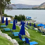
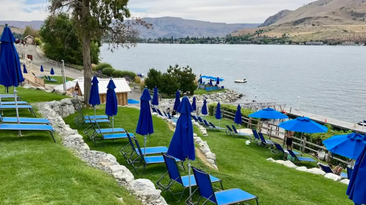
- Summer (June through August): This period features peak ambient air temperatures ranging from 78 to 90 degrees Fahrenheit, and 300 average annual days of sunshine. The lake surface temperature warms to 65 to 70 degrees Fahrenheit in the shallow Wapato Basin, driving peak water sports activity, including wakeboarding, parasailing, and jet-ski rentals. Wineries run at full capacity, hosting outdoor vineyard tastings and live music events.
- Autumn (September through November): This season is defined by the annual agricultural harvest. Vineyards execute “crush,” the intensive harvesting and pressing of wine grapes, which typically peaks between mid-September and late October. Ambient temperatures cool to 50 to 65 degrees Fahrenheit, and the mountain larches in the upper basin turn golden, drawing hikers and wine tourists who prefer lower crowd densities.
- Winter (December through February): Temperatures drop to 22 to 35 degrees Fahrenheit, accompanied by regular snowfall averaging 36 inches in the lower basin and over 150 inches in the upper mountains. The region transitions to winter sports; Echo Ridge Nordic Ski Area, located 10 miles over the town of Chelan, opens 25 miles of groomed cross-country ski and snowshoe trails. Wineries host the annual winter festival featuring outdoor ice sculptures and red wine tastings paired with open-fire pits.
- Spring (March through May): This transition period features temperatures rising to 55 to 70 degrees Fahrenheit as the winter snowpack melts, triggering high-volume whitewater flows down the Stehekin River. Vineyards experience “bud break,” the initial growth phase of the grapevines. Tourists arrive for the annual spring barrel tastings and spring wildflower blooms along the lower mountain trails.
What Are the Environmental Challenges and Future Preservation Initiatives facing Lake Chelan?
The future environmental stability of Lake Chelan is managed through strict water-quality monitoring of its oligotrophic status, wildfire mitigation programs within the surrounding national forests, and sustainable viticultural resource management.
Lake Chelan is classified as an ultra-oligotrophic lake, meaning it possesses low nutrient concentrations, low algal production, and exceptional water clarity, with visibility regularly extending down 40 to 50 feet in the upper basin. Because the lake has a prolonged water residence time of 10.6 years, any pollutants that enter the basin remain there for a decade, making the ecosystem sensitive to anthropogenic impacts.
The Washington State Department of Ecology and the Lake Chelan Water Quality Committee continuously monitor three primary metrics: total phosphorus levels, chlorophyll-a concentrations, and dissolved oxygen levels. The primary environmental challenge in the lower Wapato Basin is managing non-point source pollution from agricultural runoff and shoreline urban development.
To mitigate the influx of synthetic fertilizers and pesticides from adjacent orchards and vineyards, local conservation districts enforce Best Management Practices (BMPs). These initiatives include establishing lakeside vegetative buffer zones to filter surface water, and transitioning commercial viticulturists toward certified sustainable farming programs, such as the Sustainable WA certification. This framework restricts chemical usage and mandates precise drip irrigation systems to prevent groundwater contamination.
The second critical threat to the Lake Chelan watershed is the increasing frequency and intensity of catastrophic wildfires within the overstocked coniferous forests of the surrounding Cascade mountains. Over the past two decades, major wildfire events—including the 2015 Chelan Complex Fire and subsequent wilderness burns—have scorched tens of thousands of acres within the lake’s immediate catchment zone.
These fires remove the stabilizing forest canopy and root systems on steep mountainsides, causing two severe downstream ecological impacts during subsequent rain events: accelerated soil erosion leading to massive sediment deposits at tributary mouths, and elevated nutrient loading that can trigger localized toxic blue-green algal blooms in shallow bays.
To combat this threat, the U.S. Forest Service, the National Park Service, and the Washington Department of Natural Resources execute long-term landscape resilience strategies. These efforts include conducting controlled landscape burns during the damp spring months, executing mechanical thinning projects along urban-wildland interfaces, and enforcing strict campfire restrictions throughout the dry summer recreation season. These integrated aquatic and terrestrial preservation strategies ensure that Lake Chelan maintains its dual role as a pristine hydrological resource and an agricultural economic engine for future generations.
What is Lake Chelan?
Lake Chelan is a 50.5-mile-long glacial lake in north-central Washington. It is the third deepest lake in the United States, reaching a maximum depth of 1,486 feet, and is known for its clear water, mountain scenery, wineries, and outdoor recreation.