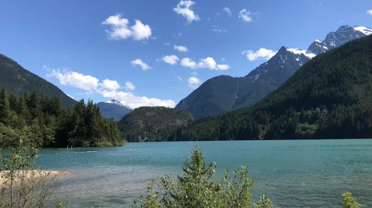
Diablo Lake Viewpoint is an elevated scenic overlook situated at milepost 131.7 on Washington State Route 20 within the Ross Lake National Recreation Area. The site provides panoramic, unobstructed views of the intensely turquoise, glacial-fed reservoir and surrounding mountain peaks.
- Why is Diablo Lake water turquoise?
- How was Diablo Lake formed?
- Where is Diablo Lake Viewpoint located?
- What can you see from Diablo Lake Viewpoint?
- When is the best time to visit Diablo Lake Viewpoint?
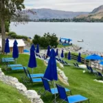
- What recreational activities are available near Diablo Lake?
- What are the ecological and infrastructure implications of Diablo Lake?
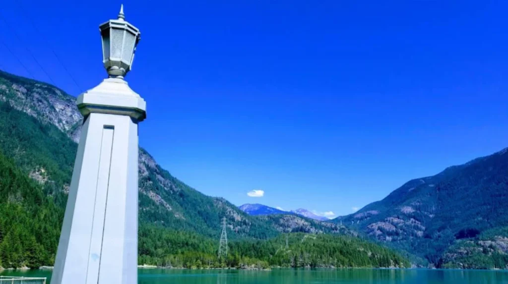
The viewpoint sits at an elevation of approximately 1,300 feet above sea level, looking down onto the 4.5-mile-long Diablo Lake, which has a surface elevation of 1,201 feet. The National Park Service manages this paved facility, providing amenities such as parking spaces for passenger vehicles and recreational vehicles, wheelchair-accessible walkways, picnic tables, and vault toilets.
The geographic feature viewed from this location is a reservoir created by the construction of the Diablo Dam on the Skagit River. The reservoir covers 900 acres and holds a water volume of 90,000 acre-feet. The site acts as a key educational waypoint, featuring multiple interpretive displays that detail the surrounding mountain ecology, geology, and human infrastructure.
Architecturally, the overlook is designed to accommodate heavy tourist traffic during the peak summer months without disrupting the alpine environment. Granite retaining walls line the viewing platforms, and safety railings extend along the edge of the steep drop-off. The area serves as a critical interpretive hub where visitors learn about the unique intersections of federal public lands, municipal utilities, and natural glaciology.
Why is Diablo Lake water turquoise?
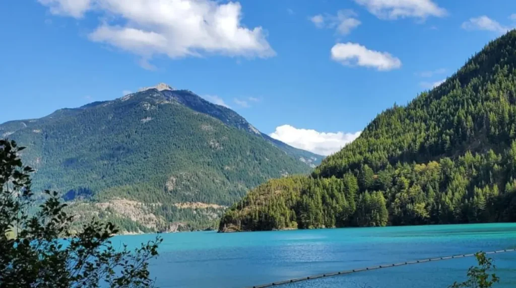
The distinct turquoise color of Diablo Lake results from the suspension of glacial flour, which consists of fine rock particles ground by moving glaciers. These microscopic particles remain suspended in the water and refract shorter wavelengths of light, specifically green and blue.
The process begins high in the surrounding mountains, where glaciers like the Colonial Glacier and Thunder Glacier grind down the underlying Skagit Gneiss Complex. This metamorphic rock is exceptionally hard, and the immense weight of the moving ice pulverizes the stone into a fine, powdery silt.
During the seasonal melting period, which spans July, August, and September, the meltwater transports this rock powder down mountain tributaries. The primary pathways include streams like Thunder Creek and Colonial Creek, which flow directly into Diablo Lake. Because the rock particles are microscopic, they do not settle rapidly to the bottom of the reservoir like larger gravel or sand. Instead, they remain suspended throughout the water column.
When sunlight strikes the surface of Diablo Lake, the water molecules naturally absorb longer wavelengths of light, such as red, orange, and yellow. The suspended glacial flour particles scatter and refract the shorter wavelengths, which are blue and green.
The intensity and exact shade of the turquoise color vary depending on three main variables: the volume of glacial meltwater input, the angle of the sun, and current weather conditions. Midday sun on a cloudless day in August yields the most vibrant, electric hue, whereas overcast winter days can make the water appear darker or muted green.
How was Diablo Lake formed?
Diablo Lake was formed artificially in 1930 by the completion of Diablo Dam, a concrete arch-gravity structure built across the Skagit River gorge. The project was executed by Seattle City Light to generate municipal hydroelectric power.
The creation of the lake belongs to a larger infrastructure initiative known as the Skagit River Hydroelectric Project. Initiated in the early twentieth century under the leadership of JD Ross, the superintendent of Seattle City Light, the project aimed to secure long-term electricity for the expanding city of Seattle.
The construction of Diablo Dam began in 1927 in a remote, rugged section of the Cascade Mountains. Workers faced immense logistical hurdles, requiring the construction of a dedicated railroad to transport concrete and machinery to the site. When completed in 1930, the dam stood 389 feet tall, making it the tallest dam in the world at that time. The structure officially became operational for power generation in 1936.
The dam intentionally blocked the natural flow of the Skagit River, flooding the narrow canyon behind it to form the 390-foot-deep reservoir now known as Diablo Lake. This construction permanently altered the regional geography, submerging old gorges and creating a stable body of water between two other hydro-project reservoirs: Ross Lake to the north and Gorge Lake to the south.
Today, the lake serves a dual purpose. It functions continuously as an active industrial facility that provides renewable energy to western Washington, and it serves as a major recreational destination protected within the National Park System.
Where is Diablo Lake Viewpoint located?
Diablo Lake Viewpoint is located in northern Washington State, within Whatcom County, along the North Cascades Highway. It is positioned inside the borders of the Ross Lake National Recreation Area, a unit managed by the National Park Service.
The viewpoint is situated approximately 130 miles northeast of Seattle and 60 miles east of Sedro-Woolley. Driving distances from major hubs vary: it takes roughly two and a half hours to drive to the overlook from Seattle, and about one hour from the eastern slope town of Winthrop.
The overlook is positioned at milepost 131.7 on State Route 20. This highway is a designated National Scenic Byway known as the North Cascades Scenic Highway, which traverses the Cascade Loop. The viewpoint lies at a geographic transition zone between the wet maritime ecosystem of western Washington and the dry continental climate of eastern Washington.
The exact coordinates of the viewpoint are 48°42’51”N and 121°7’52”W. It is situated on the northern side of the highway, allowing vehicles traveling in either direction to pull off safely into the dedicated parking zones. The surrounding terrain is dominated by steep mountain ridges, with Sourdough Mountain rising directly to the north and Davis Peak visible across the water to the south.
What can you see from Diablo Lake Viewpoint?
From Diablo Lake Viewpoint, visitors can see the expansive turquoise reservoir, the historic Diablo Dam, prominent mountain peaks, and several small forested islands. The vantage point offers a 180-degree view of the North Cascades wilderness.
Looking directly down from the stone walls, the primary feature is the winding body of Diablo Lake. The elevated perspective allows observers to see the unique shapes of the underwater topography and the deep channels where the water currents flow. Small, evergreen-covered landforms, such as Deer Island and Monkey Island, are clearly visible dotting the water’s surface.
To the far west, the top of the 389-foot Diablo Dam can be seen anchoring the reservoir. Beyond the dam, the steep walls of the Skagit Gorge drop away toward Gorge Lake. Surrounding the reservoir are several massive rock formations that define the North Cascades landscape, including colonial peaks and jagged ridgelines.
The vegetation visible from the overlook consists of dense, old-growth coniferous forests. The tree canopy includes three dominant species: Douglas fir, western red cedar, and western hemlock. On clear days, the visibility extends for miles, allowing visitors to glimpse alpine glaciers clinging to distant peaks, illustrating the active geological forces that shape the Pacific Northwest.
When is the best time to visit Diablo Lake Viewpoint?
The best time to visit Diablo Lake Viewpoint is from July through September during the middle of the day. This period offers maximum glacial melt for color intensity, clear weather, and guaranteed highway accessibility.
Seasonality is a critical factor due to alpine weather patterns. State Route 20 closes annually between milepost 134 and milepost 171 due to severe avalanche danger and heavy snowfall. This seasonal closure typically begins in late November and lasts until May or early June. Consequently, vehicle access to the viewpoint during winter and spring is completely blocked.
During the summer months of July, August, and September, environmental conditions align perfectly for sightseers. Higher summer temperatures accelerate the melting of nearby glaciers, which increases the inflow of glacial flour into the reservoir. This maximizes the turquoise saturation of the water.
Time of day also alters the visual experience. Early morning and late evening visits often catch the lake in deep shadow cast by the towering mountains, which diminishes the vibrant color. Visiting between 10:00 AM and 3:00 PM ensures the sun is high enough to penetrate the water column directly, reflecting the bright teal light back to the overlook.
Explore More Things to do
Best Day Trips from Spokane, Washington State
Spokane Historic District Guide: A Complete Architectural and Cultural Overview
What recreational activities are available near Diablo Lake?
Recreational activities near Diablo Lake include hiking alpine trails, kayaking or canoeing on the cold waters, camping at established sites, and participating in educational tours hosted by local environmental institutes.
Hiking is highly accessible from trails near the highway. The Diablo Lake Trail is a moderately difficult 7.6-mile round-trip route that climbs 1,300 feet along the northern shore, leading hikers through old-growth forests to a viewpoint of Ross Dam. For experienced mountaineers, the Sourdough Mountain Trail offers a strenuous 4,800-foot gain over 10 miles, culminating in an active historic fire lookout built in 1933.
Water recreation is popular but requires preparation. Boaters can launch watercraft at the Colonial Creek Boat Launch, located at the southern end of the lake. Kayaking, canoeing, and stand-up paddleboarding are common, though users must wear personal flotation devices. The water temperature rarely exceeds 50 degrees Fahrenheit, even in August, making swimming hazardous due to the rapid onset of cold-water shock.
Camping options are situated directly along the shoreline. The National Park Service operates the Colonial Creek Campground, which features 142 individual campsites divided into north and south loops. The North Cascades Environmental Learning Center, located on the northern shore, offers educational programs, guided skiff tours, and public seminars about the region’s natural history.
What are the ecological and infrastructure implications of Diablo Lake?
The ecological and infrastructure implications of Diablo Lake involve its critical role in clean energy production, the regulation of downstream river ecosystems, and the long-term impacts of climate change on glacial reservoirs.
As an infrastructure asset, the Diablo Dam powerhouse generates a significant portion of electricity for Seattle. It operates as part of a run-of-the-river system that utilizes three dams to capture power efficiently. The concrete barriers regulate water flow, providing critical flood control for lower Skagit Valley towns such as Concrete, Sedro-Woolley, and Mount Vernon.
Ecologically, the damming of the Skagit River altered the historical migration patterns of native fish species. Anadromous salmon species, including Chinook, Coho, and Pink salmon, cannot bypass the dams to reach upper spawning grounds. To mitigate this impact, wildlife agencies and utility companies manage strict water flow regimes below the dams to protect salmon redds (nesting sites) and maintain healthy water temperatures downstream.
The future of Diablo Lake is tied closely to global climate trends. Studies conducted by the National Park Service indicate that the North Cascades National Park Service Complex has lost over 50% of its glacial volume since 1900. As these glaciers disappear completely, the seasonal inflow of glacial flour will decrease, altering the lake’s signature color. Furthermore, changing melt patterns will impact winter power generation capacity and summer water availability across western Washington.
What is Diablo Lake Viewpoint?
Diablo Lake Viewpoint is a scenic overlook in the Ross Lake National Recreation Area along Washington State Route 20. It offers panoramic views of the turquoise waters of Diablo Lake, surrounding North Cascade mountains, and the historic Diablo Dam. The viewpoint includes parking, accessible walkways, picnic tables, interpretive displays, and restroom facilities.