North Cascades National Park is a federally protected wilderness area in northern Washington state covering 505,000 acres, managed by the U.S. National Park Service and part of the North Cascades National Park Complex.North Cascades National Park sits in northern Washington state along the U.S.–Canada border, roughly 75 miles northeast of Seattle by road. The park comprises three units: North Cascades National Park (backcountry-focused), Ross Lake National Recreation Area (lakes and reservoirs), and Lake Chelan National Recreation Area (lake-accessed backcountry). The park protects high alpine peaks, 300 glaciers, dense conifer forests, and deep river valleys. Federal designation occurred in 1968 under the National Park Service (NPS) with management coordinated across park units and shared boundary responsibilities with the U.S. Forest Service and state land agencies.
- What permits and regulations do I need to backpack in North Cascades?
- When is the best time to backpack in North Cascades National Park?
- What gear is essential for a beginner backpacking trip here?
- What are the main trailheads and routes suitable for beginners?
- How do I plan a safe itinerary and daily distances?
- What hazards should I prepare for in the North Cascades?
- How do I navigate glaciers and high passes safely?
- What water and food planning do I need for backpacking here?
- What leave-no-trace practices are required in the park?
- How do I handle river crossings and stream safety?
- What wildlife interactions should I expect and how to avoid conflicts?
- What are navigation best practices for beginners?
- How do I handle emergencies and rescues in the park?
- What sample itineraries work for first-time backpackers?
- What resources and references provide authoritative planning information?
- What are the environmental and long-term considerations for backpacking in the park?
What permits and regulations do I need to backpack in North Cascades?
Wilderness permits are required for all overnight stays; obtain free self-issued permits at ranger stations or ReserveAmerica for certain zones and follow NPS rules on campfires, food storage, and group size.All overnight trips inside the park’s designated wilderness require a wilderness permit. Self-issue permits at staffed ranger stations cover many entry points; ReserveAmerica handles quota zones and specific trailheads during high season. Group size limits are typically 12 people; party size restrictions apply in sensitive zones (example: seven people in some alpine zones). Campfire rules vary: most high-elevation zones ban campfires above certain elevations and in fragile alpine vegetation. Bear-resistant food storage is required where bears and marmots access campsites; the NPS enforces food caches, bear canisters, or suspended food protocols depending on area. Camp and travel restrictions protect riparian zones and fragile meadows; camping within 200 feet of water sources often has defined limits. Familiarize with NPS Leave No Trace regulations, seasonal closures, and special use permit requirements for guided or commercial operations.
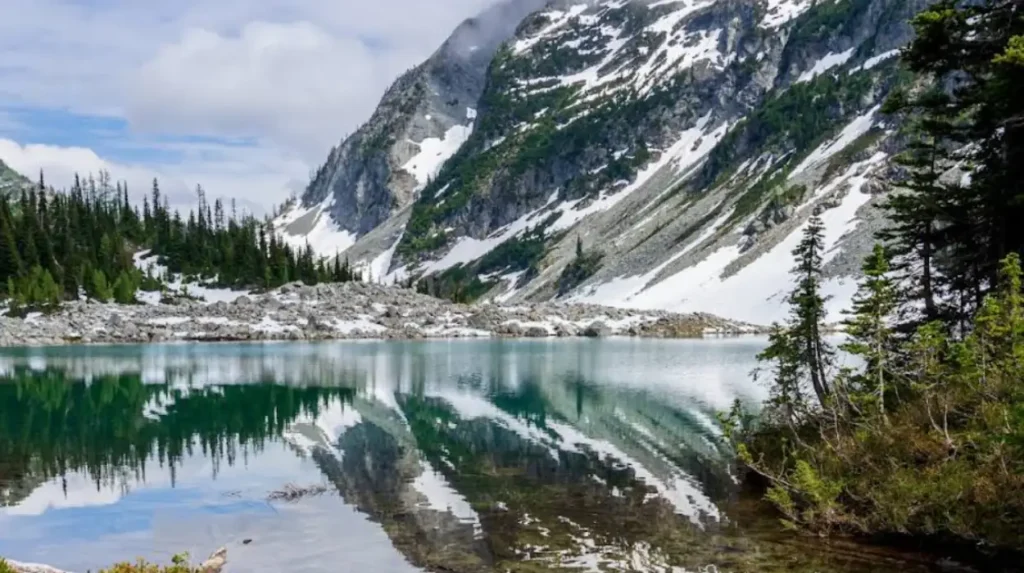
When is the best time to backpack in North Cascades National Park?
Late July through September offers the most reliable trail access, low snowpack, and open high passes; shoulder seasons require advanced snow skills and route-finding.Weather and snowpack determine access. Heavy snow persists at high elevations into July during average winters; official snow surveys and NPS seasonal access reports show most high passes melt by late July in average years. Peak wildflower displays occur late July through early August in alpine meadows. September brings clearer skies and cooler nights with reduced insect activity. Spring (May–June) and early summer require snow travel and glacier travel skills for many routes; late-season storms in October create rapid snow accumulation at elevation. Check updated NPS trail and road status, avalanche advisories from the Northwest Avalanche Center, and seasonal gate openings on Cascade River Road and State Route 20 (North Cascades Highway).
What gear is essential for a beginner backpacking trip here?
Essential gear includes a framed backpack, tent rated for expected conditions, sleeping system to 20°F, bear-resistant food storage (canister), map and compass, and a stove for cooking.North Cascades trips require gear for alpine weather variability. Pack selection: 50–70 L backpack for 2–5 day trips. Shelter: three-season tent with a waterproof rainfly; at higher elevations a four-season tent provides wind resistance. Sleep system: sleeping bag rated to at least 20°F (−6.7∘C) and insulated sleeping pad. Cooking: backpacking stove, fuel, and lighter; fires are limited in many zones. Food storage: approved bear canister or food bag suspension kit where required. Navigation: USGS topo maps, compass, and handheld GPS; download offline maps and carry route descriptions. Safety: first-aid kit, headlamp with extra batteries, repair kit, and emergency bivy. Weather and snow: microspikes, crampons, ice axe, and knowledge of glacier travel if route crosses glaciers. Water treatment: pump filter, chemical treatment, or UV purifier; many streams contain glacial silt requiring pre-filtering. Clothing: moisture-wicking base layers, insulating midlayers, waterproof-breathable shell, warm hat, and gloves. Footwear: sturdy backpacking boots or trail runners with ankle support depending on load and trail conditions.
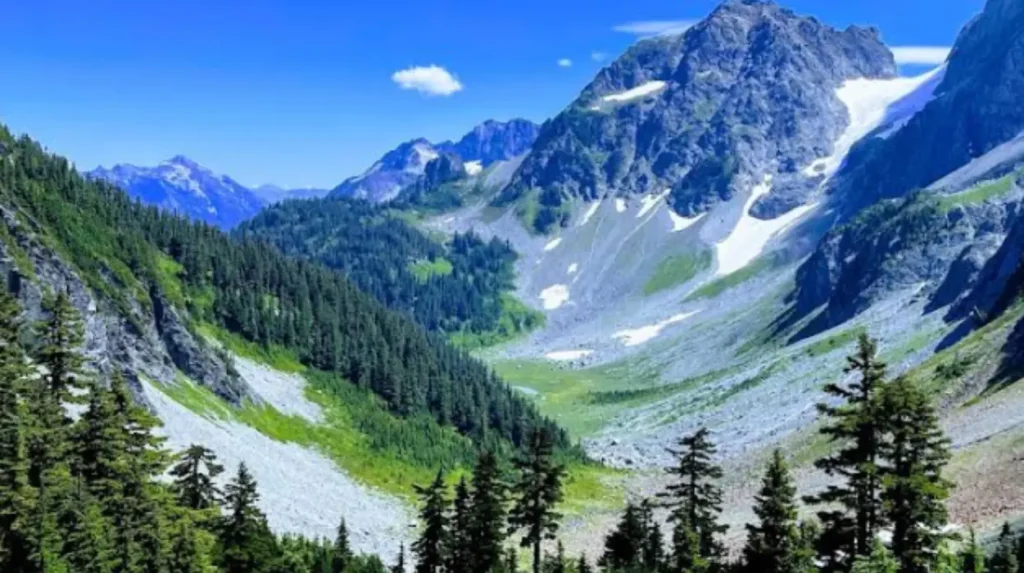
What are the main trailheads and routes suitable for beginners?
Beginner-friendly routes include the Cascade River Road approaches, Thunder Creek Trail to Copper Ridge, and portions of the Pacific Crest Trail crossing at Ross Lake.Trailhead options vary by access and difficulty. Cascade River Road (Shoreline Trailheads) provides lower-elevation loops and access to easy ridge viewpoints. Thunder Creek Trail runs 18 miles one-way along Thunder Creek with gradual elevation gain and established campsites; beginner parties commonly hike out-and-back sections (examples: Thunder Creek to Stehekin via Cascade River Road connections). Easy sections of the Pacific Crest Trail and North Cascades Scenic Trail near Ross Lake offer gentler grades and boat-accessed entry points. Lake Chelan National Recreation Area provides lake-shuttle access to lower-gradient corridors. Route choice depends on desired distance, exposure, and creek crossings. Beginners should select routes with established campsites, water sources, and minimal route-finding across loose talus or glacier terrain.
How do I plan a safe itinerary and daily distances?
Plan daily distances of 6–12 miles with 1,000–2,000 feet elevation gain per day, factor in weather delays, and include exit contingencies at trail junctions or ranger stations.Estimate pace using loaded-hiker averages: 2–3 miles per hour on moderate terrain and slower on steep or rocky sections. Factor time for campsite selection, water filtering, and route finding. Build a contingency day for weather or injury. Mark primary and secondary exit routes on maps and note distances to trailheads and road access points. Identify water availability for each planned campsite using NPS trail descriptions. File itinerary with park ranger or leave a detailed plan with a responsible person including expected return date and emergency contacts. Use daylight-hour planning: add 30 minutes per 1,000 feet of elevation gain for breaks and navigation.
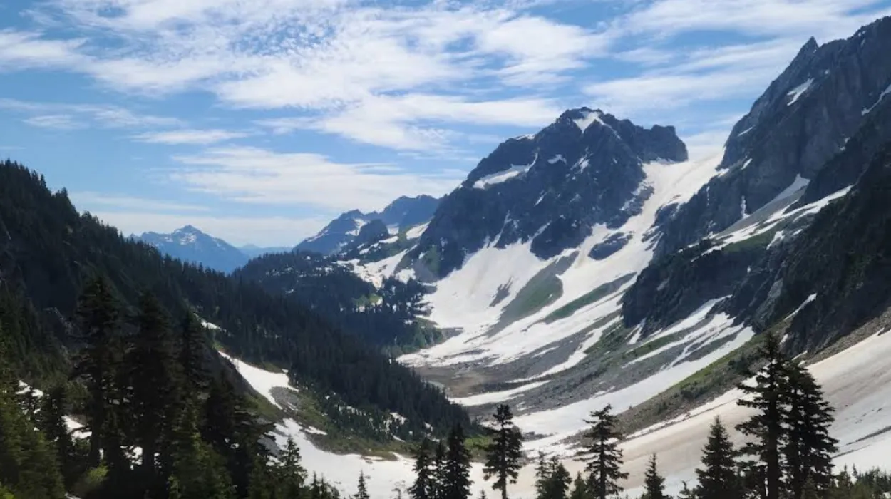
What hazards should I prepare for in the North Cascades?
Primary hazards include rapid weather changes, steep snowfields and glaciers, river crossings, and wildlife encounters (black bears, mountain goats).Weather changes occur rapidly due to maritime and mountain influence, producing sudden rain, snow, or high winds. Precipitation and temperature drops are common above 3,000 feet (914 m) outside late summer. Snowfields and glaciers persist on north aspects; crossing these features requires crampons, ice axe, rope, and crevasse-awareness training. River crossings swell with snowmelt in late spring and early summer; water velocity and depth increase between 10 a.m. and early evening. Use established crossing points and scout upstream for safe lines. Wildlife: black bears (Ursus americanus) and occasional gray wolves inhabit the ecosystem. Use bear-resistant containers and practice clean-camp techniques. Mountain goats use steep talus slopes and can be aggressive; maintain distance. Avalanches threaten steep slopes during winter and spring; consult the Northwest Avalanche Center for current danger levels and forecasted conditions.
How do I navigate glaciers and high passes safely?
Glacier and high-pass travel requires rope teams, crevasse rescue training, crampons, ice axe, and prior experience or guided instruction.Identify glacier routes from USGS maps and NPS route descriptions; many classic routes cross active glaciers (example: Eldorado Glacier approaches). Travel roped at distances appropriate for crevasse hazards; use glacier-rated harnesses, prusik loops, screws, and crevasse rescue systems. Assess snow bridges visually and probe suspect areas. Observe time-of-day travel rules: cross soft snow and steep snowfields in early morning when snow is consolidated. Hire a certified guide from an accredited guiding service for first glacier trips. Enroll in crevasse-rescue and glacier-travel courses offered by local mountaineering organizations such as the American Alpine Institute. Always file the glacier-inclusive itinerary with park staff and indicate intended route and party skill level.
What water and food planning do I need for backpacking here?
Plan for at least 3 liters per person per day, treat all surface water with filtration or purification, and pack calorie-dense meals totaling 2,500–4,000 kcal per day.Water sources are abundant in low and mid-elevation drainages, but glacial streams contain fine rock flour that clogs filters; use pre-filters or allow coarse sediment to settle before filtering. Boiling, chemical tablets, and UV purifiers provide additional disinfection. Carry contingency water for dry ridge camps. Food selection: dehydrated meals, freeze-dried entrees, energy-dense snacks (nuts, energy bars), and electrolytes. Store food in bear-resistant canisters where required and suspend food in designated areas where canisters are not mandatory. Calculate calories based on exertion: typical day-hiking backpackers require 2,500–3,500 kcal daily; heavy packs and cold nights increase needs to 3,500–4,000 kcal.
What leave-no-trace practices are required in the park?
Follow Leave No Trace: camp on durable surfaces, pack out all trash, properly dispose of human waste, and minimize impact on vegetation and water sources.North Cascades enforces standard Leave No Trace principles. Camp at established sites when available; avoid trampling alpine meadows and fragile vegetation. Bury human waste in catholes 6–8 inches deep and at least 200 feet from water, camp, and trails where permitted; in high-altitude or heavily used zones, pack out human waste using certified wag bags as mandated by NPS. Pack out all toilet paper and hygiene products. Avoid washing dishes or using soap within 200 feet of water; scatter strained dishwater away from campsites. Minimize campsite size and group impact; use existing fire rings only where fires are allowed, and only with dead-and-down wood, if permitted. Report resource damage and adhere to closure notices.
How do I handle river crossings and stream safety?
Assess current velocity, scout for shallow braided channels, unbuckle backpacks, and cross at downstream eddies when flow is lower; use trekking poles for stability.River levels rise sharply with daytime snowmelt. Cross where the channel is wide and shallow rather than narrow and deep. Face upstream, use a wide stance, and consider linking arms or using a rope for group safety. Remove pack straps and unclip hip belts so you can shed the pack if swept. Use trekking poles or fixed-length poles for balance. If water depth rises above mid-thigh, seek alternative routes or wait for lower flows. Observe water temperature and avoid crossings during storm runoff. When in doubt, retreat to a safer crossing or return to established bridges and fords.
What wildlife interactions should I expect and how to avoid conflicts?
Expect black bears, cougars, mountain goats, and small mammals; secure food, make noise on trails, and keep distance from wildlife to avoid habituation and conflict.Bears are opportunistic and frequent backcountry camps; use approved canisters or hang food where required. Cook and store food at least 100 feet from sleeping areas. Store scented items with food. Make consistent noise while traveling in dense vegetation or low-visibility sections to avoid surprising mammals. In cougar country, maintain visual contact with children and pets, do not run, back away slowly, and make yourself large and loud if a close encounter occurs. Mountain goats sometimes approach hikers; do not feed and maintain a minimum distance of 50 feet to avoid defensive behavior. Report aggressive or food-conditioned animals to park staff.
What are navigation best practices for beginners?
Carry paper topographic maps, compass, and backup GPS; pre-load digital maps offline and plan routes with marked waypoints and exit options.Rely on multiple navigation methods: topo maps for contour and water features, compass for bearing, and GPS for position. Download offline map tiles and route tracks before entering service-poor areas. Mark campsites, water sources, and known hazards on printed maps. Practice triangulation and pace-counting methods for low-visibility navigation. Check trail names, junctions, and mileages on NPS trail descriptions; confirm waypoints at junctions. Maintain time checks against planned mileage to detect delays early and adjust plans.
How do I handle emergencies and rescues in the park?
Carry communication devices (personal locator beacon or satellite communicator), know nearest ranger station locations, and follow NPS emergency procedures for reporting incidents.Cell service is unreliable in most backcountry zones. Personal locator beacons (PLBs) and satellite messengers (example: Garmin inReach) transmit location and distress signals to search-and-rescue (SAR) networks. Register expected route and return date with park staff and update if plans change. For non-life-threatening issues, call the park dispatch number when in service range; for immediate life-threatening emergencies, activate PLB or satellite SOS. Provide clear information: party size, injuries, coordinates, and nature of emergency. Expect variable SAR response times due to weather and terrain; stabilize patients with first-aid and shelter while awaiting assistance.
What sample itineraries work for first-time backpackers?
Sample itinerary: 3-day loop from Cascade River Road with camps at midpoints, daily 8–10 miles, water at each camp, and exit via gated road; alternative 4-day Thunder Creek out-and-back with established campsites.Example 1 (3-day): Day 1, Cascade River Trailhead to lower alpine campsite (8 miles, 1,200 ft gain). Day 2, traverse ridge for views and shorter mileage (6 miles, 700 ft gain/loss). Day 3, return to trailhead (8 miles). This plan keeps daily mileage moderate and uses established sites. Example 2 (4-day Thunder Creek): Day 1, trailhead to Lower Thunder Creek Camp (6 miles); Day 2, to Rainy Lake or intermediate site (7–9 miles); Day 3, day-hike for views and return to same camp; Day 4, return to trailhead (6 miles). Adjust depending on specific campsite availability and seasonal trail conditions.
What resources and references provide authoritative planning information?
Authoritative resources include the National Park Service (NPS) North Cascades pages, U.S. Geological Survey (USGS) topo maps, Northwest Avalanche Center, and American Alpine Institute for mountaineering guidance.NPS provides up-to-date trail conditions, permit details, road statuses, and seasonal advisories. USGS maps and the National Map supply detailed topo data and elevation contours. The Northwest Avalanche Center issues avalanche forecasts and snowpack analysis relevant in winter and spring. American Alpine Institute and University climbing programs offer formal instruction in glacier travel and crevasse rescue. For wildlife management details and regulations consult NPS policy documents and regional wildlife agencies. Consult scientific literature for glacier statistics and climate impacts; peer-reviewed studies document glacier retreat in the North Cascades and regional climate trends.
What are the environmental and long-term considerations for backpacking in the park?
Climate change drives glacier retreat, altered streamflow, and shifting vegetation zones; plan trips with awareness of changing route stability, water availability, and increased fire seasons.Glacier monitoring by the USGS and academic researchers documents significant mass loss and retreat across North Cascades glaciers since the mid-20th century. Reduced glacier volume changes stream temperature and seasonal flow timing, affecting water availability in late summer. Warming trends increase frequency and intensity of wildfires and insect outbreaks that alter trail conditions and air quality. Trail maintenance demands and closure frequency will shift with extreme weather events. Backpackers should track long-term updates on trail reroutes, stream crossings, and campsite relocations issued by NPS and regional land managers.
Do I need a permit to backpack in North Cascades National Park?
Yes. All overnight wilderness trips in North Cascades National Park require a wilderness permit. Some permits are self-issued, while others require advance reservations through the park’s permit system.