The Olympic Peninsula Road Trip Guide: Ultimate Travel Route covers a 330-mile counter-clockwise loop on Highway 101 around Washington’s Olympic Peninsula, featuring Olympic National Park’s three distinct ecosystems: temperate rainforests, alpine mountains, and 73 miles of rugged Pacific coastline.
- What Is the Olympic Peninsula, and Why Is It a Unique Road Trip Destination?
- How Do You Plan the Ultimate Counter-Clockwise Olympic Peninsula Loop Route?
- What Are the Three Ecosystems You Will Experience on This Road Trip?
- Alpine Mountain Ecosystem
- Temperate Rainforest Ecosystem
- Pacific Coastal Ecosystem
- When Is the Best Time to Visit the Olympic Peninsula for Optimal Weather and Access?
- What Are the Must-Visit Stops and Attractions Along Highway 101?
- Hurricane Ridge
- Lake Crescent
- Sol Duc Hot Springs
- Hoh Rainforest
- Pacific Coast Beaches
- Cape Flattery
- How Much Does It Cost to Visit Olympic National Park and What Passes Are Available?
- What Essential Travel Tips Ensure a Safe and Successful Olympic Peninsula Road Trip?
What Is the Olympic Peninsula, and Why Is It a Unique Road Trip Destination?
The Olympic Peninsula is a 3,600-square-mile landmass in northwestern Washington State, surrounded by the Pacific Ocean, Strait of Juan de Fuca, and Hood Canal, containing Olympic National Park’s 922,651 acres of wilderness with three ecosystems.
The Olympic Peninsula occupies the northwestern corner of Washington State, separated from the rest of the mainland by water on three sides. This geographic isolation created unique ecological conditions that support endemic plant and animal species found nowhere else in the continental United States. President Theodore Roosevelt originally designated the area as Olympic National Monument in 1909 to protect its old-growth forests.
President Franklin Roosevelt visited the Olympic Peninsula in 1937 and added his support for national park establishment. He signed the act redesignating Olympic National Monument as Olympic National Park in 1938. The park received International Biosphere Reserve designation in 1976 and UNESCO World Heritage Site status in 1981, recognizing its outstanding universal value.
The peninsula’s unique geography creates dramatic climate variations across short distances. The Olympic Mountains block moist Pacific air, creating a rain shadow that produces 150 inches of annual rainfall in western rainforests while eastern areas receive only 25 inches. This ecological diversity allows visitors to experience ocean, rainforest, and glacier-covered mountains within 100 miles.
Olympic National Park protects 366,000 acres of old-growth forests, representing one of the largest remaining blocks of temperate rainforest in the lower 48 states. The park contains 60 named glaciers, 3,000 miles of rivers and streams, and 73 miles of wilderness coastline.
How Do You Plan the Ultimate Counter-Clockwise Olympic Peninsula Loop Route?
Drive the 330-mile Olympic Peninsula Loop counter-clockwise on Highway 101, starting at Port Angeles, proceeding through Lake Crescent, Forks, La Push, Kalaloch, Hood Canal, and returning via Sequim, which takes 3-5 days for complete exploration.
The Olympic Peninsula Loop follows Highway 101, a 330-mile scenic highway that circles the entire peninsula. National Geographic recommends entering the loop at its junction with Highway 104, then following Highway 101 for 330 miles (531 kilometers) counter-clockwise via Port Angeles to Aberdeen.
Begin your journey in Port Angeles, positioned at the northern edge of Olympic National Park. From Seattle, drive approximately 95 miles via US-101 West to reach Port Angeles, taking about 2 hours and 36 minutes without traffic. This northern gateway provides access to Hurricane Ridge and Lake Crescent, making it the logical starting point for counter-clockwise travel.
Travel west from Port Angeles on Highway 101 for 18 miles to reach Lake Crescent, one of the deepest lakes in the United States at 614 feet deep. Continue another 14 miles to reach the town of Forks, the gateway to the western rainforests and Pacific coast. From Forks, head south on Highway 110 for 17 miles to reach La Push and the Quillayute River, where Ruby Beach and Rialto Beach provide access to tide pools and sea stacks.
Proceed south on Highway 101 along the Pacific coast for approximately 40 miles to Kalaloch, where Beach 4 offers premier tidepooling opportunities. Continue south another 40 miles to reach the Hood Canal area, passing through Aberdeen and Hoquiam at the loop’s southwestern corner.
Drive east on Highway 101 along Hood Canal for approximately 60 miles, passing through Sequim in the rain shadow area known for lavender farms. Complete the loop by returning to Port Angeles via Highway 101, covering the final 30-mile segment.
The complete 330-mile loop takes approximately 8-10 hours of pure driving time, but a 3-5 day itinerary allows proper exploration of all major attractions. Many visitors extend their trip to 7 days to include hiking, beach exploration, and wildlife viewing without rushing.
What Are the Three Ecosystems You Will Experience on This Road Trip?
Olympic National Park contains three distinct ecosystems: sub-alpine mountain meadows with glacier-capped peaks, temperate rainforests receiving 12-17 feet of annual rainfall, and 60 miles of rugged Pacific shoreline with tide pools and sea stacks.
Alpine Mountain Ecosystem
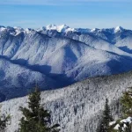
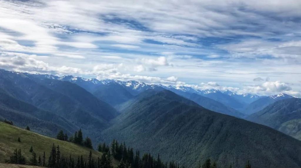
The Olympic Mountains rise in the park’s center, covered with enormous glaciers including the 3.06-mile-long Hoh Glacier, the largest in the park. These mountains reach elevations exceeding 7,900 feet at Mount Olympus, creating sub-alpine forests that give way to alpine meadows and rocky slopes.
Hurricane Ridge, accessible via a 17-mile road from Port Angeles, sits at 5,242 feet elevation and provides panoramic views of the Olympic Mountains. The ridge experiences 75-mile-per-hour winds, which gave it its name, and receives heavy snowfall from January through March ideal for cross-country skiing and snowshoeing.
Alpine meadows bloom with wildflowers from late June through mid-July, creating colorful displays against the rocky mountain backdrop. Eastern slopes lie in the rain shadow, receiving only 25 inches of annual rainfall compared to 150 inches on western slopes, creating dry subalpine brush distinct from western rainforests.
Temperate Rainforest Ecosystem
Temperate rainforests spread across the park’s western portion, including the Hoh Rainforest and Quinault Rainforest, receiving 12-17 feet (140-200 inches) of annual rainfall. The Hoh Rainforest averages 135 inches yearly, while the Quinault Rainforest receives approximately 17 feet (204 inches).
Some portions of the Olympic Peninsula receive rainfall exceeding 200 inches per year, making it the wettest area in the continental United States. Lake Quinault recorded over 198 inches of precipitation in 2020 alone, demonstrating the extreme rainfall these ecosystems receive.
The abundant rainfall creates lush moss-covered forests where plant life literally clings to every surface, including tree trunks, branches, and forest floors. Old-growth trees reach heights exceeding 200 feet, with Douglas Firs, Western Hemlocks, and Sitka Spruces dominating the canopy.
Hoh Rainforest Visitor Center provides access to the Hall of Mosses Trail, a 0.8-mile loop showcasing epiphyte-covered trees, while the Spruce Railroad Trail near Lake Crescent offers 10 miles of forested hiking with moss-draped ancient trees.
Pacific Coastal Ecosystem
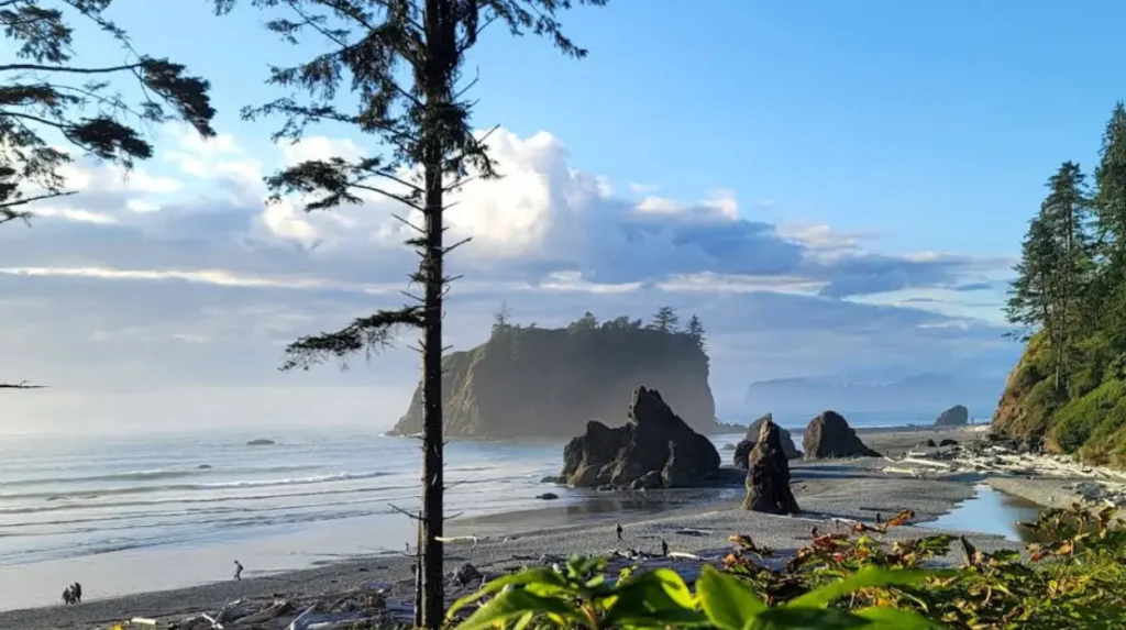
Olympic National Park includes a 60-mile strip of wilderness coastline along the Pacific Ocean with sandy beaches, rocky outcroppings, and offshore islands. The coastline changes with every tide, creating new experiences hourly as water levels expose or cover intertidal zones.
Coastal rainfall averages 103 inches annually, with winter receiving 17 inches, spring 9 inches, summer 3 inches, and fall 11 inches. Sandy beaches like Ruby Beach feature large sea stacks including Abbey Island, while rocky sections contain boulders and offshore formations.
Popular coastal destinations include Ruby Beach with easy access from Highway 101, Second Beach requiring a 0.7-mile forested hike with switchbacks, Third Beach, and Rialto Beach at Mora Road’s end. Kalaloch’s Beach 4 and Mora’s Hole in the Wall provide the most popular tidepooling locations.
Low tide exposes tide pools containing sea stars, crabs, eels, snails, anemones, and other marine life. The best tidepooling occurs during “minus tides” lower than 1 foot, which expose maximum intertidal zones.
When Is the Best Time to Visit the Olympic Peninsula for Optimal Weather and Access?
July through September offers the best overall weather with warm temperatures, minimal rain, and fully open trails, while May, early June, and September provide fewer crowds with acceptable conditions for rainforest and beach exploration.
Summer months (June-August) average 47-60°F with cool climate, very little rainfall, and more sunny days ideal for beach activities, camping, and high-altitude hiking. July is the single best month to visit, offering the best weather combined with lavender blooms in Sequim and fully snow-free trails.
The dry season runs from May to September, with it being just the reverse of winter: mostly dry with rain occurring only 2 out of 10 days. July and August offer warm temperatures and minimal rain, making them the most popular months despite larger crowds.
Mountain wildflowers reach peak bloom from late June through mid-July, creating spectacular displays in alpine meadows at Hurricane Ridge and higher elevations. Late June through July also marks lavender season in Sequim, with farms along the Sequim Valley Road attracting visitors.
Best snow-free hiking in deep backcountry occurs from August to mid-October, when trails remain clear of snow and facilities operate fully. Park facilities function completely from June through October, including visitor centers, campgrounds, and high-elevation roads like Hurricane Ridge Road.
Spring (March-May) averages 32-41°F with cold, humid climate and less rainfall than winter, though staying warm remains necessary. Spring and fall provide optimal rainforest visiting conditions when the moss appears most vibrant and waterfalls flow strongly.
Fall (September-November) averages 42-52°F with cooler temperatures and gradually increasing rainfall. September offers fewer crowds with acceptable weather, making it ideal for visitors seeking solitude.
Winter (December-February) averages cold temperatures with more rainfall and possible snow in mountain areas. October through April represents wet months, with rain occurring 8 out of 10 days. However, winter provides opportunities to witness intense Pacific storms along the coast and cross-country skiing or snowshoeing on abundant snow from January through March.
Hurricane Ridge Road typically opens mid-December through mid-April for winter sports, weather permitting. Severe weather events with torrential rains and high winds lasting several days occur 2-4 times annually, usually between October and January when few visitors remain.
What Are the Must-Visit Stops and Attractions Along Highway 101?
The essential Olympic Peninsula stops include Hurricane Ridge (17 miles from Port Angeles), Lake Crescent (18 miles west), Sol Duc Hot Springs (20 miles from Lake Crescent), Hoh Rainforest (55 miles from Forks), Ruby Beach (17 miles south of Forks), Cape Flattery (44-mile detour to Neah Bay), and Kalaloch Beach 4 (40 miles south of La Push).
Hurricane Ridge
Hurricane Ridge sits 17 miles south of Port Angeles on Hurricane Ridge Road at 5,242 feet elevation. This alpine destination provides panoramic views of the Olympic Mountains, Strait of Juan de Fuca, and on clear days, Vancouver Island. Summer offers wildflower meadows while winter provides cross-country skiing and snowshoeing opportunities.
The visitor center operates seasonally, with full facilities available June through October. Winter access depends on weather conditions, with the road typically open mid-December through mid-April for snow activities.
Lake Crescent
Lake Crescent lies 18 miles west of Port Angeles on Highway 101, featuring turquoise waters reaching 614 feet deep. The lake’s crystal-clear waters result from low nutrient levels, preventing algae growth and maintaining exceptional visibility.
Marymere Falls requires a 1.8-mile round-trip hike from the Storm King Ranger Station, dropping 90 feet through old-growth forest. The Love’s Cabin trail and Pyramid Mountain trail offer additional hiking options around the lake.
Sol Duc Hot Springs
Sol Duc Hot Springs sits 20 miles north of Lake Crescent in the Sol Duc Valley, featuring three mineral hot spring pools ranging from 102-104°F. The Sol Duc Falls Trail is a 1.6-mile round-trip hike through old-growth forest to a 60-foot waterfall.
The hot springs resort offers lodging, cabin rentals, and a restaurant, requiring reservations well in advance during summer months. Entrance fees apply for pool access, separate from Olympic National Park entrance fees.
Hoh Rainforest
The Hoh Rainforest lies 55 miles south of Forks on Highway 101, receiving 135 inches of annual rainfall. The Hall of Mosses Trail is a 0.8-mile loop showcasing moss-covered ancient trees, while the Sol Duc River Trail offers 3.5 miles of forested hiking.
Hoh Rainforest Visitor Center provides exhibits, ranger programs, and camping facilities. The visitor center operates year-round with extended hours during summer season.
Pacific Coast Beaches
Ruby Beach sits 17 miles south of Forks on Highway 101, featuring easy access from parking to driftwood-lined shoreline with large sea stacks including Abbey Island. The beach combines sand and pebbles with tide pools revealing anemones and starfish at low tide.
Second Beach requires a 0.7-mile forested hike with switchbacks from near La Push, featuring offshore rock formations including Quillayute Needles. Third Beach and Rialto Beach at Mora Road’s end provide additional coastal access points.
Kalaloch’s Beach 4 offers the most popular tidepooling location, accessible via a short trail from the campground. Hole in the Wall at Mora features a natural rock arch accessible during low tide.
Cape Flattery
Cape Flattery, the northwesternmost tip of the continental United States, requires a 44-mile detour from Sappho on Highway 113/112 through Clallam Bay to Neah Bay. The Cape Flattery Trail is 0.75 miles from trailhead to overlook with boardwalks, stairs, and dirt sections.
The trail descends downhill to the lighthouse lookout and requires a recreation permit available at the Makah Tribe visitor center. From Sequim, Cape Flattery is approximately two hours each way, making it a full-day trip.
How Much Does It Cost to Visit Olympic National Park and What Passes Are Available?
Olympic National Park entrance fees cost $30 per vehicle for a 7-day pass, $25 per motorcycle, $15 per person on foot or bicycle, with annual park-specific passes at $55 and America the Beautiful Annual Pass at $80 covering all federal recreation sites.
Standard entrance fees for U.S. residents remain unchanged at $30 per vehicle, $25 per motorcycle, and $15 per person for visitors entering on foot or by bicycle. Youth 15 and under are admitted free of charge.
The 7-day private vehicle pass covers entry to all areas of Olympic National Park including Hurricane Ridge, Lake Crescent, rainforests, and coastal areas. Individual passes ($15) apply for hikers, bicyclists, or pedestrians without vehicles.
For frequent visitors, the Olympic National Park annual pass costs $55 and provides unlimited entry for one year. This pass is available at park entrance stations and the Olympic National Park Visitor Center at 3002 Mount Angeles Road in Port Angeles.
The America the Beautiful Annual Pass costs $80 and covers entrance fees at more than 2,000 federally managed sites including all national parks, national forests, wildlife refuges, and Bureau of Land Management areas. This pass covers entrance fees for up to two motorcycles and the pass holder plus three adults (ages 16 and older).
U.S. military members and dependents with Common Access Cards (CAC) or Military ID (Form 1173) receive free year-long entry to national parks. Visiting military families should obtain their pass in person at a federal recreation site by showing proper identification.
Visitors 62 years or older qualify for the Senior Lifetime Pass costing $80, providing lifetime access to more than 2,000 federally managed sites. The Senior Pass can be obtained in person at federal recreation sites for $80 or by mail for $90 including $10 processing fee.
The Interagency Annual Pass costs $80 and provides the best value per dollar for travelers visiting multiple national parks, Forest Service Lands, or Wildlife Refuges. This pass is available at the USGS online store and REI’s online store with free shipping and National Park Foundation donation.
Purchasing Olympic National Park passes online at yourpassnow.com requires printing the receipt in advance, as rangers do not accept receipts shown on cell phones. Rangers check passes at park entrance stations along Highway 101 at multiple locations including near Port Angeles, Forks, and Kalaloch.
What Essential Travel Tips Ensure a Safe and Successful Olympic Peninsula Road Trip?
Pack rain gear year-round, check tide tables before visiting beaches, arrive early at Hurricane Ridge to avoid crowds, book accommodations months in advance for summer travel, and download offline maps as cell service remains limited throughout most of the peninsula.
The Olympic Peninsula experiences rain year-round, with fall and winter being the wettest seasons and summer typically much drier. Pack waterproof jackets, rain pants, and waterproof footwear regardless of season, as rainforests receive 140-200 inches of annual rainfall and coastal areas receive 103 inches annually.
Tide tables are essential for beach visits since tidepools expose marine life only during low tide, particularly “minus tides” lower than 1 foot. The best tidepooling occurs at Kalaloch’s Beach 4 and Mora’s Hole in the Wall during morning low tides.
Hurricane Ridge Road’s 17-mile ascent from Port Angeles experiences traffic congestion during summer weekends, with recommended arrival times before 9 AM to secure parking. The parking lot holds approximately 200 vehicles and fills completely by mid-morning on peak days.
Accommodations in Port Angeles, Forks, and Sequim require booking 3-6 months in advance for summer travel, particularly for cabins and lodges near park entrances. Cultural and economic impacts of tourism have increased demand, with limited lodging options throughout the peninsula.
Cell service remains limited throughout most of the Olympic Peninsula, with no service in the Hoh Rainforest, on most coastal beaches, and in many mountain areas. Download offline maps from Google Maps or use physical maps available at visitor centers before departing main towns.
Gas stations are sparse on the peninsula, with major refueling stops in Port Angeles, Forks, Aberdeen, and Sequim. Fill your tank before heading to remote areas like the western rainforests or Cape Flattery, where distances between services exceed 50 miles.
Wildlife viewing requires quiet, patient observation without approaching animals too closely, as National Park Service regulations prohibit feeding or approaching wildlife. Black bears, elk, deer,/raccoons, and bald eagles are commonly spotted throughout the peninsula.
Dinner reservations in Port Angeles should be made 1-2 weeks in advance during summer, with popular restaurants including the Broadmoor Restaurant, Pelindaba Lavender House, and Pizzeria Venti filling quickly. Many restaurants close early (9 PM) in smaller towns like Forks and Sequim.
What is the Olympic Peninsula Loop road trip?
The Olympic Peninsula Loop is a 330-mile scenic drive around Washington’s Olympic Peninsula on Highway 101, featuring mountains, rainforests, beaches, and coastal towns.