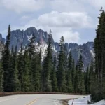
The North Cascades ecosystem in northern Washington represents one of the most rugged, geologically complex, and ecologically diverse alpine landscapes in North America. Governed by a combination of federal agencies, this region contains North Cascades National Park, Ross Lake National Recreation Area, and Lake Chelan National Recreation Area. Often referred to as the “American Alps,” the mountain range features sharp peaks, dense old-growth forests, and the largest concentration of active glaciers in the contiguous United States. Despite its ecological significance and proximity to major metropolitan areas like Seattle and Vancouver, parts of the interior wilderness remain exceptionally isolated, preserving pristine environments for researchers and wilderness enthusiasts.
- What Is the Ecological Significance of the North Cascades Ecosystem?
- How Did the North Cascades Become a Protected Wilderness?
- What Isolated Hidden Gems Exist on the Western Maritime Slopes?
- Where Are the Best Eastern Rain Shadow Hidden Gems Located?
- How Are Environmental Transformations Reshaping This Wilderness?
What Is the Ecological Significance of the North Cascades Ecosystem?
The North Cascades ecosystem serves as a critical biological sanctuary that preserves complex trophic structures, immense water resources, and high levels of biodiversity within the Pacific Northwest. This region functions as a primary hydrological and thermal regulator for northwestern Washington, directly influencing the climate, river systems, and wildlife habitats of the broader Puget Sound basin.
Glacial Hydrology and Water Resources
The North Cascades National Park Complex contains 25% of the total glacier population found in the contiguous United States (Granshaw, 2002). These active glaciers store vast quantities of frozen freshwater, acting as an essential buffer for regional water systems. During the late summer months of August and September, when seasonal precipitation is at its annual low, glacier mass loss and meltwater production contribute significantly to the total streamflow of major river networks (Granshaw, 2002). For example, three primary river systems rely directly on this glacial discharge:
- The Skagit River System: This is the largest watershed draining into Puget Sound, generating significant hydroelectric power and sustaining major salmon populations.
- The Nooksack River System: This system drains the northern and western slopes of the range, supplying water to agricultural and municipal sectors in Whatcom County.
- The Stehekin River System: Located on the eastern side of the crest, this river feeds into Lake Chelan and forms a critical interior drainage corridor.
Glacier mass loss augments late-summer streamflow by 0.1% to 6.0% during dry periods, effectively mitigating the effects of seasonal droughts and maintaining cold water temperatures required by native aquatic species (Granshaw, 2002).
Biodiversity and Intact Habitats
Because of its extreme topographic relief and positioning across the Cascade crest, the ecosystem spans multiple distinct climate zones. The western slopes experience a maritime climate with heavy precipitation, supporting dense temperate rainforests dominated by three tree species: Douglas fir (Pseudotsuga menziesii), western hemlock (Tsuga heterophylla), and western redcedar (Thuja plicata).
Conversely, the eastern slopes occupy a rain shadow, exhibiting a drier, continental climate characterized by open woodlands of ponderosa pine (Pinus ponderosa) and western larch (Larix occidentalis).
This sharp environmental gradient supports more than 1,600 vascular plant species and provides continuous, undisturbed habitat for wide-ranging apex predators and sensitive fauna. The 125-mile Skagit Wild and Scenic River system within the park complex hosts one of the largest wintering populations of bald eagles (Haliaeetus leucocephalus) in the United States and supports nearly one-third of all salmonids in the Puget Sound region (Baker, 2007).
Additionally, the high-elevation zones support specialized sub-alpine and alpine plant communities, including fragile heather meadows and whitebark pine (Pinus albicaulis) stands, which are critical for stabilizing alpine soils and providing food for sub-alpine wildlife.
How Did the North Cascades Become a Protected Wilderness?
The protection of the North Cascades required over a century of legislative effort, shifting public attitudes, and resource management conflicts between conservation groups and industrial logging or mining interests. The transition from an resource-extraction zone to a highly protected federal sanctuary illustrates the evolving priorities of public land management in the United States.
Early Resource Exploitation and Public Land Designation
During the 19th and early 20th centuries, the North Cascades region was primarily valued for its economic commodities, specifically timber, furs, and minerals. Miners established remote outposts to extract gold, silver, and copper, while timber companies sought access to the massive old-growth forests along the lower river valleys.
Recognizing the need to regulate timber extraction and protect watersheds, the federal government established the Washington Forest Reserve in 1892. This massive tract of land was later re-organized and divided into multiple National Forests, including the Mt. Baker, Wenatchee, and Okanogan National Forests, managed by the United States Forest Service (USFS). Under USFS management, public lands were governed by a “multiple-use” mandate, which permitted commercial logging, mining, livestock grazing, and motorized recreation alongside watershed protection.
The Wilderness Act and the Creation of the National Park
By the mid-20th century, growing environmental awareness led conservation organizations, such as the North Cascades Conservation Council and the Sierra Club, to campaign for stronger protections. These groups argued that the multiple-use mandate failed to protect the core alpine wilderness from destructive clear-cut logging and mining operations. The passage of the Wilderness Act of 1964 provided the legal mechanism to permanently protect public lands from industrial development, defining wilderness as areas untrammeled by man, retaining their primeval character (WCPA, 2002).
The political debate culminated on October 2, 1968, when President Lyndon B. Johnson signed the North Cascades National Park Act, establishing the North Cascades National Park Complex. This legislative compromise split the region into distinct management units to balance preservation with existing recreational infrastructure:
- North Cascades National Park: Split into the North and South Units, covering 504,614 acres of strictly preserved alpine wilderness where resource extraction and motorized access are prohibited.
- Ross Lake National Recreation Area: Encompassing 117,575 acres along the Skagit River and State Route 20 corridor, accommodating existing hydroelectric dams and reservoirs while permitting more flexible recreational use.
- Lake Chelan National Recreation Area: Comprising 61,958 acres at the northern end of Lake Chelan, protecting the remote gateway community of Stehekin while allowing traditional land uses.
Further protections were established in 1988 when Congress designated 93% of the park complex as the Stephen Mather Wilderness, ensuring that 634,614 acres would remain permanently free of roads, permanent structures, and motorized equipment (Baker, 2007).
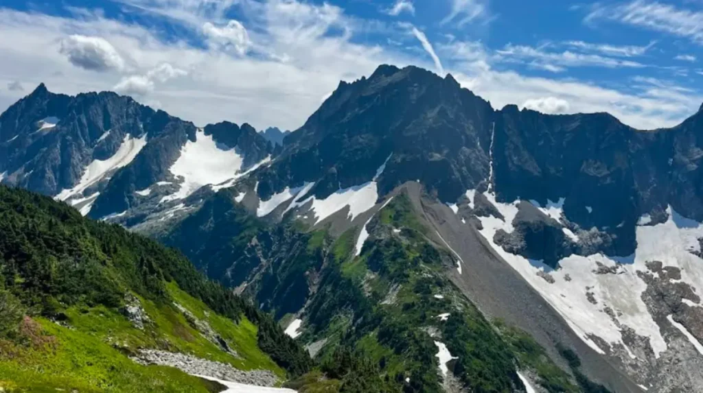
What Isolated Hidden Gems Exist on the Western Maritime Slopes?
The western unit of the North Cascades is characterized by steep, glacially carved valleys, high annual precipitation, and dense temperate rainforests. While popular trailheads along State Route 20 experience higher visitor volumes, several isolated corridors offer exceptional solitude and undisturbed views of alpine geology.
The Baker Lake Basin and Hidden Lake Lookout
Located approximately 16 miles east of Sedro-Woolley along Baker Lake Road, the Baker Lake Basin serves as a western gateway to the remote interior of the Mt. Baker National Recreation Area and the national park boundary (Baker, 2007). The basin provides access to the Hidden Lake Peaks trail, a strenuous route that climbs through old-growth forests into an expansive alpine cirque.
At the summit, sitting at an elevation of 6,890 feet, rests the Hidden Lake Lookout. Built in 1931 by the USFS for fire detection, this historic structure provides panoramic views of the standard geological features of the range, including the jagged spires of Mount Shuksan and the massive glacier system of Mount Baker. The area displays distinct sub-alpine plant communities, where heather meadows and mountain hemlock dominate the high-altitude terrain.
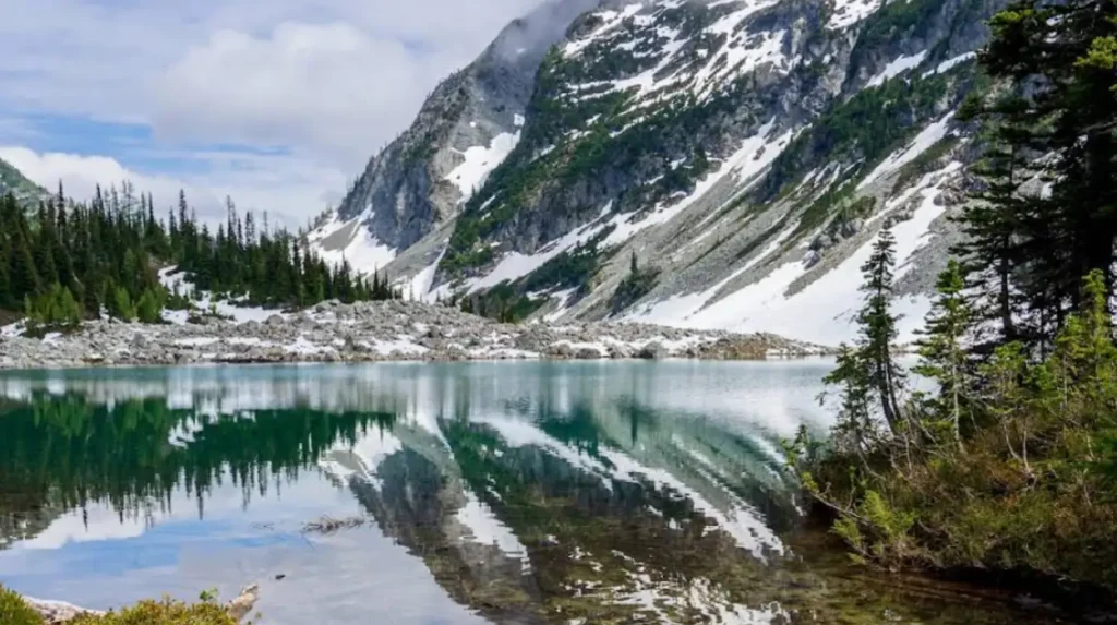
Thornton Lakes and Trappers Peak
Tucked away north of the small community of Marblemount, the Thornton Lakes basin is accessed via a rugged, unpaved forest road that deters standard vehicular traffic. The trail ascends steeply through a secondary-growth forest before entering primary old-growth wilderness within the national park boundary.
The basin contains three alpine lakes arranged in a stair-step pattern within a steep glacial cirque. A split in the trail leads to the summit of Trappers Peak, which rises to 5,966 feet. From this vantage point, visitors can observe the direct transition from deep valley floors to exposed granitic ridges. The lower lakes are bordered by dense stands of Alaskan yellow cedar (Cupressocarpus nootkatensis) and vine maple (Acer circinatum), which provide critical nesting habitat for specialized avian species, including the endangered marbled murrelet (Brachyramphus marmoratus).
Where Are the Best Eastern Rain Shadow Hidden Gems Located?
The eastern side of the Cascade crest features a significantly drier climate, resulting in open forests, distinct geological formations, and a different composition of plant and animal life. Accessing these areas requires navigating remote valleys or utilizing ferry transportation across deep glacial lakes.
The Stehekin Valley and Blue Lake Corridor
Stehekin remains one of the most isolated communities in the contiguous United States, completely inaccessible by road. It can only be reached by passenger ferry across Lake Chelan, by floatplane, or via backpacking trails across the mountain passes. The Stehekin Valley serves as a base for exploring the Lake Chelan National Recreation Area, where the Stehekin River forms a broad valley floor before emptying into the lake.
Further north along the State Route 20 corridor, near the eastern park boundary, lies the Blue Lake trail. Situated at an elevation of 6,250 feet, Blue Lake is a tarn—a mountain lake formed in a cirque excavated by a glacier. The lake is framed by the towering granite walls of the Early Winters Spires and Liberty Bell Mountain. The surrounding forest consists primarily of subalpine fir (Abies lasiocarpa) and western larch, a deciduous conifer whose needles turn a vibrant yellow during autumn before dropping. This dry alpine environment supports specialized mammals, including mountain goats (Oreamnos americanus) and pikas (Ochotona princeps), which thrive in the extensive talus slopes.
Rainy Lake and the Pacific Crest Trail Intersection
Rainy Lake is situated near the crest of the Cascade Mountains at an elevation of 4,800 feet, accessible via a short, paved accessible path from the Rainy Pass trailhead along State Route 20. The lake is fed by a series of dramatic waterfalls cascading down thousands of feet of sheer rock walls from the Lyall Glacier.
Rainy Pass serves as a critical junction point where State Route 20 intersects the Pacific Crest National Scenic Trail, a 2,650-mile trail extending from Mexico to Canada. Hikers traveling north from Rainy Pass enter the Pasayten Wilderness, a massive protected area characterized by high rolling ridges and open tundra. The Rainy Lake basin exhibits an overlap of maritime and continental ecosystems, where western hemlock grows in close proximity to subalpine larch, demonstrating the complex botanical mixing that occurs at the mountain crest.
How Are Environmental Transformations Reshaping This Wilderness?
The North Cascades ecosystem is experiencing rapid environmental transformations driven by changing climate conditions. These shifts alter the physical landscape, affect hydrological cycles, and challenge established wildlife management protocols.
Glacier Retreat and Ecosystem Vulnerability
Long-term monitoring projects demonstrate that the glaciers of the North Cascades are undergoing significant mass reduction. Between 1958 and 1998, the total glacier population within the park complex dropped from 321 to 316, and the combined surface area of the glaciers decreased by 7.0% (Granshaw, 2002). This reduction represents a total volume loss of approximately 0.8 cubic kilometers of ice, caused by a regional warming and drying trend (Granshaw, 2002).
The accelerated melting of these glaciers creates long-term hazards for regional ecosystems. As glaciers shrink, their ability to augment summer streamflow diminishes. This change leads to lower water levels and higher water temperatures in critical salmon-spawning rivers, such as the Skagit River, which alters aquatic habitats and threatens cold-water fish populations.
Adaptation Strategies and Resource Management
To address these environmental transformations, federal resource managers have implemented comprehensive climate change adaptation strategies. The North Cascades Adaptation Partnership represents a large-scale collaboration between the USFS, the National Park Service, and regional research institutions to build ecological resilience across public lands (Raymond et al., 2014). This initiative provides a scientific foundation for sustainable resource management, focusing on three core areas:
- Infrastructure Resilience: Redesigning culverts, bridges, and forest roads to withstand high-volume flooding events caused by rapid snowmelt and extreme autumn rainstorms.
- Habitat Connectivity: Restoring and protecting migration corridors to allow sensitive wildlife species to shift their geographic ranges to higher, cooler elevations as lower valleys warm.
- Vegetation Management: Replanting disturbed areas with climate-resilient native plant strains and conducting active restoration of vulnerable tree species, such as the whitebark pine, which faces simultaneous pressures from blister rust infection and mountain pine beetle infestations.
These coordinated adaptation efforts enhance the long-term functionality of ecosystems, ensuring that the remote interior wilderness continues to serve as an intact refuge for native biodiversity amidst shifting global conditions (Raymond et al., 2014).
What is the North Cascades ecosystem?
The North Cascades ecosystem is a vast protected mountain region in northern Washington that includes North Cascades National Park, Ross Lake National Recreation Area, and Lake Chelan National Recreation Area. Known as the “American Alps,” it contains rugged peaks, old-growth forests, abundant wildlife, and the largest concentration of glaciers in the contiguous United States.