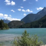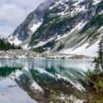
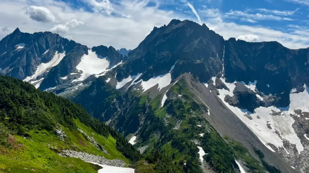
North Cascades National Park is a 504,781-acre wilderness in northern Washington featuring over 300 glaciers, 300 alpine lakes, and jagged peaks rising to 9,000 feet. Located 3 hours north of Seattle along State Route 20, the park offers Washington residents and visitors year-round alpine adventures including hiking, climbing, camping, and wildlife viewing across three distinct units: North Cascades National Park, Ross Lake National Recreation Area, and Lake Chelan National Recreation Area.
- What Is North Cascades National Park and Why Does It Matter?
- When Is the Best Time to Visit North Cascades National Park?
- How Do You Plan Your Trip to North Cascades National Park?
- What Are the Best Hiking Trails in North Cascades National Park?
- How Do You Climb Mountains and Navigate Glaciers in the Park?
- What Wildlife and Ecosystems Define North Cascades?
- Where Should You Stay and How Do You Access the Park?
- What Safety Precautions Must Alpine Adventurers Follow?
What Is North Cascades National Park and Why Does It Matter?
North Cascades National Park is a federal wilderness area protecting Washington’s most rugged mountain terrain with 300+ glaciers, old-growth forests, and 300+ alpine lakes. Established October 2, 1968, it preserves 1.5 million acres of the Cascade Range ecosystem.
The park sits within the North Cascades Ecosystem, one of North America’s most biologically diverse mountain regions. The National Park Service manages three contiguous protected areas: North Cascades National Park (204,000 acres), Ross Lake National Recreation Area (135,000 acres), and Lake Chelan National Recreation Area (165,781 acres). This complex protects critical habitat for mountain goats, black bears, gray wolves, and grizzly bears.
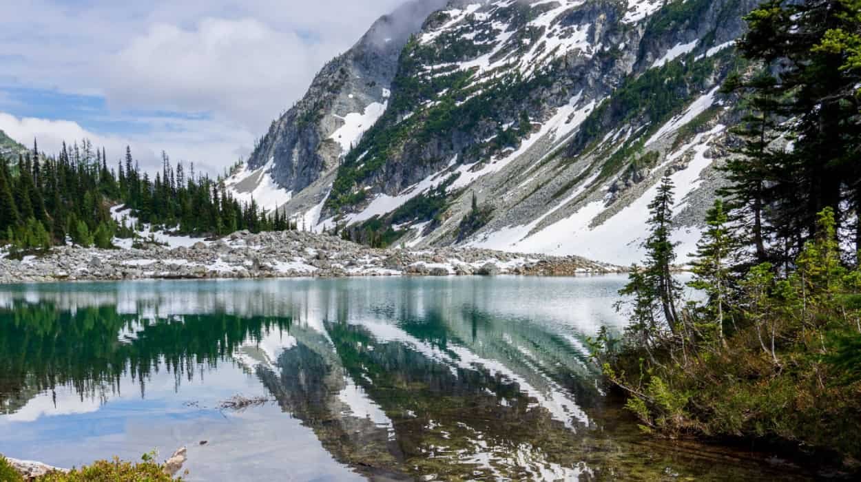
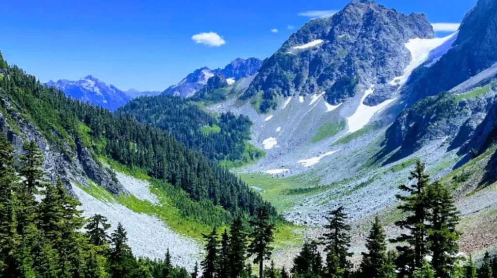
The Cascades Range formed 40 million years ago through volcanic activity and tectonic plate collision. Glaciers carved the current landscape during the last Ice Age, creating U-shaped valleys, cirques, and horn peaks. The park receives 15-25 feet of annual snowfall at elevation, feeding the glacier system that supplies 75% of Washington’s drinking water downstream.
Primary access occurs via State Route 20 (North Cascades Highway), which runs east-west through the park’s center. The Silver-Skagit Road and State Route 542 provide northern access to Hozomeen, Mount Shuksan, and Copper Ridge regions. SR 20 closes annually from November to April due to avalanche danger between Ross Dam Trailhead and Lone Fir Campground.
When Is the Best Time to Visit North Cascades National Park?
The optimal visiting window is July through September when snow melts, roads open, and all trails become accessible. Mid-to-late July marks the start of the alpine season with 16-hour daylight hours and temperatures of 65-80°F at elevation.
Summer (July-September) offers complete trail access, wildflower blooms in alpine meadows, and all facilities open. July brings snowmelt completing at higher elevations above 5,000 feet. August provides stable weather with minimal precipitation. September features fewer crowds, crisp air, and golden larch trees beginning color change.
Spring (May-June) keeps most trails snow-covered above 3,000 feet. Lower elevation valleys access early but alpine routes remain closed. Wildflowers bloom in valleys during June. Road closures on SR 20 typically lift late April to early May, depending on snowpack.
Fall (October-November) brings larch peak color mid-October, creating dramatic gold-and-green landscapes. Early snowstorms can close SR 20 by late October. Hunting seasons begin October, requiring orange clothing in non-wilderness areas. Daylight decreases rapidly, limiting hiking windows.
Winter (December-March) closes SR 20 but enables snowshoeing, cross-country skiing, and backcountry skiing in accessible lower regions. Diablo Lake Overlook and Washington Pass Overlook remain accessible by car. Avalanche danger limits backcountry travel. No park facilities operate during winter except for ranger stations in Concrete.
How Do You Plan Your Trip to North Cascades National Park?
Start planning at nps.gov/noca/planyourvisit/things2do.htm for official trails, maps, and permits. Reserve camping 6 months ahead, check SR 20 road status before departure, and prepare for wilderness conditions with no cell service above 2,000 feet.
Accommodations divide into three categories: frontcountry camping, backcountry camping, and nearby towns. Diablo Lake Campground (115 sites) operates May-October with reservations required. Goodell Creek Campground (90 sites) opens late May through September on first-come, first-served basis. Newhalem Creek Campground (85 sites) works similarly. Backcountry permits require advance application through Recreation.gov for popular zones like Cascade Pass and Sahale Arm.
Nearby towns provide lodging and services: Concrete (15 miles west) offers motels and gas stations. Marblemount (20 miles west) has lodges and grocery stores. Winthrop (30 miles east) provides full services including equipment rentals. Sedro-Woolley (25 miles southwest) features larger hotels and supermarkets. Baker Lake (25 miles north) offers cabins and RV parks.
Permit requirements include: backcountry camping permits (free, required year-round), fire permits for campfires outside designated areas (free, Washington state requirement), and commercial use permits for guided groups. Popular trails like Cascade Pass to Sahale Arm handle 30,000+ annual visitors, creating congestion during peak summer weekends.
Vehicle requirements: no fees for park entry, but Washington State Parks pass needed for some day-use parking areas. RVs over 26 feet face restrictions on SR 20’s steep grades and sharp curves. Winter tires mandatory November-April on SR 20. No gas stations inside the park; fill up in Concrete or Winthrop.
What Are the Best Hiking Trails in North Cascades National Park?
Top trails include Maple Pass (7.1 miles, hard), Cascade Pass to Sahale Arm (11.6 miles, hard), Ptarmigan Ridge (11.6 miles, moderate), and Artist Point (short, moderate). These 4 trails represent the park’s most iconic alpine experiences with glacier views and mountain goat encounters.
Maple Pass Loop traverses 7.1 miles with 2,100 feet elevation gain, completing in 4-6 hours. The trail climbs through fir forests to 7,000-foot Maple Pass, offering panoramic views of Mount Challenger and Mount Assyria. Wildflowers peak mid-July to early August. This loop ranks as the park’s most popular day hike, handling 15,000+ visitors annually.
Cascade Pass to Sahale Arm extends 11.6 miles round-trip with 3,400 feet elevation gain, requiring 7-9 hours. The path crosses Cascade Pass (5,400 feet), then ascends to Sahale Arm (6,800 feet) with views of Sahale Glacier, Thunder Tor, and the Cathedral Group. Crowds peak Saturday-Sunday summer mornings. The trailhead sits 19 miles east of Marblemount on SR 20. Bear National Historic Trail continues another 3 miles to Cascade Glacier.
Ptarmigan Ridge covers 11.6 miles with 4,200 feet elevation gain, rated moderate due to steady grade rather than technical difficulty. The ridgeline traversal provides 360-degree views of Mount Shuksan,_processed,_and他不。The route requires route-finding skills above treeline. Best attempted July-September when snow clears.
Artist Point near Mount Baker Ski Area offers a 1.3-mile loop with minimal elevation gain, suitable for all fitness levels. The trail provides close-up views of Mount Shuksan’s Fisherman’s Ridge and Curtis Ridge. Accessible year-round when snow permits. Parking fills by 9 AM summer weekends.
Additional significant trails include Diablo Lake Trail (11.2 miles, moderate), Thunder Creek Trail (14.2 miles, moderate), and Senator Beck Basin (4.5 miles, moderate). The Washington Trails Association maintains interactive maps and trail condition updates at wta.org.
Explore More Things to do
Sol Duc Hot Springs Guide: Relaxation in Nature for Washington Visitors
Kalaloch Beach Guide: Coastal Beauty in Olympic National Park, Washington
How Do You Climb Mountains and Navigate Glaciers in the Park?
Alpine climbing requires glacial mountaineering skills including crampon technique, ice axe self-arrest, rope management, and crevasse rescue. The East Ridge of Eldorado Mountain offers an excellent introductory glacial experience on a snowy spine to the shark’s-tooth summit.
The Cascades Range provides the Pacific Northwest’s premier location for learning glacial mountaineering. Mount Shuksan’s Fisherman’s Ridge (9,131 feet) serves as a classic beginner alpine climb requiring minimal technical skills. East Ridge of Eldorado Mountain (9,024 feet) presents a snowy spine ascent to the shark’s-tooth summit, excellent for glacial training.
Required equipment includes: crampons (12-point, general mountaineering), ice axe (60-70cm), climbing harness, rope (30-40 meters static), helmet, avalanche beacon, probe, and shovel. Glacier travel demands crevasse rescue gear: pulleys, prusik cords, webbing, and carabiners. Layered clothing systems handle temperature swings from 30°F mornings to 70°F afternoons.
Seven-day alpine climbing courses teach safe glacier travel through certified guide services. These programs cover snow anchor construction, glacier navigation, weather assessment, and emergency protocols. North Cascades Alpine Climbing Course operates annually through January 2026, accepting registrations for summer 2026 seasons.
Crevasse danger exists on all glaciers above 6,000 feet. The park’s 300+ glaciers move 1-3 feet daily, creating hidden crevasses beneath snow bridges. Spring and early summer present maximum crevasse opening risk. Summer warmth thickens snow bridges but increases collapse danger. Rope teams traveling 50-75 feet apart minimize falls.
Mountain goats inhabit alpine zones above 5,000 feet year-round. These native animals approach hikers seeking salt. Maintain 100-foot distance. Electrolyte tablets in backpacks attract goats dangerously. Report aggressive behavior to rangers.
What Wildlife and Ecosystems Define North Cascades?
The North Cascades Ecosystem supports mountain goats, black bears, gray wolves, grizzly bears, bobcats, and over 150 bird species across old-growth forests, alpine meadows, and glacial valleys. Old-growth Douglas fir, western hemlock, and western red cedar dominate lower elevations.
Primary forest types include: temperate rainforest (western red cedar, western hemlock), dry pine forest (ponderosa pine, Douglas fir), and subalpine meadow (wildflowers, grasses). Elevation determines vegetation zones: 0-2,000 feet features Douglas fir dominance, 2,000-4,000 feet transitions to mixed conifer, 4,000-6,000 feet hosts subalpine fir and mountain hemlock, above 6,000 feet limits to alpine tundra.
Mammal species include: mountain goats (3,000+ in the ecosystem), black bears (1,000+), gray wolves (50+), grizzly bears (reintroduced population recovering), bobcats, coyotes, mule deer, black-tailed deer, and elk. Mountain goats concentrate above 5,000 feet on steep slopes. Black bears forage in valleys year-round. Gray wolves recolonized the park naturally from Canadian populations during the 2010s.
Bird species exceed 150 identified, including gray jays, Steller’s jays, mountain bluebirds, worm-eating warblers, and gray-crowned rosy-frogs. Golden eagles nest on cliff faces. Horner’s owls inhabit old-growth forests. Compact hummingbirds migrate through alpine corridors July-August.
The ecosystem faces climate change threats including glacier loss (30% reduction since 1984), shifting vegetation zones upward, and decreased snowpack affecting water supply. Reduced snowpack impacts downstream agriculture and urban water systems serving 75% of Washington residents.
Where Should You Stay and How Do You Access the Park?
Primary access occurs via State Route 20 from Seattle (3 hours north), with lodging available in Concrete, Marblemount, and Winthrop. Traditional lodging outside the park exists in Marblemount and Concrete. Best visiting months are July-September when snow melts mid-to-late July.
Seattle to park entrance: 165 miles via I-5 North to SR 20 East, 3 hours without stops. Portland to park: 270 miles via I-5 North, 4.5 hours. Bellingham to park: 90 miles via SR 542, 2 hours. Vancouver, BC to park: 140 miles via I-5 South, 2.5 hours with border crossing.
Public transportation:没有任何直达班车。Amtrak Cascades serves Seattle, Bellingham, and Everett. From Seattle, Greyhound buses reach Concrete. Local shuttle services operate seasonally from Sedro-Woolley to park entrances.
Camping reservations: Reserve Diablo Lake Campground 6 months ahead through Recreation.gov. Goodell Creek and Newhalem Creek operate first-come, first-served beginning late May. Backcountry permits apply through Recreation.gov with zone-specific quotas.
Day-use parking: Cascade Pass trailhead fills by 8 AM summer weekends. Alternate parking at Maple Pass trailhead. Washington Pass Overlook offers roadside parking. Diablo Lake Overlook has 50 spaces.
Fuel and supplies: No gas stations inside park boundaries. Concrete (15 miles) offers gas, groceries, and lodging. Marblemount (20 miles) provides gas, small grocery, and lodges. Winthrop (30 miles east) features full services including outdoor equipment rentals. Fill gas tanks before entering.
What Safety Precautions Must Alpine Adventurers Follow?
Prepare for wilderness conditions with no cell service above 2,000 feet, carry 10 essentials including navigation, water filtration, and bear spray. Check avalanche forecasts November-April and road status before departure as SR 20 closes annually November-April due to avalanche danger.
The 10 essentials include: navigation (map, compass, GPS), headlamp, sun protection (sunglasses, sunscreen, hat), first aid kit, knife, fire starter, shelter (emergency bivy), extra food, extra water (3 liters minimum), and extra clothing (insulating layers, rain gear). Water filtration systems required for backcountry streams.
Avalanche danger dominates November-April. SR 20 closes between Ross Dam Trailhead and Lone Fir Campground during this period. Check avalanche forecasts at nwac.us before entering backcountry. Carry beacon, probe, and shovel for winter travel.
Bear safety requires proper food storage using bear canisters (required in backcountry) or hang methods. Black bears inhabit all elevations. Cook 200 feet from campsites. Store food, trash, and scented items in bear-proof containers. Carry bear spray (effective 92% of encounters).
Weather changes rapidly: 15-25 feet annual snowfall at elevation creates winter conditions year-round above 7,000 feet. Afternoon thunderstorms common July-August. Lightning strikes kill 2-3 people annually in Washington mountains. Descend below treeline before noon during summer storms.
Altitude sickness affects visitors above 8,000 feet on first exposure. Symptoms include headache, nausea, and dizziness. Descend immediately if symptoms worsen. Acclimatization requires 2-3 days at intermediate elevation.
Emergency contact: Dial 911 for emergencies. No cell coverage above 2,000 feet in most areas. Satellite communication devices (Garmin inReach, Zoleo) recommended for backcountry travel. Ranger stations operate in Concrete (primary) and Newhalem (seasonal).
North Cascades National Park delivers Washington’s most authentic alpine wilderness experience with 300+ glaciers, legendary hiking trails, and abundant wildlife. The park’s July-September window provides complete accessibility for day hikes, backpacking, and mountaineering. Proper preparation, advance reservations, and respect for wilderness conditions ensure safe adventures across this 504,781-acre protected landscape. Start planning at nps.gov/noca and join 2 million annual visitors experiencing America’s least-visited national park.
What is North Cascades National Park?
North Cascades National Park is a 504,781-acre protected wilderness area in northern Washington known for its rugged mountains, over 300 glaciers, more than 300 alpine lakes, and diverse ecosystems.