Key Points
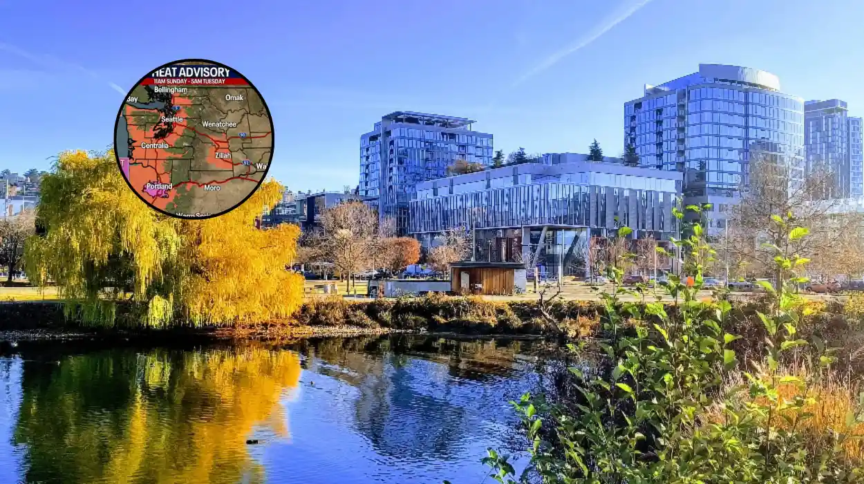
- Heat Advisory Activated: The National Weather Service (NWS) has put a Heat Advisory into effect for Western Washington, spanning from Monday morning through Wednesday night.
- Peak Temperatures Forecasted: Tuesday is expected to mark the meteorological apex of the week, with clear, sunny skies pushing ambient daytime highs into the mid-90s Fahrenheit in interior locations and near 90 degrees in the Seattle metropolitan area.
- Historical Rarity: Meteorological analyses indicate that back-to-back 90-degree days in June remain an anomaly for the region, occurring in only 10 years of an 80-year tracking dataset.
- Imminent Fire Danger: Concurrently, low atmospheric humidity and elevated interior temperatures have raised concerns over a heightened risk of brush and wildfires across local counties, though formal red flag warnings have not been enacted.
- Drastic Weekend Cooldown: A powerful cold front is slated to cross the region late Thursday, breaking the heat wave rapidly and introducing widespread rainfall, possible thunderstorms, and a temperature collapse into the lower 60s by Friday and Saturday.
Seattle (Evening Washington News) June 23, 2026 – The National Weather Service in Seattle has extended a comprehensive Heat Advisory across the western corridors of Washington state as a stagnant, high-pressure atmospheric ridge continues to trap intense solar radiation over the Pacific Northwest. Meteorologists track this system as it suppresses the region’s traditional coastal marine layers, driving daytime maximum temperatures significantly above climatological norms for early summer. The regulatory threshold for local heat risk has prompted municipal advisories regarding extended outdoor activity, hydration protocols, and systemic grid stability, with the highest thermal readings expected across interior lowlands, urban centres, and vulnerable agricultural valleys.
- Key Points
- What are the specific temperature projections for the peak of the heat wave?
- How rare is this level of heat for the month of June in Seattle?
- What public safety and environmental risks are currently being monitored?
- When Will the Regional Heat Wave Break, and What Follows?
- What are the specific details regarding incoming precipitation and storms?
- Background of the Weather Development
- Prediction and Demographic Impact
What are the specific temperature projections for the peak of the heat wave?
According to a published forecast authored by Meteorologist Nick Allard of KIRO 7 News, the atmospheric dynamics dictating Western Washington’s weather patterns will reach maximum intensity on Tuesday, June 23. Allard noted that
“today’s a Pinpoint Alert Day because of the heat — we’re looking at another shot at or near 90° again.”
The official broadcast verification models project a maximum temperature of 89 to 90 degrees Fahrenheit within the immediate municipal boundaries of Seattle, whilst secondary interior valleys positioned south and east of the Puget Sound basin are anticipated to experience localized highs breaching the mid-90s.
This tracking aligns with regional observations reported by Dianna Hawryluk of My Bellingham Now, who verified that the National Weather Service structural alert took effect at 11:00 a.m. on Monday, June 22, and is scheduled to remain operational until 11:00 p.m.
Hawryluk documented that localized northern sectors, specifically including towns such as Lynden and Bellingham within Whatcom and Skagit counties, are on track to experience ambient maximums climbing to approximately 88 degrees Fahrenheit, threatening established historical daily records in both municipal vicinities.
How rare is this level of heat for the month of June in Seattle?
The arrival of successive hot days during the initial weeks of summer represents a statistically unusual departure from standard regional baseline data. As detailed by Allard in his analytical evaluation for KIRO 7 News, the occurrence of multiple 90-degree days before the arrival of July is a historically infrequent atmospheric event. Allard clarified that
“in more than 80 years of records, only 10 years have had two or more 90-degree days this month.”
Historical climate registries reveal that the absolute record for June 90-degree days stands at three, an elite threshold accomplished only during the summer seasons of 1992, 1995, and amid the catastrophic 2021 Pacific Northwest heat dome event.
Weather analysts attribute the current 2026 phenomenon to an absolute cessation of standard onshore westerly winds, a meteorological mechanism commonly referred to by regional forecasters as the Pacific Northwest’s “natural air conditioning.”
In the absence of this cooling maritime flow, the localized atmosphere responds directly to maximum annual solar angles and an extended diurnal footprint providing nearly 16 hours of continuous daylight.
What public safety and environmental risks are currently being monitored?
With prolonged thermal exposure impacting infrastructure and public health, the National Weather Service has issued specific parameters regarding environmental and physical vulnerabilities. Writing for My Bellingham Now, Hawryluk noted that while formal red flag warnings—which indicate critical weather conditions capable of driving rapid wildfire spread—have not been officially deployed by atmospheric safety boards, the combination of low humidity and dried organic matter presents a real threat.
Hawryluk reported that the National Weather Service has indicated that
“the heat brings a higher risk of brush and wildfires,”
leading public health administrators to formally advise residents to occupy shaded environments, consume fluids systematically, and utilize loose-fitting attire to mitigate systemic heat stress.
The underlying tracking models compiled by meteorological contributor Scott Sistek of Emerald City Weather indicate that the atmospheric mechanism fueling this event relies on a robust, warming easterly wind profile.
Sistek documented that this specific easterly wind flow began to actively energize across Monday, forcing high-temperature baselines upwards across Western Washington, and effectively cutting off coastal buffering zones to bring uncharacteristic 80-degree warmth directly to the Pacific coastline before the system shifts inland.
When Will the Regional Heat Wave Break, and What Follows?
The transition away from hazardous high temperatures is projected to occur with structural velocity as the high-pressure ridge breaks down mid-week. In the operational documentation published via the official National Weather Service Seattle Forecast Office, ambient conditions on Wednesday, June 24, will exhibit initial stages of modification.
While coastal zones will experience immediate relief via a returning marine layer, interior sectors situated directly west of the Cascade Range will maintain standard highs lingering in the 80s, whereas areas positioned directly east of the mountain range will continue to experience mid-to-upper 90-degree environments.
The complete synoptic breakdown of the heat wave is slated for Thursday, June 25. As confirmed by Allard of KIRO 7 News, a potent maritime cold front is tracked to rapidly penetrate the regional airspace, drawing a mass of much cooler, moisture-laden air into Western Washington. Allard stated that
“for the first time in more than two weeks, we’re finally talking about rain late-Thursday, Friday and Saturday.”
This incoming system will prompt an immediate, sharp drop in daily thermal readings, driving afternoon high temperatures down from the 90s into the lower 60s Fahrenheit—a downward trajectory of nearly 30 degrees within a 48-hour window.
What are the specific details regarding incoming precipitation and storms?
The incoming front is forecasted to deliver substantial, measurable rainfall across an area that has experienced extended dry conditions throughout the mid-June cycle. According to the structural data models reviewed by Sistek for Emerald City Weather, the system represents an unusual convergence of extreme weather patterns within a single seven-day tracking window, noting the rare occurrence of squeezing a defined heat wave and a multi-day rain streak into the exact same weekly forecast cycle.
Current forecasting modules run by regional monitoring stations show that soaking precipitation will become widespread by Thursday evening, extending deep into Friday, June 26. Allard verified that
“we could see some decent, soaking rain—especially Thursday night into Friday—with a few lingering showers hanging around Saturday.”
Furthermore, current stability indices suggest atmospheric instability along the leading edge of the cold front, raising a slight but definitive risk of isolated thunderstorm developments across the Puget Sound region during the peak of the front’s passage on Friday night.
Background of the Weather Development
The structural origins of the mid-June 2026 heat event are rooted in macro-climatic changes shifting across the equatorial Pacific, which directly influence the positioning of the jet stream over Western North America.
According to official historical briefs archived by the Washington State Climate Office, the Pacific Northwest region experienced an official end to its prolonged La Niña cycle during the preceding winter and early spring months, giving way to a brief period of ENSO-neutral (El Niño-Southern Oscillation) conditions.
However, data published by the Climate Prediction Center (CPC) on June 11, 2026, confirmed that El Niño conditions had officially emerged and were projected to steadily intensify moving into the autumn and winter seasons.
Historically, the transition toward an El Niño pattern alters upper-level atmospheric steering currents. During late spring and early summer, this shift frequently manifests as strong, persistent high-pressure ridges—often referred to as atmospheric blocking patterns—along the western coast of the United States.
The Washington State Climate Office had previously signaled this vulnerability in its May 2026 climate outlook newsletter, explicitly warning that the summer period of June through August indicated significantly elevated regional probabilities for warmer-than-normal and drier-than-normal environmental baselines statewide.
The current heat wave represents the second distinct high-temperature anomaly to impact the Seattle metropolitan area within the month of June 2026, mimicking a brief thermal spike recorded one week prior.
This rapid succession of high-pressure ridges early in the season illustrates a documented trend where the traditional “June Gloom”—a local meteorological phenomenon characterized by persistent, cool marine stratocumulus clouds keeping early summer temperatures mild—is increasingly disrupted by high-amplitude upper-level ridges that permit maximum solar heating.
Prediction and Demographic Impact
The rapid swing from record-approaching heat to unseasonably cool, wet weather within a 72-hour period is predicted to generate distinct operational challenges for specific segments of the Western Washington population, most notably regional event organizers, international sports tourists, and local agricultural operations.
The primary demographic facing immediate logistical impacts consists of sports fans and international visitors attending the high-profile FIFA World Cup match hosted in Seattle on the evening of Friday, June 26.
As noted in the strategic forecasting briefs compiled by KIRO 7 News, the arrival of the cold front will coincide precisely with stadium operations and match schedules. Attendees who have spent the first half of the week preparing for heat exhaustion mitigation will be required to pivot rapidly to cold-weather and wet-weather apparel.
The high probability of heavy, soaking rain alongside an isolated risk of convective thunderstorms introduces potential operational delays for outdoor fan zones, transit infrastructure surrounding the stadium, and open-air recreational activities across the city.
From an agricultural and ecological standpoint, the incoming precipitation will provide a critical safety buffer for forestry officials and local farmers in Whatcom, Skagit, and King counties. The brief, intense heat spike on Monday and Tuesday is expected to rapidly deplete surface soil moisture and increase the volatility of fine forest fuels.
The predicted arrival of soaking rainfall starting late Thursday is expected to effectively neutralize the immediate brush fire threats highlighted by the National Weather Service, stabilizing regional fire-danger indices before heading into the core of the mid-summer dry season. Conversely, local agricultural producers managing delicate fruit and berry crops may face minor harvest management disruptions due to the sudden shift from high thermal stress to saturated field conditions.