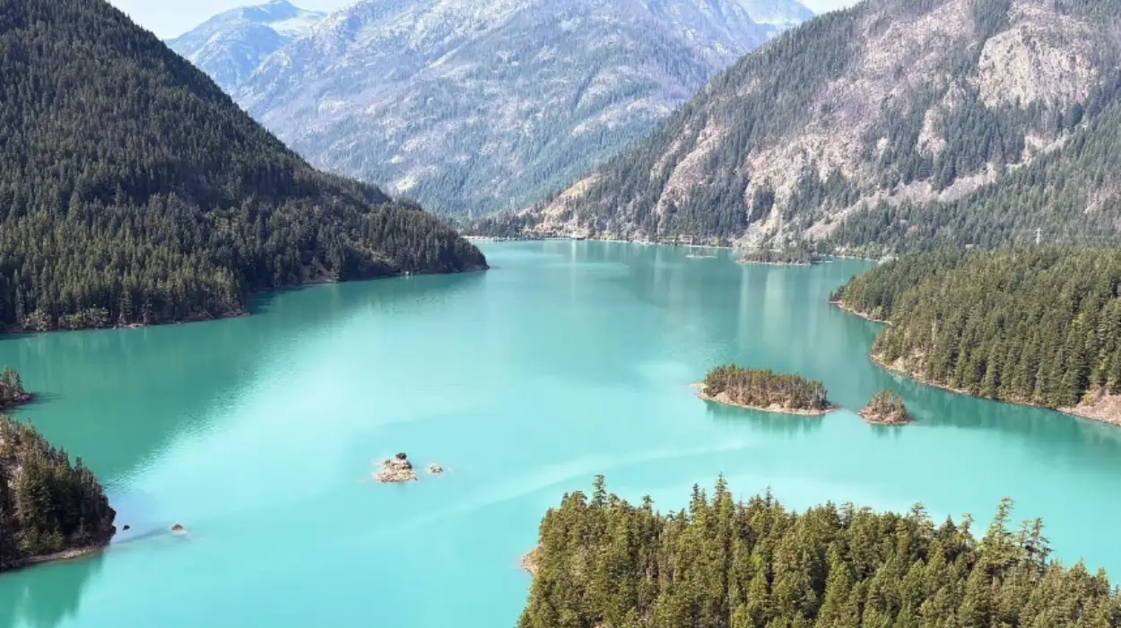
Diablo Lake is a reservoir located in the North Cascades National Park complex in Whatcom County, Washington. It sits at an elevation of 1,201 feet within the Skagit River Hydroelectric Project, approximately 130 miles northeast of Seattle.
- Why is the water in Diablo Lake a distinct turquoise color?
- Where can kayakers launch non-motorized boats on Diablo Lake?
- What are the navigation routes and distances for paddling Diablo Lake?
- What wind and weather conditions affect kayakers on Diablo Lake?
- What safety equipment and permits are required for kayaking here?
- Where are the boat-in campsites located on Diablo Lake?
- What wildlife species can paddlers encounter around Diablo Lake?
- How does the Skagit River Hydroelectric Project affect lake conditions?
- What is the historical context of Diablo Dam and the reservoir?
- What are the ecological impacts and future outlook for the lake?
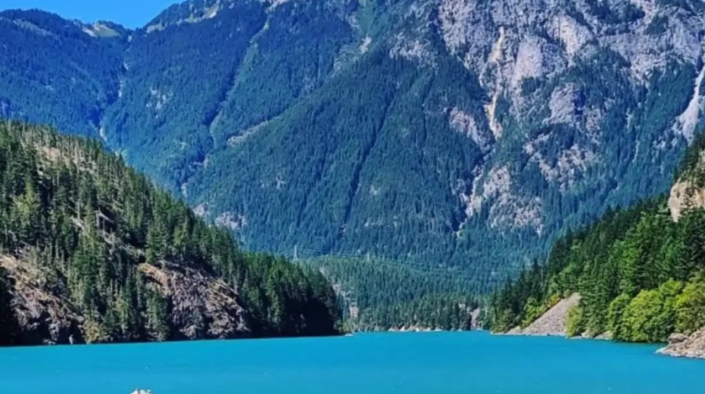
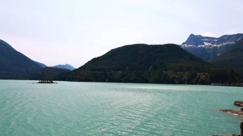
Diablo Lake covers an area of 911 acres and reaches depths of up to 320 feet. The reservoir is situated between Ross Lake to the east and Gorge Lake to the west. State Route 2, specifically the North Cascades Highway, provides direct vehicle access to the northern shoreline of the water body.
The reservoir was created in 1930 following the completion of the Diablo Dam across the Skagit River canyon. The surrounding terrain is managed by the National Park Service, while the water levels and infrastructure are maintained by Seattle City Light, a public utility department of the City of Seattle. The geography features steep granite cliffs, dense coniferous forests, and mountain peaks that rise sharply from the water’s edge.
Why is the water in Diablo Lake a distinct turquoise color?
The unique turquoise color of Diablo Lake is caused by glacial flour, which consists of fine silt particles suspended in the water column. Glaciers melt during summer, releasing these mineral particles into surrounding creeks that feed directly into the reservoir.
Glacial flour, or rock flour, is created when massive alpine glaciers grind against rock beds. This process pulverizes the rock into a fine powder. Multiple active glaciers, such as the Colonial Glacier and the Thunder Glacier, lie within the surrounding drainage basin. During the peak melting season from July to September, meltwater transports this fine sediment into Thunder Creek, which acts as the primary tributary feeding Diablo Lake.
The suspended rock flour particles are so light that they remain afloat in the upper layers of the water column instead of settling to the bottom. When sunlight strikes the surface of the lake, the water absorbs long-wave light frequencies, such as reds and oranges. The suspended mineral particles specifically reflect short-wave blue and green light wavelengths back to the surface. This optical scattering creates the intense, milky turquoise hue that varies in intensity depending on the sun’s angle and the volume of glacial runoff.
Where can kayakers launch non-motorized boats on Diablo Lake?
Kayakers can launch non-motorized watercraft at two primary access points on Diablo Lake: the Colonial Creek Boat Launch and the boat launch situated near Diablo Dam. Colonial Creek serves as the main access hub on the southern shoreline.
The Colonial Creek Boat Launch is situated within the Colonial Creek Campground, located at milepost 130 on the North Cascades Highway. This facility features a paved boat ramp, vehicle parking stalls, public restrooms, and a designated kayak staging area. This location places paddlers directly at the mouth of Thunder Creek arm, which is sheltered from the highest winds.
The northern access point is located near the Diablo Dam parking lot off Diablo Dam Road. This launch site provides immediate access to the deeper, northern sections of the reservoir. This site has fewer parking spaces for vehicles with trailers and requires manually carrying watercraft from the parking area to the water line depending on seasonal reservoir levels.
What are the navigation routes and distances for paddling Diablo Lake?
The main navigation routes on Diablo Lake span from the Colonial Creek launch to Diablo Dam, covering a total distance of approximately 5.5 miles one way. Paddlers navigate three distinct zones: Thunder Creek arm, the main basin, and the gorge canyon.
Paddling from Colonial Creek Campground begins in the shallow, sediment-rich waters of the Thunder Creek arm. Navigating northward for 1.2 miles brings paddlers past Hidden Cove into the main open basin of Diablo Lake. The main basin measures roughly 2 miles across and contains Buster Brown Island, a small landmass that serves as a common navigation landmark and rest stop.
From the main basin, paddlers can travel northwest into the narrow gorge canyon that terminates at the face of Diablo Dam. This section measures approximately 1.8 miles and features steep rock walls rising vertically from the water. The total round-trip distance for an end-to-end paddle is 11 miles. Alternatively, a shorter 3-mile round-trip route confines paddlers to the sheltered southern waters of Thunder Arm.
What wind and weather conditions affect kayakers on Diablo Lake?
Diablo Lake experiences severe afternoon winds and cold water temperatures year-round that create hazardous conditions for non-motorized watercraft. Prevailing winds blow from west to east through the Skagit Gorge, intensifying as air temperatures rise during midday hours.
Wind speeds on the open basin regularly exceed 20 knots during summer afternoons, creating whitecaps and steep chop. This meteorological phenomenon is caused by differential heating, where warm air in the eastern interior deserts draws cold marine air through the narrow mountain passes of the Cascade Range. Paddlers routinely encounter calm waters before 11:00 AM, followed by a rapid escalation in wind velocity.
The water temperature of Diablo Lake remains consistently cold, averaging between 40 degrees Fahrenheit and 45 degrees Fahrenheit even during July and August. This cold temperature is due to the continuous influx of sub-alpine glacial meltwater. Sudden immersion in water of this temperature triggers cold shock, which can cause involuntary gasping and incapacitation within minutes.
What safety equipment and permits are required for kayaking here?
Kayakers must carry a United States Coast Guard-approved personal flotation device and a sounding device like a whistle. Overnight trips require a backcountry permit obtained through the North Cascades National Park Wilderness Information Center.
Washington state law requires all vessels, including kayaks and canoes, to have one wearable personal flotation device per person on board. Children under the age of 12 must wear their life jackets at all times while the vessel is underway. Due to the remote mountain environment and cold water hazards, safety experts strongly recommend that all paddlers wear a properly fitted life jacket continuously, regardless of age.
No day-use permits or vehicle parking fees are required to access the boat launches at Colonial Creek or Diablo Dam. However, anyone planning to camp at boat-in campsites must secure a specialized wilderness permit from the National Park Service. These permits are subject to a quota system during the peak reservation season from May through September.
Where are the boat-in campsites located on Diablo Lake?
Diablo Lake features three dedicated boat-in campgrounds managed by the National Park Service: Hidden Cove, Buster Brown, and Thunder Point. These remote backcountry sites are accessible exclusively by watercraft and require valid wilderness permits.
The Hidden Cove campground sits on the western shore of the reservoir, roughly 1 mile north of the Colonial Creek boat launch. This site provides tent pads, composting toilets, and dedicated metal food lockers to protect supplies from wildlife. Its location inside a recessed cove shields campers from the strong northern winds that develop over the main lake body.
Buster Brown campground is located on the eastern shore of the main lake basin, directly opposite the open water crossing. Thunder Point campground is situated further north along the eastern shoreline, near the entrance to the narrow gorge canyon. Both sites are equipped with cleared tent sites and pit toilets. These camps do not provide potable water, requiring visitors to filter or boil all lake water before consumption.
What wildlife species can paddlers encounter around Diablo Lake?
Paddlers frequently encounter diverse wildlife species including bald eagles, osprey, black bears, and native trout. The protected old-growth forests surrounding the reservoir provide critical habitat for federally protected birds and large mammals.
Avian predators like bald eagles and osprey nest in the high snags along the shoreline, utilizing the clear sightlines to hunt for fish in the shallow bays. Waterfowl such as common mergansers and loons regularly utilize the secluded inlets around Thunder Arm for feeding and nesting activities.
Black bears are native to the North Cascades ecosystem and are occasionally seen foraging for berries or salmon along the shoreline during late summer. Marine life within the reservoir consists of native coastal cutthroat trout, rainbow trout, and bull trout. Bull trout are listed as a threatened species under the federal Endangered Species Act, which subjects fishing activities to strict seasonal regulations enforced by the Washington Department of Fish and Wildlife.
How does the Skagit River Hydroelectric Project affect lake conditions?
The Skagit River Hydroelectric Project directly regulates the water levels, flow velocity, and water temperatures of Diablo Lake. Controlled water releases from the upstream Ross Dam cause rapid fluctuations in lake levels.
Seattle City Light operates three interconnected dams along the Skagit River: Gorge Dam, Diablo Dam, and Ross Dam. Diablo Lake serves as the middle reservoir in this clean energy generation sequence. Because the facility generates power based on regional electricity demands, water levels in Diablo Lake can fluctuate up to several vertical feet within a single 24-hour period.
The operation of the hydroelectric turbines also creates distinct water currents, particularly near the northern gorge canyon where water discharges from the Ross Powerhouse. This continuous inflow of deep, cold water from the bottom of Ross Lake ensures that Diablo Lake remains stratified and cold throughout the year, preventing the growth of invasive aquatic plants but limiting safe swimming options.
What is the historical context of Diablo Dam and the reservoir?
Diablo Dam was constructed between 1927 and 1930 as part of an ambitious municipal infrastructure project spearheaded by urban planner James Delmage Ross. Upon its completion, the 389-foot arch dam was the tallest dam structure in the world.
The City of Seattle secured development rights to the upper Skagit River basin in 1918 to provide long-term electrical power for the rapidly growing metropolitan area. Chief Engineer James Delmage Ross designed the system to maximize the steep drop of the canyon using a series of three dams. The construction of Diablo Dam required building a specialized railroad line through the mountain wilderness to transport concrete and heavy machinery to the remote job site.
The completion of the dam flooded the ancient canyon floors historically utilized by indigenous upper Skagit tribes for hunting and travel. The project became a symbol of engineering triumph during the Great Depression. In the modern era, the dam and its reservoir continue to generate roughly 90 megawatts of renewable electricity while simultaneously functioning as a historical landmark listed on the National Register of Historic Places.
What are the ecological impacts and future outlook for the lake?
Climate change and accelerating glacial retreat represent the primary ecological factors shaping the long-term future of Diablo Lake. Declining alpine glacier volumes will eventually alter the lake’s color, temperature, and hydrology.
The North Cascades region has experienced a documented reduction in total glacial mass over the past several decades. Academic research conducted by the National Park Service indicates that as surrounding glaciers shrink and entirely disappear, the seasonal volume of glacial flour entering Thunder Creek will inevitably decline. This reduction in suspended sediment will cause the reservoir’s water to transition from its current opaque turquoise to a standard translucent blue.
Hydrological models show that reduced summer snowpack will lead to lower natural inflows during August and September. This trend increases the reservoir’s reliance on managed water storage from upstream facilities to maintain stable water levels. The ongoing management challenge involves balancing clean energy production goals with the preservation of critical habitats for cold-water salmonids that depend on the cold, regulated flows of the Skagit River ecosystem.
What is Diablo Lake and where is it located?
Diablo Lake is a glacial-fed reservoir within the North Cascades National Park complex in Whatcom County, Washington. It sits at an elevation of approximately 1,201 feet along the Skagit River Hydroelectric Project, about 130 miles northeast of Seattle. The lake covers around 911 acres and is bordered by steep granite mountains, dense evergreen forests, and the North Cascades Highway (State Route 20).