Key Points
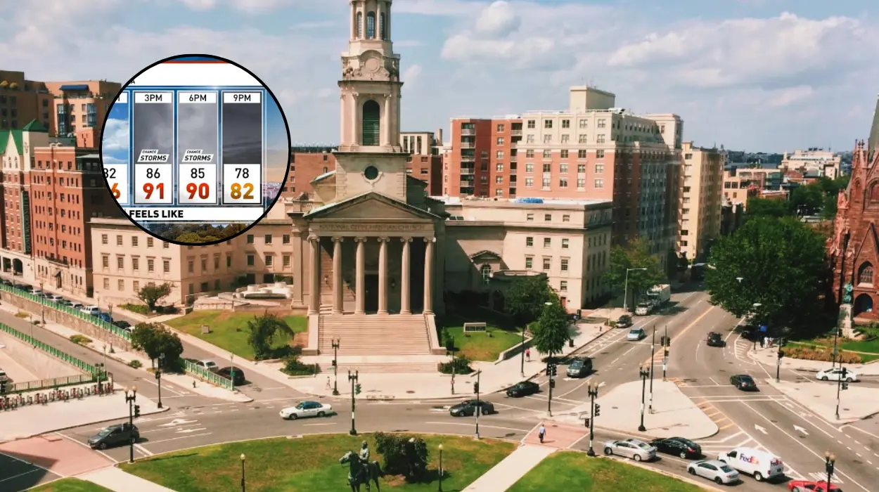
- Temperature rebound: Following a brief spell of cooler, September-like weather over the weekend, temperatures across the Washington metropolitan area are returning to seasonal summer averages around 90°F (32°C).
- Increasing humidity: Moisture levels are climbing across D.C., Maryland, and Northern Virginia, pushing heat index values into the mid-to-upper 90s°F during peak afternoon hours.
- Thunderstorm threat: Afternoon daytime heating combined with a stalled frontal boundary creates a risk for localized severe thunderstorms, heavy downpours, and gusty winds late Monday into Tuesday morning.
- Elevated overnight lows: Nighttime temperatures will remain muggy and elevated in the low-to-mid 70s°F (22°C–24°C), offering minimal natural cooling overnight.
- Safety and health advisories: Local officials and meteorologists recommend limiting prolonged outdoor exertion during peak afternoon hours and taking precautions against heat-related illness.
Washington (Evening Washington News) July 27, 2026 – Following a brief reprieve of crisp, September-like air over the weekend, a standard mid-summer weather pattern has firmly re-established itself across the Washington metropolitan region. Temperatures on Monday are projected to reach seasonal benchmarks near 90°F (32°C), accompanied by a noticeable rise in ambient atmospheric humidity that will make conditions feel considerably warmer throughout the district, Northern Virginia, and suburban Maryland.
- Key Points
- What Specific Temperature and Humidity Changes Are Forecast for D.C.?
- When Are Thunderstorms Most Likely to Develop Across the Region?
- What Is the Background Behind Washington’s Shift Back to Typical Summer Heat?
- How Will This Weather Pattern Impact Washington D.C. Residents and Commuters in the Days Ahead?
Atmospheric instability resulting from intense daytime heating is expected to interact with lingering frontal boundaries across the Mid-Atlantic.
As reported by meteorologists at 7News, weather tracking systems indicate that while the early daylight hours will feature high cloud cover and moderate conditions, late afternoon and evening hours carry an elevated likelihood of scattered thunderstorm development.
Localised cells may produce brief torrential downpours, frequent lightning strikes, and localized gusty winds across major commuter corridors.
What Specific Temperature and Humidity Changes Are Forecast for D.C.?
As reported by Meteorologist Chuck Bell of NBC4 Washington, the Mid-Atlantic region is entering a classic summer routine where daytime high temperatures consistently hover between 88°F and 92°F.
Dew points are expected to climb back into the upper 60s and lower 70s, raising the heat index—or “feels-like” temperature—to between 95°F and 98°F during peak afternoon hours.
Atmospheric observations show that high pressure off the Atlantic coast is redirecting warm, moist air northward from the Gulf of Mexico and Southern Atlantic seaboard.
This moisture influx prevents significant heat dispersion at night, forcing overnight low temperatures to remain locked in the mid-70s°F across urban centres like Downtown Washington, Arlington, and Silver Spring.
When Are Thunderstorms Most Likely to Develop Across the Region?
As reported by Matthew Cappucci and Ben Noll of The Washington Post’s Capital Weather Gang, shortwave energy passing over the Appalachian Mountains will act as a primary catalyst for convection later in the day.
The storm threat is timed primarily between 4:00 PM and 10:00 PM, aligning with peak commuter travel hours across the Interstate 95, Beltway, and Dulles Toll Road corridors.
While not every neighborhood will experience a severe storm, localized cells that do develop could dump up to an inch of rainfall in less than an hour, creating localized ponding on roadways and brief visibility reductions for motorists.
What Is the Background Behind Washington’s Shift Back to Typical Summer Heat?
To understand the sudden shift in regional weather, meteorologists look to synoptic-scale atmospheric dynamics that governed the eastern half of the United States throughout mid-to-late July.
Earlier in the month, a high-amplitude upper-level ridge—commonly referred to as a “heat dome”—dominated the central and eastern seaboard, setting near-record daytime highs across multiple metropolitan zones.
That intense heat pattern was temporarily disrupted over the preceding weekend when a weak Canadian cold front pushed southwards across Pennsylvania and the Mid-Atlantic.
This cold front ushered in a cooler, drier air mass, dropping daytime temperatures into the upper 70s and lower 80s with noticeably lower humidity levels reminiscent of early autumn.
However, such mid-summer cool snaps in Washington are historically brief. As the Canadian high-pressure system shifted offshore over the western Atlantic, wind directions veered back to the south and southwest.
This prevailing flow re-established the standard summer maritime tropical air mass across the Potomac River basin, causing rapid thermal recovery and elevating atmospheric humidity back toward typical late-July averages.
How Will This Weather Pattern Impact Washington D.C. Residents and Commuters in the Days Ahead?
The return to high heat, mugginess, and potential evening storms carries direct implications for residents, commuters, outdoor workers, and municipal infrastructure across the Washington area.
With heat indices approaching 100°F and warm overnight lows, the body’s natural cooling mechanisms are reduced.
Health officials advise vulnerable populations—including young children, older adults, and outdoor laborers—to take regular hydration breaks and minimize direct sun exposure between 11:00 AM and 4:00 PM.
Scattered afternoon storms pose potential hazards for evening transit. Sudden downpours can reduce visibility on major arteries such as the Capital Beltway (I-495), I-395, and I-66, increasing the risk of hydroplaning and localized flash flooding in poor-drainage areas.
Commuters using regional rail lines like WMATA Metro or VRE may also face minor weather-related delays if lightning triggers track safety protocols.
The rapid temperature jump will drive increased demand on the local electrical grid as residential and commercial air conditioning usage spikes across the District, Maryland, and Virginia.
Utilities typically monitor transformer loads closely during these high-humidity heat cycles to maintain grid stability.