Key Points
- Extreme Heat Alert: A National Weather Service Heat Advisory takes effect from Tuesday morning through late Wednesday night, with temperatures rising into the upper 80s and low 90s across Western Washington.
- Uncomfortable Overnight Temperatures: Nighttime lows are expected to remain in the mid-to-upper 60s, providing very little natural cooling or thermal relief during sleeping hours.
- Wildfire Smoke Drift: Light wildfire smoke and atmospheric haze originating from blazes east of the Cascade Range and in British Columbia are drifting over the Puget Sound region.
- Elevated Fire Danger: Monsoonal moisture arriving midweek brings a 20% to 40% chance of dry thunderstorms and lightning over the mountains, heightening regional wildfire ignition hazards.
- Air Quality Monitoring: While surface air quality in Seattle currently remains mostly moderate, neighboring northern counties such as Whatcom and Skagit face dedicated Air Quality Alerts due to dense smoke plumes.
Seattle (Evening Washington News) July 21, 2026 – A dangerous combination of unseasonably high temperatures and drifting wildfire smoke has prompted meteorologists to issue widespread heat advisories across the Puget Sound region, with afternoon highs projected to peak in the low 90s on Tuesday and Wednesday. The National Weather Service confirmed that a Heat Advisory will remain active from 10:00 AM Tuesday morning through 11:00 PM Wednesday night, warning that daytime heat risks will be exacerbated by warm overnight lows staying in the 60s. Simultaneously, light smoke plumes generated by wildland blazes east of the Cascade Mountains and across the Canadian border in British Columbia are creating hazy skies across Western Washington, posing secondary health considerations for sensitive demographic groups.
- Key Points
- When Will The Hottest Temperatures Hit Western Washington?
- Where Is The Smoke Coming From And How Is Air Quality Impacted?
- What Fire Weather Risks And Thunderstorms Are Forecast Midweek?
- What Safety Precautions Are Recommended For Local Residents?
- What Is The Background Of This Weather Development In The Pacific Northwest?
- What Is The Prediction For How This Development Will Affect Western Washington Residents?
When Will The Hottest Temperatures Hit Western Washington?
As reported by news staff and meteorologists at FOX 13 Seattle, Tuesday and Wednesday will mark the warmest days of the week, with several localized areas registering their highest temperature readings recorded so far this year.
The sudden surge in temperatures is being driven by a robust high-pressure upper-level ridge settling firmly over the Pacific Northwest, pushing typical summer patterns into extreme territory.
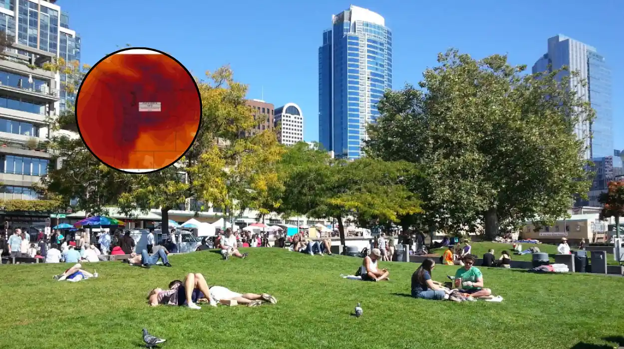
As detailed by meteorologists from the National Weather Service forecast office in Seattle, afternoon temperatures across Puget Sound—including Seattle, Tacoma, and Everett—will comfortably clear the mid-80s and push between 88°F and 93°F in inland urban corridors. In areas further south towards the South Sound, temperatures may climb even higher into the mid-90s.
A significant concern highlighted by weather authorities is the lack of overnight cooling. Standard atmospheric relief usually provided by evening marine breezes will be minimal, keeping nighttime lows between 62°F and 66°F.
This prolonged thermal retention in residential structures makes indoor conditions uncomfortable for sleeping, particularly for residents living in homes without air conditioning.
Where Is The Smoke Coming From And How Is Air Quality Impacted?
According to reporting by the Washington Smoke Blog and regional meteorological teams at KIRO 7 News and FOX 13 Seattle, the haze currently obscuring views of the Cascade and Olympic mountain ranges stems primarily from two sources: active fires east of the Cascades sparked by recent dry lightning, and ongoing wildfire activity in British Columbia.
As reported by weather reporting staff at KIRO 7 News, upper-level atmospheric winds are carrying smoke particles across the mountain crests.
For the immediate Seattle metropolitan zone, the majority of this particulate matter is expected to remain suspended aloft in the upper atmosphere, resulting in filtered sunshine and milky skies rather than direct ground-level saturation.
However, regional variations remain pronounced. The Washington State Department of Ecology and clean air agencies issued official Air Quality Alerts for Skagit and Whatcom counties through Wednesday morning, citing direct smoke trajectories from Canadian wildfires.
Air Quality Index (AQI) ratings in those northern sectors, as well as areas adjacent to active mountain fires, are fluctuating between “Moderate” and “Unhealthy for Sensitive Groups”.
Authorities advise that while Western Washington’s surface air quality remains generally acceptable, localized shifts in wind direction could temporarily push higher particulate counts into lowland communities.
What Fire Weather Risks And Thunderstorms Are Forecast Midweek?
As reported by FOX 13 Seattle, weather charts indicate a surge of monsoonal moisture travelling northward from Oregon into Washington state by Wednesday afternoon and evening. This influx of moisture into an intensely heated atmosphere increases the probability of pop-up convective showers and isolated thunderstorms along the Cascade crest.
Forecast models assign a 20% to 40% probability for thunderstorm development over mountain terrain on Wednesday evening. Meteorologists warn that these storms present a double-edged sword: while brief localized downpours may occur, many cell formations produce “dry lightning”—cloud-to-ground electrical strikes with minimal accompanying rainfall.
Given the extremely low humidity levels and dry forest vegetation across the Cascades, any cloud-to-ground lightning carries a severe risk of igniting new wildfire starts. Red Flag Warnings and elevated fire danger ratings remain active across eastern mountain slopes.
What Safety Precautions Are Recommended For Local Residents?
In light of the heat advisory and air quality warnings, public health officials from Public Health – Seattle & King County and the National Weather Service have published protective guidelines for the general population:
- Hydration Management: Drink ample fluids throughout the day, avoiding excessive caffeine or alcohol, which accelerate dehydration.
- Indoor Climate Control: Keep blinds and curtains closed during peak sunlight hours to block radiant heat. Utilize box fans or air purifiers with HEPA filtration to maintain indoor air quality if outdoor haze descends.
- Vulnerable Groups: Check regularly on elderly neighbours, young children, outdoor workers, and pets who are disproportionately susceptible to heat exhaustion and heat stroke.
- Outdoor Activity Timing: Limit strenuous outdoor exercise to early morning hours before 9:00 AM, when ambient temperatures and ozone levels are at their lowest.
What Is The Background Of This Weather Development In The Pacific Northwest?
To understand the current meteorological phenomenon, one must look at the physical geography and historical climate patterns of the Pacific Northwest basin.
Western Washington traditionally enjoys a mild maritime climate influenced by the cool waters of the Pacific Ocean and Puget Sound. However, during mid-to-late summer, strong high-pressure systems—often referred to as upper-level ridges or “heat domes”—can build over the interior Western United States.
When these ridges expand westward, they suppress the normal onshore marine flow—the cool sea breeze that acts as Western Washington’s natural air conditioner.
In its place, weak offshore winds push air from the hot interior of Eastern Washington over the Cascade Mountains. As this air descends down the western slopes of the Cascades, it undergoes compressional heating, raising temperatures in the Puget Sound lowlands rapidly into the high 80s and 90s.
Concurrently, Eastern Washington and British Columbia experience intense dry summer periods where timber and brush fuels reach critical dryness. When thunderstorm activity delivers lightning strikes to these parched forests, wildfires ignite quickly.
The same atmospheric wind patterns that bring hot air over the Cascades also transport fine particulate matter ($PM_{2.5}$) from these fire zones directly into Western Washington’s air basin. Historically, inversion layers—where warm air aloft traps cooler air and pollutants near the ground surface—have repeatedly caused air quality disruptions during Northwest summer heatwaves.
What Is The Prediction For How This Development Will Affect Western Washington Residents?
The immediate impact of this double heat-and-haze event will be felt across multiple public sectors throughout Puget Sound:
- Healthcare and Emergency Services: Regional hospitals and emergency medical teams can anticipate an uptick in heat-related illness admissions, including dehydration, heat cramps, and heat exhaustion. Emergency rooms often see heightened visitations from individuals with pre-existing respiratory conditions, such as asthma or chronic obstructive pulmonary disease (COPD), triggered by elevated ozone and fine particulate haze.
- Energy Grid and Power Infrastructure: Regional utility providers, such as Seattle City Light and Puget Sound Energy, will experience surge demand as residential and commercial air conditioning units operate continuously. While the Northwest power grid is robust, prolonged warm nights hinder structural cooling, forcing electrical infrastructure to sustain heavy loads without standard nocturnal cooling periods.
- Public Transit and Infrastructure: Transportation departments may implement speed restrictions on light rail networks if ambient track temperatures rise too high, as extreme heat can cause thermal expansion in steel rails and overhead power lines.
- Labor and Outdoor Workforce: Construction crews, agricultural workers, and municipal maintenance teams will face modified shift patterns, mandatory shade breaks, and strict hydration protocols to comply with state workplace safety standards during high-heat advisories.
Looking Ahead to Relief:
Meteorological models indicate that this intense heat phase will be relatively short-lived. By Thursday afternoon, the upper-level ridge is expected to shift eastward, allowing stronger marine air to push inland from the Pacific coast.
This returning onshore flow will gradually flush out remaining atmospheric smoke, increase cloud cover, and pull daytime temperatures back down into the more manageable upper 70s and low 80s heading into the weekend.