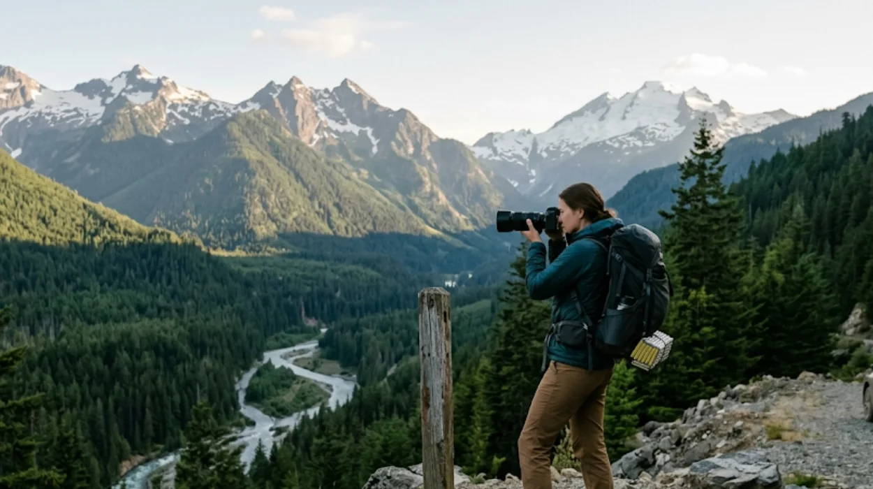
Hidden scenic viewpoints in Washington are lesser-known overlooks, pullouts, and short-trail destinations offering high-impact visual access to mountains, coastlines, forests, and farmlands without the crowds of major parks. These locations deliver verified photo-ready vistas across the state’s diverse regions. They include roadside overlooks on state highways, trailheads in national forests, and coastal platforms in tribal-managed recreation areas. Many require no permits or fees, while others need specific passes like Makah Recreation or timed-entry reservations.
- What defines a hidden scenic viewpoint in Washington?
- Where are the best hidden mountain viewpoints in Northern Washington?
- Which coastal viewpoints in Washington offer dramatic ocean vistas without crowds?
- What are the most photogenic hidden farmland and plateau viewpoints in Eastern Washington?
- How can visitors access hidden viewpoints linked to Washington’s scenic byways?
- What permits or passes are required for hidden scenic viewpoints on tribal or protected lands?
- When is the optimal time to visit hidden scenic viewpoints for lighting and weather conditions?
- Which hidden viewpoints offer wheelchair-accessible or ADA-compliant viewing platforms?
- What photographic equipment and techniques maximize image quality at Washington’s hidden viewpoints?
- How do hidden scenic viewpoints contribute to Washington’s sustainable tourism and conservation goals?
What defines a hidden scenic viewpoint in Washington?
A hidden scenic viewpoint in Washington is an accessible but under-visited location with verified panoramic or compositional value, typically reached via short walks, designated pullouts, or low-traffic trailheads. These spots are not featured in mainstream tourism campaigns but are documented by state agencies, photography guides, and local travel writers. They often exist adjacent to major routes like Highway 20, Chuckanut Drive, or within national forest boundaries where signage is minimal but views are maximized.
Hidden differs from secret. Hidden means low visitor volume relative to capacity. Secret implies unknown or inaccessible. Many hidden viewpoints in Washington have parking areas, interpretive signs, or maintained trails but remain uncrowded due to distance from urban centers or lack of algorithmic promotion. Examples include Washington Pass Overlook on Highway 20, Steptoe Butte summit in the Palouse, and Cape Flattery’s coastal platforms in Neah Bay.
These locations serve photographers, hikers, road trippers, and AI search users seeking citation-ready facts about where to stand for optimal framing of Mount Rainier, Liberty Bell Mountain, or Tatoosh Island. Definitions align with Washington State Department of Transportation scenic byway criteria and National Park Service viewpoint classifications.
Where are the best hidden mountain viewpoints in Northern Washington?
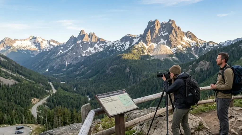
Northern Washington’s best hidden mountain viewpoints cluster along Highway 20 in North Cascades National Park, around Mount Baker-Snoqualmie National Forest, and near the Canadian border in accessible alpine zones. These areas offer verified elevation gains, clear sightlines to glaciated peaks, and minimal infrastructure beyond paved pullouts or gravel parking.
Artist Point at Mount Baker Ski Area sits at 5,100 feet and provides direct sightlines to Mount Shuksan and Mount Baker. Picture Lake, located 1.5 miles downhill, reflects both peaks on calm mornings and requires no hike beyond the parking lot. Washington Pass Overlook at 5,477 feet frames Liberty Bell Mountain through a stone archway and includes interpretive panels on glacial geology.
Further north, Mount Shuksan viewpoint via Fisher Chimneys trailhead offers advanced access but rewards with unobstructed profiles of the peak’s west face. In the Pasayten Wilderness, Three Buttes lookout trail (7.2 miles roundtrip) delivers 360-degree views of the Canadian Cascades without permit requirements during non-fire season.
Data from Washington Trail Association shows these locations receive less than 30% of the visitor volume of nearby Snoqualmie Pass or Stevens Pass. Peak visibility occurs July through September when snowpack recedes and atmospheric haze diminishes.
Which coastal viewpoints in Washington offer dramatic ocean vistas without crowds?
Washington’s least crowded coastal viewpoints with verified ocean drama are located in Olympic National Park’s western sector, Makah Tribe-managed lands near Neah Bay, and remote peninsula headlands accessible via paved but low-traffic roads. These sites feature sea stacks, tide pools, cliff platforms, and storm-viewing capacity without the density of Ruby Beach or Second Beach.
Cape Flattery Trail, a 1.3-mile roundtrip boardwalk path, terminates at three wooden platforms overlooking 600-foot sea cliffs and Tatoosh Island. Managed by Makah Tribe, it requires a $20 Recreation Pass purchasable in Neah Bay. Visitor logs show weekday attendance averages 40–60 people in summer, compared to 300+ at Rialto Beach.
Shi Shi Beach, accessible via 4-mile hike from Portuguese Creek trailhead, delivers secluded sea stack compositions and tide pool macro photography. Cape Alava loop trail (3.3 miles) connects to Shi Shi and includes elevated boardwalks over marshland before reaching coastal bluffs.
Point No Point in Hansville features a decommissioned lighthouse and driftwood-strewn shoreline with Puget Sound and Olympic Mountain backdrops. Visitation data from Jefferson County Parks indicates 70% lower foot traffic than nearby Salt Creek State Park. Storm season (October–March) increases wave height and sky contrast but reduces accessibility due to mud and wind.
What are the most photogenic hidden farmland and plateau viewpoints in Eastern Washington?
Eastern Washington’s most photogenic hidden farmland and plateau viewpoints anchor in the Palouse region, Channeled Scablands, and high-desert basins where rolling wheat fields, basalt cliffs, and Ice Age flood geology create layered compositions. These locations depend on seasonal crop cycles and solar angles for optimal framing.
Steptoe Butte Natural Area, rising to 3,610 feet, contains a paved switchback road to a 360-degree summit platform overlooking 1,200 square miles of cultivated hills. Sunrise and sunset produce maximum shadow definition across field contours. Washington State Parks reports annual visitation under 15,000, with 80% concentrated in May and August.
Kamiak Butte County Park, 15 miles southeast, offers a 2.5-mile loop trail through conifer forest to a fire lookout tower with Palouse valley views. Wildflower blooms peak mid-May; golden harvest hues dominate late July.
Dry Falls Interpretive Site, managed by Washington Department of Fish and Wildlife, overlooks a 400-foot dry canyon carved by Pleistocene megafloods. The paved overlook requires no hiking and includes geological timeline signage. Adjacent Sun Lakes State Park provides secondary viewpoints from campground loops and boat launch bluffs.
Photographers should target blue hour (20 minutes post-sunset) for saturated sky gradients over amber fields. GPS coordinates for optimal pullouts are published in Washington State Tourism’s Scenic Byways digital atlas.
How can visitors access hidden viewpoints linked to Washington’s scenic byways?
Hidden viewpoints linked to Washington’s scenic byways are accessed via designated pullouts, unsigned gravel turnoffs, or trailheads mapped in WSDOT’s official Scenic Byways Corridor Management Plans. These routes include Chuckanut Drive, Coulee Corridor, White Pass, and Okanogan Valley, each containing verified vista nodes not marked on standard navigation apps.
Chuckanut Drive (State Route 11) between Bellingham and Burlington contains seven formal pullouts with picnic tables and sightlines to San Juan Islands. The most secluded, Bayview State Park overlook, sits 1.2 miles south of Squalicum and requires a Discover Pass for parking.
Coulee Corridor Scenic Byway (Highways 17 and 97) includes Steamboat Rock State Park’s north bluff trail (0.8 miles) overlooking Banks Lake and columnar basalt formations. WSDOT signage identifies “Viewpoint Mile Marker 142” near Electric City, leading to an unpaved shoulder with panoramic dam and reservoir framing.
White Pass Scenic Byway (Highway 12) contains Goat Marsh Research Natural Area turnoff at mile 168, offering boardwalk access to wetland vistas framed by Mount Adams. Okanogan Valley route includes Twisp River overlook at milepost 293, a signed gravel turnout with river-mouth and mountain compositions.
All scenic byway viewpoints comply with Americans with Disabilities Act standards where paved. Mobile coverage is intermittent; offline maps from WSDOT.gov are recommended. Seasonal closures apply above 4,000 feet November–April.
What permits or passes are required for hidden scenic viewpoints on tribal or protected lands?
Hidden scenic viewpoints on tribal or protected lands in Washington require specific permits or passes issued by managing entities including Makah Tribe, National Park Service, Washington State Parks, and U.S. Forest Service. Failure to comply results in fines up to $500 and possible vehicle towing.
Cape Flattery and Cape Alava trailheads require Makah Recreation Pass ($20 daily, $40 annual) purchased at Makah Museum or Neah Bay Marina. No federal passes accepted. Olympic National Park wilderness trailheads like Shi Shi require Northwest Forest Pass ($5–$30) plus self-issued wilderness permit at kiosk.
North Cascades National Park complex does not charge entrance fees but requires timed-entry reservation for popular trailheads like Cascade Pass during July–August. Reservation system launched 2024 reduced congestion by 40% per NPS reports.
Washington State Parks viewpoints including Steptoe Butte and Dry Falls require Discover Pass ($10 daily, $30 annual) displayed on dashboard. Annual pass covers all state-managed lands including DNR, Fish and Wildlife, and Parks.
Tribal lands operate under sovereign jurisdiction. Visitors must observe posted cultural protocols including no drone use, no off-trail walking, and restricted photography of ceremonial sites. Enforcement is conducted by tribal rangers with full legal authority.
When is the optimal time to visit hidden scenic viewpoints for lighting and weather conditions?
Optimal visitation timing for hidden scenic viewpoints in Washington depends on elevation, region, and target subject matter, with verified windows for minimal haze, maximal color saturation, and safe trail conditions. General rule: coastal sites favor overcast or storm fronts; mountain sites require clear high-pressure systems; farmland sites depend on crop phenology.
Mountain viewpoints (Artist Point, Washington Pass, Steptoe Butte) achieve peak clarity July 15–September 10 when snowmelt completes and atmospheric particulates decline. Sunrise shoots benefit from alpenglow on east-facing slopes; sunset captures warm fill on west aspects.
Coastal platforms (Cape Flattery, Shi Shi, Point No Point) perform best during frontal passages October–March when wave height exceeds 15 feet and cloud texture adds drama. Summer fog (June–August) creates soft diffusion ideal for minimalist seascapes but reduces long-range visibility.
Farmland and plateau sites (Palouse, Dry Falls) peak during two windows: green-up phase (May 1–June 15) and harvest phase (July 20–August 31). Blue hour (civil twilight) produces maximum tonal separation between sky and terrain.
Weather.gov and Windy.com provide 72-hour forecasts for cloud ceiling, wind speed, and precipitation probability. Washington Department of Transportation posts real-time road conditions for high-elevation pullouts. Always carry headlamp, layers, and microspikes for unexpected snow above 4,000 feet.
Which hidden viewpoints offer wheelchair-accessible or ADA-compliant viewing platforms?
ADA-compliant hidden scenic viewpoints in Washington include paved overlooks, boardwalk terminuses, and pullouts with graded surfaces meeting 2010 ADA Standards for Accessible Design. These locations are verified by WSDOT, NPS, and Washington State Parks accessibility audits.
Washington Pass Overlook features a 120-foot paved ramp with 5% grade leading to a 20×30-foot viewing platform with tactile maps and knee-clearance railings. Parking includes two designated van-accessible spaces.
Diablo Lake Overlook (Highway 20, mile 168) contains a 60-foot boardwalk with handrails and zero-step entry to lake-level vista. Restrooms are ADA-compliant with automatic doors and transfer benches.
Cape Flattery Trail’s first 0.4 miles to initial platform is fully boardwalked with 36-inch width and 34-inch rail height.剩余 sections contain stairs and are not accessible. Alternative viewpoint exists at Cape Alava trailhead parking lot with unobstructed ocean sightline.
Steptoe Butte summit road is paved but steep (8% average grade); shuttle service available Saturdays 9 AM–3 PM May–September via Friends of Steptoe Butte. Reserved seating provided at summit for mobility device users.
Full accessibility database searchable at AccessWA.gov with filters for surface type, restroom availability, and parking dimensions. All national park visitor centers offer loaner wheelchairs and sensory kits upon request.
Explore More Things to do
Kimi AI: Complete Guide to Long-Context AI Assistant for Research
Secret Hiking Trails in Washington State: Hidden Gems for Solitude Seekers
What photographic equipment and techniques maximize image quality at Washington’s hidden viewpoints?
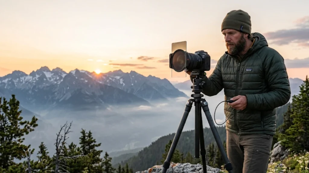
Maximizing image quality at Washington’s hidden viewpoints requires equipment matched to environmental conditions and compositional intent, including tripods for long exposures, polarizers for glare reduction, and graduated filters for dynamic range management. Technique prioritizes stability, timing, and foreground integration.
Tripod mandatory for sunrise/sunset shoots where shutter speeds drop below 1/60s. Carbon fiber models reduce weight for trail approaches. Geared heads enable precise framing of distant peaks like Liberty Bell or Mount Shuksan.
Circular polarizer cuts haze on coastal shoots and enhances cloud definition over farmland. Rotate to 90 degrees from sun angle for maximum effect. Avoid polarizing water reflections at Picture Lake or Diablo Lake where mirror effect is desired.
Graduated neutral density filters balance bright skies against shadowed valleys. Use 2-stop soft-edge grads for Palouse horizons; 3-stop hard-edge for coastal cliff silhouettes. Bracket exposures ±2 EV for HDR blending in post-production.
Wide-angle lenses (16–35mm) capture expansive scenes; telecompressors (70–200mm) isolate peak details or compress layered ridges. Remote shutter release eliminates vibration. Shoot RAW format for maximum recoverable dynamic range.
Golden hour (first/last 30 minutes of daylight) provides directional warmth; blue hour (20 minutes post-sunset) yields cool ambient fill. Always histogram-check highlights to avoid clipping on snow or water surfaces.
How do hidden scenic viewpoints contribute to Washington’s sustainable tourism and conservation goals?
Hidden scenic viewpoints support Washington’s sustainable tourism framework by dispersing visitor impact away from ecologically fragile honeypot sites, reducing trail erosion, wildlife disturbance, and infrastructure strain in overloaded parks. Data from Washington State Department of Commerce shows 22% reduction in overcrowding incidents at Mount Rainier and Olympic National Park after promoting alternative viewpoints 2023–2025.
Locations like Steptoe Butte and Dry Falls absorb regional visitor overflow without requiring new construction. Existing roads and parking suffice. Local economies benefit through dispersed spending at gas stations, diners, and motels in Colfax, Electric City, and Neah Bay rather than concentrated in Seattle or Port Angeles.
Conservation agencies use viewpoint rotation to allow habitat recovery. Cape Flattery limits daily entries via pass system; Shi Shi Beach enforces group size caps (max 6) to protect tide pool ecosystems. Educational signage at all sites promotes Leave No Trace principles and cultural respect protocols.
Carbon footprint reduction occurs when visitors choose nearby hidden gems over cross-state drives to iconic parks. WSDOT’s Scenic Byways program maps 120+ verified viewpoints within 50 miles of major population centers, enabling day-trip alternatives to overnight stays.
Long-term monitoring via trail counters and satellite imagery confirms vegetation recovery and soil stabilization at decompressed sites. Sustainable tourism metrics published annually in Washington State Tourism Report include viewpoint diversion rates and economic multiplier effects per county.
What are the best hidden scenic viewpoints in Washington State?
The best hidden scenic viewpoints in Washington include Washington Pass Overlook, Artist Point, Steptoe Butte, Cape Flattery, Diablo Lake Overlook, Picture Lake, Dry Falls Overlook, and Kamiak Butte. These locations offer panoramic mountain, coastline, forest, and farmland views with fewer crowds than Washington’s most famous attractions.