Key Points
- A weak atmospheric weather front is actively transitioning through western Washington, triggering increased cloud cover and suppressed regional temperatures across the Pacific Northwest.
- Daily peak temperatures across the Puget Sound lowlands are anticipated to settle strictly within the lower-to-mid 70s Fahrenheit range, offering brief respite from recent seasonal heat.
- Meteorological observations indicate minor probabilities of localized, trace morning precipitation and light sprinkles concentrated primarily within the higher elevations of the Cascade and Olympic mountain ranges.
- A critical Fire Weather Watch has been officially instituted for targeted zones within central and eastern Washington due to a dangerous combination of high temperatures, low relative humidity, and accelerated wind velocities.
- State environmental agencies and weather experts warn that the escalating meteorological divergence between the damp western coast and the arid interior poses immediate containment risks for ongoing and new regional wildfires.
Seattle (Evening Washington News) July 10, 2026 — A shifting weak weather front is moving directly through western Washington, introducing immediate thermal cooling and dense cloud formations across the regional airspace. The weak atmospheric system, tracking eastward from the Pacific coastline, has successfully depressed regional high temperatures down into the comfortable 70s Fahrenheit range. While coastal communities and lowland urban centres remain largely dry under overcast skies, localized high-altitude zones within the Cascade and Olympic mountains are experiencing trace morning sprinkles and isolated light drizzle. Conversely, the meteorological progression is triggering dangerous environmental conditions east of the mountain crests. State authorities have declared an active Fire Weather Watch and subsequent Red Flag warnings across central and eastern Washington, where dry, gusty, and hot air masses are dramatically heightening regional wildfire vulnerability.
- Key Points
- How Will the Weak Weather System Change Western Washington’s Sky Conditions?
- What Are the Specific High Temperatures Projected for the Puget Sound Region?
- Why Has a Fire Weather Watch Been Issued for Central and Eastern Washington?
- Background of the Weather and Wildfire Developments
- Prediction and Future Atmospheric Impacts
How Will the Weak Weather System Change Western Washington’s Sky Conditions?
As documented by the meteorological reporting team at FOX 13 Seattle, the current atmospheric transition is driven primarily by an onshore maritime flow that is shifting low-level marine layers inland. This dynamic has resulted in widespread overcast conditions breaking periodically into afternoon sunbreaks. According to senior meteorologists tracking the front, the system lacks the deep convective lifting necessary to generate substantial regional rainfall, meaning dry weather will continue to dominate the general forecast for the vast majority of local residents.
The localized precipitation remains strictly confined to topographical uplift areas. Specifically, the weather desk at KING 5 News reported that any moisture associated with this weak front is restricted to early morning hours along western-facing mountain slopes, leaving the metropolitan areas of Seattle, Tacoma, and Bellevue without measurable rainfall accumulations.
What Are the Specific High Temperatures Projected for the Puget Sound Region?
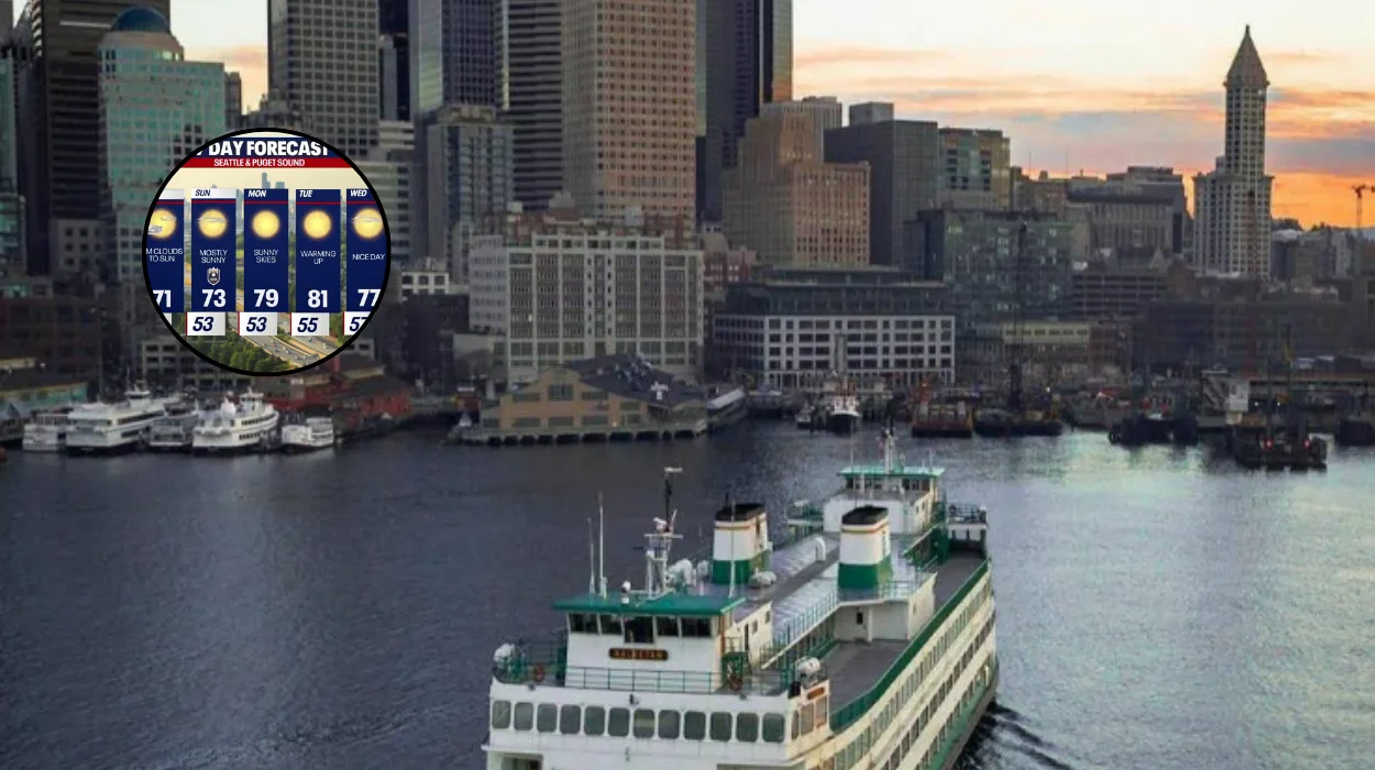
In the official regional temperature logs published by FOX 13 Seattle, thermal readings across western Washington have dropped well below the record-breaking maximums observed during previous high-pressure ridges. Daily highs across the immediate Puget Sound basin are firmly bounded between 70°F and 75°F. Coastal sectors are experiencing significantly cooler conditions, with marine air suppressing afternoon temperatures into the upper 60s Fahrenheit.
In stark contrast to the mild conditions west of the Cascade curtain, central and eastern portions of Washington State are sustaining heavily elevated thermal baselines. Regional tracking logs indicate that inland communities are facing high temperatures reaching into the upper 80s and lower 90s Fahrenheit, expanding the stark climate divergence between the two halves of the state.
Why Has a Fire Weather Watch Been Issued for Central and Eastern Washington?
According to a severe weather briefing published by the National Weather Service and broadcasted via FOX 13 Seattle, a critical Fire Weather Watch—often upgraded to a Red Flag Warning depending on hourly wind shifts—has been established through Saturday evening. The primary structural drivers behind this safety declaration include critically low relative humidity percentages coupled with sudden, dry wind gusts accelerating through the Cascade gaps.
Wildfire response coordinators note that while western Washington enjoys a temporary reprieve due to cooler maritime air masses, the high-altitude gaps are channeling swift winds directly into arid vegetation zones. This creates an environment where any newly ignited flame can expand exponentially before local emergency suppression assets can establish secure containment lines.
Background of the Weather and Wildfire Developments
The arrival of the current weak weather front follows a documented pattern of intense high-pressure ridges that have periodically stalled over the Pacific Northwest. Historically, western Washington has relied on regular marine pushes to regulate summer temperatures and prevent the rapid drying of forested areas. However, regional data from the past five years indicates that these cool maritime interventions are increasingly accompanied by sharper, drier thermal gradients in eastern Washington.
The current fire season has already seen major infrastructure impacts, including the sudden closure of Interstate 90 near Vantage due to the rapid intensification of brush fires. The structural divergence between the damp coastal strip and the combustible interior remains a recurring logistical challenge for Washington’s Department of Natural Resources and local emergency management agencies.
Prediction and Future Atmospheric Impacts
The current atmospheric setup will have distinct, direct consequences for different target audiences across the Pacific Northwest over the coming days:
For Regional Agricultural Producers and Outdoor Laborers
The continuation of dry, windy conditions in central and eastern Washington will accelerate the dehydration of topsoil and vulnerable crop sectors. Farmers and orchard managers will need to increase irrigation intervals to offset the high evaporative rates caused by the combination of low humidity and persistent gap winds. Outdoor laborers face extended periods under active Fire Weather Watches, requiring stricter compliance with machinery operations to avoid accidental spark ignitions in dry fields.
For Municipal Emergency Responders and Wildland Firefighters
Fire suppression crews face an increasingly complex operational window through the weekend. While the cooler weather in western Washington allows for normal operations, crews stationed in the interior must prepare for rapid fire spread vectors driven by wind gusts. The threat of new ignitions remains exceptionally high through Saturday night, meaning resource allocation will likely favor eastern deployment zones to mitigate risks to rural infrastructure and highways.
For the General Public and Urban Commuters
Residents within the urban corridors of western Washington can anticipate ideal outdoor conditions with minimal thermal stress, as temperatures remain stable in the mid-70s through Friday. However, long-range tracking models indicate that this cooling trend is temporary. High-pressure systems are modeled to rebuild rapidly early next week, which will clear out the cloud cover and drive regional maximum temperatures back up into the 80s Fahrenheit by Monday and Tuesday.