Key Points
- Impending Weather System: A line of scattered showers and severe thunderstorms is projected to sweep across the Washington metropolitan area, directly threatening the Monday evening rush hour.
- Atmospheric Drivers: A northward-moving warm front has introduced a humid, tropical air mass into the region, with early morning temperatures in the mid-70s serving as the baseline for afternoon destabilisation.
- Peak Thermodynamic Window: Daytime high temperatures are forecasted to reach near 90 degrees Fahrenheit, creating elevated heat indices and maximum instability between mid-afternoon and early evening.
- Hazards and Impacts: The National Weather Service and regional meteorologists warn that stronger storm cells crossing from the Appalachian mountains could produce localized damaging winds, intense downpours, and hazardous driving conditions.
- Subsequent Outlook: Conditions are expected to gradually clear on Monday night, leading into a drier, cooler mid-week pattern with temperatures in the low-to-mid 80s before intense summer heat returns for the weekend.
Washington (Evening Washington News) June 22, 2026 – The Washington metropolitan region is bracing for a significant disruption to its transport network as an advancing warm front triggers a volatile mix of scattered showers and severe thunderstorms timed precisely to hit during the peak evening commute, according to regional meteorological reports published
- Key Points
- How Will the Approaching Weather System Impact the Monday Evening Commute?
- What Atmospheric Mechanics Are Driving This Storm System?
- What Does the Multi-Day Meteorological Outlook Reveal for the DMV Region?
- The Mid-Week Stabilization Pattern
- Background of the Particular Development
- Prediction and Regional Audience Implications
- Infrastructure and Utility Integrity
How Will the Approaching Weather System Impact the Monday Evening Commute?
The primary operational concern for city administrators and commuters across the District, Maryland, and Virginia (DMV) area is the high probability of flash flooding, reduced visibility, and structural blockages caused by wind damage during the late afternoon rush hour.
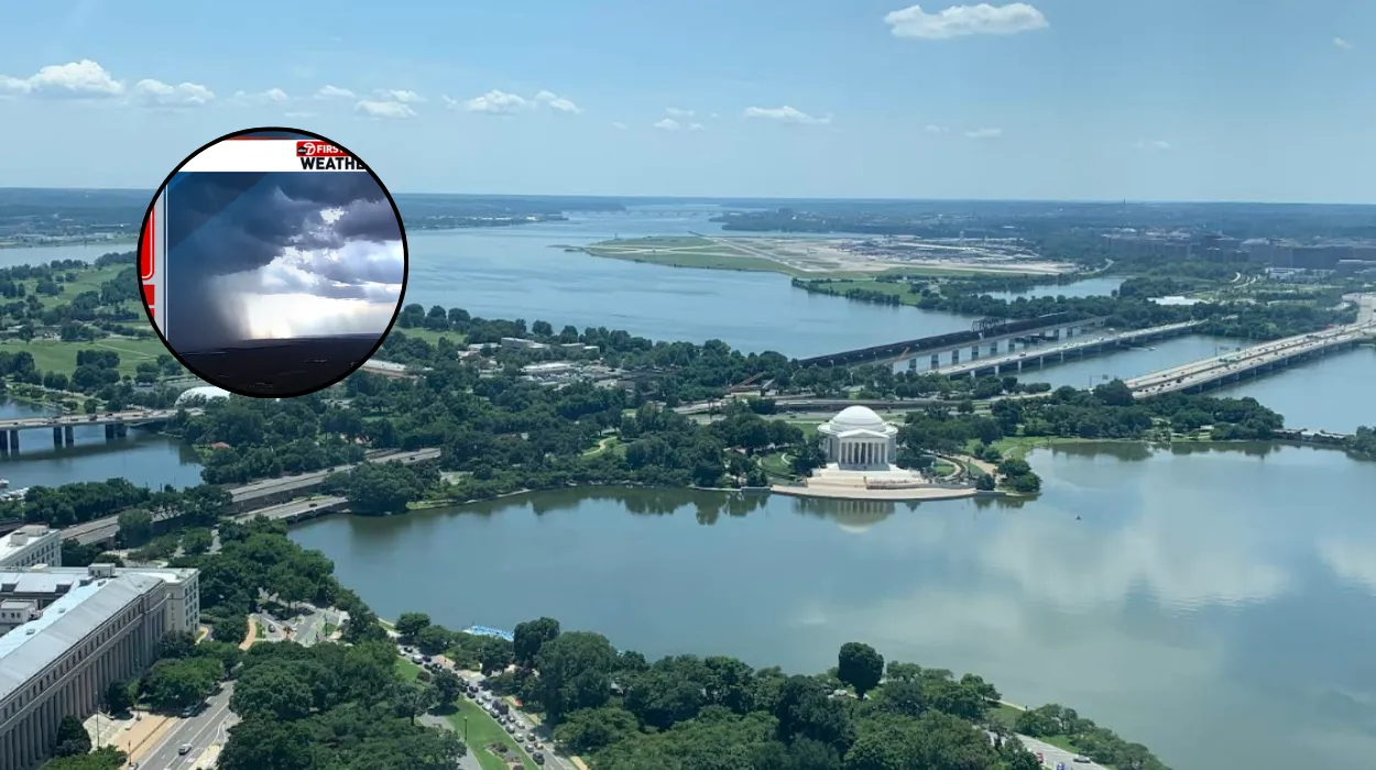
As documented by the editorial team at FOX 5 DC, the atmospheric pattern is structured around an unstable, highly energized environment.
Initial precipitation began developing west of the immediate metropolitan area during the early morning hours, initially tracking northward away from the urban center.
However, meteorological models indicate that as solar heating intensifies throughout the day, the atmosphere will reach a tipping point.
By late morning, isolated convective cells are expected to manifest across the region, coalescing into a more organised and severe line of thunderstorms between mid-afternoon and early evening.
The physical mechanics of the storm system rely heavily on the complex topography of the Mid-Atlantic region.
Cells originating over the western mountain ranges will gain momentum as they march eastward into the heavily populated urban corridors of Washington, bringing a distinct threat of straight-line wind damage and frequent cloud-to-ground lightning.
What Atmospheric Mechanics Are Driving This Storm System?
To understand why this system poses an elevated risk, meteorologists point toward the influx of thermodynamic energy sweeping across the Atlantic seaboard.
According to the foundational weather briefings issued by regional stations, the day commenced with remarkably warm and moist conditions, with early morning temperatures remaining anchored in the mid-70s across the urban core.
This elevated baseline was caused by a persistent warm front lifting aggressively northward across the Potomac Valley. As this boundary moved through, it pumped a dense layer of moisture into the lower atmosphere, markedly increasing relative humidity levels.
When combined with projected daytime solar radiation—which is expected to push ambient thermometer readings to approximately 90 degrees Fahrenheit—the air mass will become heavily buoyant.
In meteorological terms, this environment provides an optimal environment for deep atmospheric convection.
The heat acts as fuel, while the incoming upper-level atmospheric triggers act as the spark, allowing ordinary rain showers to rapidly evolve into severe, vertical storm structures capable of producing localized downpours and microbursts.
What Does the Multi-Day Meteorological Outlook Reveal for the DMV Region?
While the immediate focus remains locked on navigating Monday’s hazardous atmospheric conditions, long-range tracking models indicate that the severe weather will be relatively short-lived, followed by a sequence of rapid transitions.
As reported within the official regional weather updates, the main line of organized storms is projected to pass eastward of the immediate metro area by late evening. Following its departure, atmospheric pressure will begin to rise, and dry air dropping down from the northwest will initiate a gradual clearing trend.
Monday night will feature breaking clouds and dropping humidity levels, bringing some atmospheric relief, though residual standing water may continue to impact secondary roadways.
The Mid-Week Stabilization Pattern
According to the extended outlook compiled by regional forecasting desks, the transition into Tuesday will require some caution from motorists:
- Tuesday Morning: The region may experience a few lingering morning rain showers as the trailing edge of the low-pressure system departs, potentially creating minor delays for the early morning commute.
- Tuesday Afternoon: Conditions will dry out rapidly. A cooler, less humid air mass will settle into the area, capping afternoon high temperatures in the comfortable low 80s.
- Wednesday: High pressure is expected to take complete control of the regional weather pattern, yielding mostly sunny skies with pleasant, seasonally appropriate temperatures peaking near 85 degrees Fahrenheit.
The mid-week reprieve will serve as a brief interlude rather than a permanent seasonal shift. The long-range forecasting models analyzed by local stations confirm that a powerful sub-tropical ridge is scheduled to rebuild across the southern and eastern United States late in the week. Consequently, summer-like heat and oppressive humidity are projected to return to the District heading into the upcoming weekend, sending temperatures back into the 90s.
Background of the Particular Development
The atmospheric instability observed on June 22, 2026, fits into a broader historical and seasonal context characteristic of the mid-Atlantic summer solstice transition.
Late June represents a period where the sub-tropical jet stream routinely interacts with localized thermal troughs generated over the Appalachian Mountains.
Historically, the Washington D.C. infrastructure has faced persistent vulnerabilities regarding convective precipitation events that occur during peak traffic hours.
The region’s extensive reliance on interconnected highway systems—such as the I-495 Capital Beltway, I-95, and the I-66 corridor—means that even minor localized flash flooding can create cascading delays extending for tens of miles across state lines.
Furthermore, urban heat island effects inherent to the densely built environment of the District routinely exacerbate afternoon storm intensities, as stored concrete heat amplifies vertical wind currents.
This specific event marks the first major widespread severe weather threat to the evening commute for the current summer season, following an extended period of unseasonably stable conditions earlier in the month.
Prediction and Regional Audience Implications
The impending arrival of organized afternoon thunderstorms will directly hit the daily operations of hundreds of thousands of commuters, commercial transit operators, and regional utility providers across the District of Columbia, Northern Virginia, and Suburban Maryland.
Given that the core of the storm system is modeled to intersect with the 4:00 PM to 7:00 PM traffic window, travelers should anticipate immediate operational downgrades across both road and rail networks:
- Roadways: Heavily trafficked subterranean routes, low-lying underpasses, and standard drainage basins across the DMV are highly likely to experience temporary flash inundation, forcing emergency lane closures.
- Mass Transit: Above-ground segments of the Washington Metro rail system face potential delays from debris accumulation and lightning-induced signaling faults.
- Aviation: Flight operations at both Ronald Reagan Washington National Airport (DCA) and Washington Dulles International Airport (IAD) will likely encounter significant ground stoppages and rolling delays as terminal radar areas manage cell routing.
Infrastructure and Utility Integrity
With stronger storm cells carrying the capacity for damaging straight-line winds, localized structural impacts are highly probable. The regional tree canopy, heavily weighted by summer foliage, will experience significant aerodynamic stress.
This is predicted to cause scattered branch failures onto local overhead distribution lines, translating into localized electrical outages for residential and commercial customers. Residents are advised to secure loose outdoor items ahead of the mid-afternoon transition and brace for a challenging evening transit window.