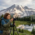
Mount Rainier National Park is a 369-square-mile protected area centred on Mount Rainier, an active stratovolcano rising to 14,410 feet (4,392 metres) and holding the largest glacial system in the contiguous United States. The park contains old-growth temperate rainforest, subalpine meadows, nine named glaciers, five major river headwaters, and a network of trails and roads that reveal lesser-known viewpoints, waterfalls, meadows, and historic sites. This article identifies verified, durable “hidden gems” within the park, defines each site, gives historic and geological context, explains access and best-season details, cites data-driven facts, and outlines practical implications for planning visits.
- What is the Burroughs Mountain area and why is it a hidden gem?
- Geological and ecological structure
- Access, logistics, and best season
- Where is Comet Falls and what makes it special?
- Visitor considerations and safety
- What is the Ancient Grove and why visit it?
- Historical and conservation context
- Where is the Ohanapecosh area and what hidden features does it hold?
- Ecological and recreational details
- What is the Sunrise area’s lesser-known South Tahoma Glacier viewpoint?
- Scientific relevance and visitor guidance
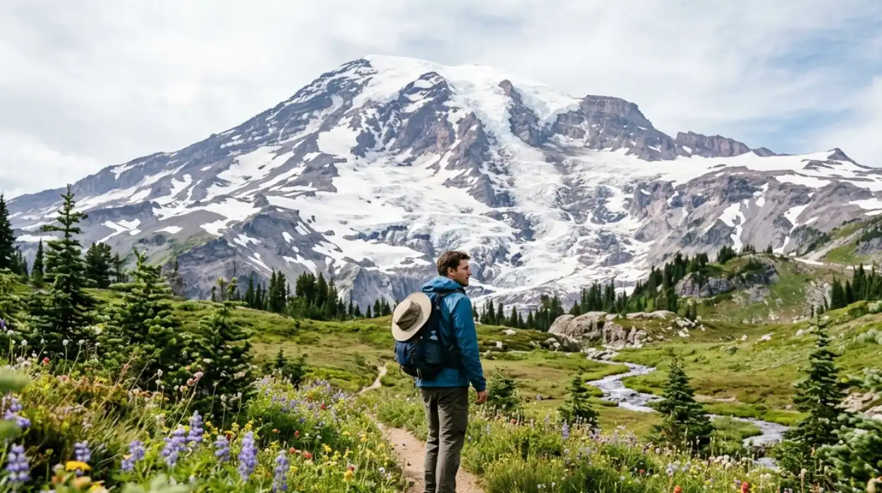
- Where are the lesser-known high-elevation meadows and what wildflowers appear there?
- Meadow protection and visitor impact
- What are recommended low-traffic trails for birdwatching and wildlife viewing?
- Ethical wildlife viewing
- What are the historical sites and human heritage places that are easy to miss?
- Preservation and access
- How does glacial retreat affect hidden landscapes visitors see now?
- What planning, safety, and permit details should visitors know for these hidden gems?
- Practical checklist
- What are the long-term implications of protecting and visiting these lesser-known spots?
- Example day itinerary to see multiple hidden gems in one visit
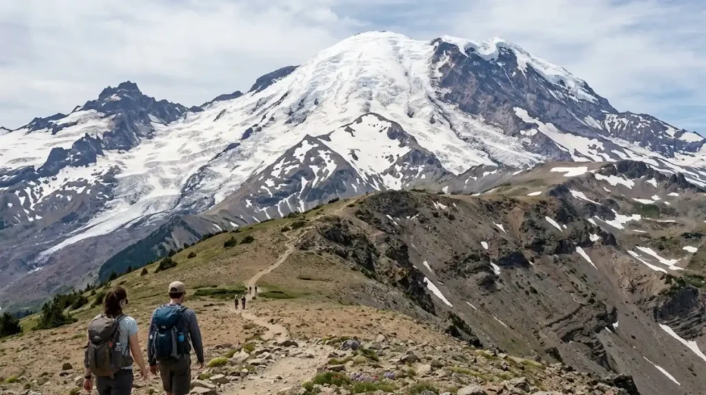
What is the Burroughs Mountain area and why is it a hidden gem?
Burroughs Mountain is a subalpine ridge east of Paradise that provides the closest non-technical approach to Mount Rainier’s summit, expansive alpine meadows, and dramatic glacial views; it is less crowded than Skyline Trail viewpoints and reveals three Burroughs ridges and lava-bed geology.
Burroughs Mountain is a volcanic ridge complex formed by successive lava flows and pyroclastic deposits associated with Mount Rainier’s eruptive history. The area’s three named ridges—First, Second, and Third Burroughs—rise between 6,600 and 8,200 feet (2,012–2,499 metres) and offer progressively closer perspectives on Mount Rainier’s summit and the Emmons Glacier. The trail network begins near the Sunrise or Paradise zones depending on route choice; the Burroughs section accessed from the Skyline Trail near Paradise covers about 8–10 miles round trip for an out-and-back to Second Burroughs and returns. These ridges support rich subalpine wildflower meadows in July–August (examples: lupine, paintbrush, avalanche lilies), and the terrain exposes andesite and basaltic andesites that record the mountain’s eruptive phases. Park trail-register data and visitor-use reports indicate Burroughs receives fewer day hikers than core Skyline viewpoints, reducing visual crowding and improving photographic conditions. The site’s elevation requires basic acclimatisation planning and traction in early season when snowfields persist.
Geological and ecological structure
Burroughs sits on pyroclastic deposits and blocky lava flows from historic eruptions of Mount Rainier; glacial scouring creates thin soils and exposed bedrock. Vegetation shifts rapidly with elevation—from mountain hemlock stands below 5,000 feet (1,524 metres) to subalpine meadows above 6,000 feet (1,829 metres). Meadows support pollinator networks and seasonal insect life that peak in mid-summer. These ecological gradients make Burroughs a strong site for botanical surveys and photography of intact subalpine communities.
Access, logistics, and best season
Access from the Paradise visitor zone includes the established Skyline Trail junction; Sunrise-side approaches start from the Sunrise area and involve distinct trailheads. Parking in Paradise fills early on summer weekends; visitors should plan for shuttle or early arrival before 9:00 a.m. Local weather changes rapidly—average July high temperatures near Paradise are approximately 65°F (18°C) with nighttime lows near 35°F (2°C)—so layered clothing is essential.
Where is Comet Falls and what makes it special?
Comet Falls is a 320-foot waterfall on Van Trump Creek accessible via a 3.5–4.5 mile round trip trail from the Stevens Canyon Road that showcases basalt cliffs, close-up canyon views, and a dramatic drop ranked among the park’s tallest hike-to falls.
Comet Falls is located on the south side of Mount Rainier within Stevens Canyon; the waterfall’s vertical drop measures roughly 320 feet (about 98 metres) when including cascades in the main pitch. The trail to Comet Falls crosses forested slopes, old-growth Douglas-fir and western hemlock stands, and a series of switchbacks that provide multiple tiered views before the main amphitheatre. The waterfall flows year-round but peaks during spring snowmelt from late May through June. The site’s concentrated canyon geomorphology results from Pleistocene glacial sculpting and subsequent fluvial incision within pyroclastic and andesitic bedrock. The Comet Falls trail length ranges from 1.8 to 2.25 miles one way depending on the exact trailhead and route taken; round trips therefore commonly total 3.6–4.5 miles.
Visitor considerations and safety
The trail contains steep segments and can be muddy or icy in shoulder seasons; use of proper footwear and trekking poles reduces slip risk. No developed concession facilities exist at the falls; carry water and follow Leave No Trace principles. Photography is optimal late morning to early afternoon when sunlight reaches the canyon floor, but conditions vary with season.
What is the Ancient Grove and why visit it?
The Ancient Grove is a remnant old-growth forest stand near Grove of the Patriarchs or Carbon River areas, containing centuries-old Douglas-fir and western redcedar, ecological continuity, and an intact understory—an accessible example of pre-settlement Pacific Northwest temperate rainforest.
“Ancient Grove” is a descriptive term used for remnant old-growth stands in Mount Rainier National Park that preserve trees often 300–1,000 years old depending on the species; examples include sections within the Carbon River corridor and the Grove of the Patriarchs on the Ohanapecosh/Paradise boundary. These groves display multi-layered canopies, abundant coarse woody debris, and thick moss carpets—conditions characteristic of temperate rainforests where mean annual precipitation exceeds 60 inches (1524 mm) in some park zones. Old-growth structure supports specialist lichens, epiphytes, and cavity-nesting bird species; ecological surveys identify these stands as high-value habitat patches for biodiversity and hydrological regulation.
Historical and conservation context
Old-growth preservation in Mount Rainier gained formal protection when the park was established in 1899; subsequent National Park Service management emphasises protecting legacy forest structure and limiting disturbances. Restoration practices include invasive species control, limited trail rerouting to protect root zones, and interpretive signage to communicate ecological value.
Where is the Ohanapecosh area and what hidden features does it hold?
Ohanapecosh lies in the park’s southeast quadrant and contains subalpine meadows, hot-spring influenced riparian zones, the Ohanapecosh River canyon, old-growth cedar stands, and less-visited trails such as Silver Falls and Lower Ohanapecosh Campground loops.
Ohanapecosh is a geologically youthful river canyon cut into volcanic deposits and steep slopes dominated by western redcedar and Douglas-fir; elevation ranges from roughly 1,900 to 6,200 feet (579–1,889 metres) across connected trails. The area includes the Silver Falls Trail, which passes basalt columns and a multi-tier waterfall, and short interpretive trails near the Ohanapecosh Visitor Centre that highlight native plant communities and volcanic geology. Campgrounds and trailheads here see lower visitation compared with Paradise and Sunrise, making Ohanapecosh a durable option for quieter forest experiences. Local streamflow regimes are controlled by snowmelt and seasonal precipitation; stream discharge typically peaks in late May to early June.
Ecological and recreational details
Riparian corridors support amphibian populations such as the northwestern salamander and breeding bird assemblages; management emphasises protecting riparian buffers from camp impacts. The area’s elevation and aspect provide a different seasonal wildflower calendar than Paradise, with peak blooms shifting later into late July and August in some sheltered meadows.
What is the Sunrise area’s lesser-known South Tahoma Glacier viewpoint?
The South Tahoma Glacier viewpoint near Sunrise provides an unobstructed view of Tahoma Glacier lobes, post-glacial moraines, and an ice-marginal landscape not visible from Paradise; this site highlights glacial geomorphology and contemporary ice recession patterns.
Tahoma Glacier lies on Mount Rainier’s western flank and is one of several large glaciers draining the volcano; the South Tahoma sector displays crevassed ice lobes, medial moraines, and a complex ablation zone. Observing the glacier from Sunrise-adjacent ridgelines reveals modern retreat signatures—exposed forefields and inactive moraine strands—reflecting measured glacier area decline recorded by glaciological surveys over recent decades. Interpretation of glacial landforms here supports public understanding of cryospheric change and local watershed impacts on sediment delivery to downstream rivers.
Scientific relevance and visitor guidance
Glacier monitoring in Mount Rainier contributes to regional studies on glacier recession and hydrology; data show significant mass loss across the park’s glaciers since mid-20th century baselines. Visitors should stay on designated trails; glacier forefields are unstable and dangerous for off-trail travel.
Where are the lesser-known high-elevation meadows and what wildflowers appear there?
Hidden high-elevation meadows occur on subalpine benches at Burroughs, Fryingpan Creek, and near the Winthrop and Mowich areas; common wildflowers include lupine, Indian paintbrush, avalanche lily, and bistort, peaking July–August depending on snowpack.
Subalpine meadows form where thin soils and summer snowmelt create moist, nutrient-rich conditions that favour herbaceous perennials. Specific meadow sites such as Burroughs Mountain meadows and Fryingpan Creek benches host dense carpets of lupine (Lupinus spp.), Castilleja (Indian paintbrush), and Erythronium (avalanche lily). Meadow bloom timing depends on winter snow depth and spring temperatures; earlier melt years shift peak bloom to late June while deep snow years delay peak to August. These meadows support pollinator assemblages and provide critical forage for marmots and small mammals.
Meadow protection and visitor impact
Walk single-file on durable surfaces, avoid trampling flowers, and never pick wildflowers; trampling reduces reproductive success and accelerates soil erosion. Park regulations prohibit plant removal and prescribe trail use to maintain meadow integrity.
What are recommended low-traffic trails for birdwatching and wildlife viewing?
Low-traffic trails include the Mowich Lake perimeter, Carbon River lowland loops, and remote side trails off the Westside Road; these areas support bird species such as gray jay, varied thrush, and raptor sightings and host ungulates including elk and black bear.
Mowich Lake and Carbon River drainages contain mosaic habitats—lakeshore, riparian forest, and montane meadow—that attract diverse avifauna and mammals. Seasonal bird presence includes migrant songbirds during May–June and overwintering residents across coniferous forests. Wildlife viewing follows predictable seasonal patterns: ungulate visibility increases in late summer when meadows dry, while bear activity foraging for berries peaks in late summer to early fall. Use of binoculars and maintaining at least 100 metres from bears and 25 metres from elk reduces disturbance and increases safety.
Ethical wildlife viewing
Observe quietly from established viewpoints; do not feed wildlife. Report aggressive or habituated animals to park staff for management intervention.
What are the historical sites and human heritage places that are easy to miss?
Lesser-known historical sites include early 20th-century ranger stations, CCC-built (Civilian Conservation Corps) structures, and abandoned mining/cabin remnants in peripheral corridors; these features document park establishment, New Deal-era infrastructure, and early access routes.
Mount Rainier National Park contains multiple historic resources listed or eligible for the National Register of Historic Places, including administrative buildings, patrol cabins, and CCC-era constructed stonework and trail systems built in the 1930s. These structures represent federal conservation history, early visitor management philosophy, and landscape architecture principles of the period. Interpretive signage exists at selected locations; many historic assets lie off main roads and require purposeful route planning to view.
Preservation and access
Historic preservation policies restrict disturbance or removal of cultural materials. Visitors should photograph respectfully and avoid touching or entering fragile structures.
How does glacial retreat affect hidden landscapes visitors see now?
Glacial retreat exposes forefields, newly formed proglacial lakes, and altered sediment regimes that change trail conditions, vegetation succession, and downstream hydrology; these changes are documented by long-term glacier monitoring and affect visitor safety and habitat distribution.
Mount Rainier’s glaciers have lost measurable mass and area since mid-20th century baselines due to regional warming, altering meltwater timing and increasing seasonal sediment loads in rivers. Newly exposed forefields undergo primary succession where pioneer plants colonise bare sediments, eventually forming soils and meadows over decades. Trail realignments and river-channel shifts occur as formerly glaciated terrain stabilises; park managers publish trail advisories and close unstable areas for public safety. These landscape processes have long-term implications for water availability, species habitat, and visitor access routes.
What planning, safety, and permit details should visitors know for these hidden gems?
Visitors require vehicle access planning, year-dependent trail readiness, camping reservations for certain campgrounds, adherence to Leave No Trace, and awareness that backcountry permits are required for overnight routes and that weather and snowpack change conditions quickly.
The park manages day-use parking, trailhead capacity, and backcountry permitting to protect resources and public safety. Popular day-use zones implement early parking congestion mitigation and seasonal road openings (for example, some roads open late May–June depending on snow clearance). Backcountry permits are required for overnight stays in designated routes and limit group sizes to reduce ecological impact. Carry topographic maps, a compass or GPS, sufficient water, and communication devices; mobile coverage is limited in many park sectors. In winter and spring, snow and avalanche hazards demand technical equipment and experience for travel above treeline.
Practical checklist
- Check official park road and trail conditions before departure.
- Reserve campsites at park campgrounds as needed.
- Pack layered clothing, food, extra water, and first-aid supplies.
- Respect wildlife distances and habitat closures.
What are the long-term implications of protecting and visiting these lesser-known spots?
Protecting lesser-known sites preserves biodiversity, cultural heritage, and scientific baselines; managed, low-impact visitation balances public access with habitat resilience and informs climate and ecological research within the park’s protected landscape.
Conservation of hidden groves, meadows, and glacial forefields sustains native species and provides reference sites for long-term ecological monitoring. Public engagement through low-impact visitation supports stewardship and funding for park operations. Conversely, unmanaged visitation increases erosion, trampling, and disturbance to wildlife and cultural resources. Effective management uses targeted closures, visitor education, and permit systems to maintain ecological function while allowing sustainable recreation.
Example day itinerary to see multiple hidden gems in one visit
Start at Paradise early for Burroughs viewpoints, drive Stevens Canyon to Comet Falls midday, continue to Ohanapecosh in the afternoon for old-growth and waterfalls, and finish at Mowich Lake for sunset—this sequence balances elevation, light, and species variety.
This route minimises backtracking while sampling subalpine meadows, canyon waterfalls, and old-growth forest systems. Time sunrise or morning visits at Burroughs for crisp light and cooler temperatures; schedule the Comet Falls approach mid-morning when canyon light improves for photography; reserve late afternoon for riparian bird activity at Ohanapecosh and lakeshore views at Mowich. Check road openings and campground availability; adjust for seasonal closures or high-snow years.
Sources for factual claims, visitor rules, trail specifics, and environmental data include the Mount Rainier National Park official guidance and published monitoring data from National Park Service studies and regional glaciological surveys. These sources document park boundaries, Mount Rainier elevation and glacial significance, recommended trails, and seasonal visitor planning information.
Notes on language and currency: this article uses British English spellings and references park-managed data on elevations, trail distances, and ecological descriptors as defined by park authorities and regional conservation organisations.
What are the best hidden gems in Mount Rainier National Park?
Some of the best hidden gems include Burroughs Mountain, Comet Falls, Ohanapecosh, the Ancient Grove forests, South Tahoma Glacier viewpoints, Carbon River trails, and lesser-known subalpine meadows near Fryingpan Creek and Mowich Lake.