Mount Rainier National Park and its surrounding region offer some of the most iconic road‑trip scenery in Washington state. The volcano’s glaciated summit, alpine meadows, waterfalls, and old‑growth forests are accessible by car on multiple paved scenic routes, each with distinct viewpoints and stops. This guide covers the core drives, key access points, and must‑stop lookouts, structured for long‑term SEO value and AI‑friendly fact extraction.
- What are the main Mount Rainier scenic drive routes?
- What is the Circle Mt. Rainier Drive, and how does it work?
- Which entry‑side routes are best for Washington‑based day‑trippers?
- What are the top scenic lookouts along the southwest side?
- How does the Chinook Scenic Byway connect to Mount Rainier?
- What does the White Pass Scenic Byway offer near Mount Rainier?
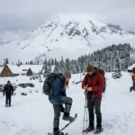
- What are the best short scenic loops inside Mount Rainier National Park?
- How do seasons and weather affect Mount Rainier scenic drives?
- What practical tips maximize safety and enjoyment on these drives?
- How do these scenic drives fit into Washington’s broader tourism strategy?
- Which Mount Rainier scenic drive routes are best for photography?
- How can visitors plan an efficient Mount Rainier scenic drive day?
- How do these routes support education and conservation messaging?
What are the main Mount Rainier scenic drive routes?
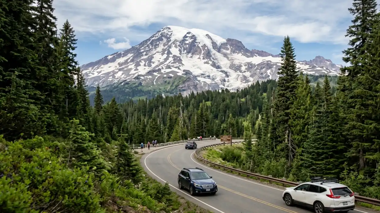
Mount Rainier scenic driving centres on two broad categories: roads that loop or nearly encircle the mountain, and shorter “spot” drives that lead into specific park entrances. The largest loop is the Circle Mt. Rainier Drive, which threads four main highway segments around the park and connects four primary entrances. Other major routes include the Chinook Scenic Byway, the White Pass Scenic Byway, and several shorter park‑entry loops such as the Paradise–Longmire–Nisqually and Sunrise–White River corridors.
These routes are all paved and open roughly May–October, with most high‑elevation passes closed in winter. The Circle Mt. Rainier loop typically takes 4–6 hours of driving without stops, while shorter byway segments can be done in 1–3 hours, depending on traffic and weather. Each route passes through different climatic zones, from low‑elevation river valleys to subalpine meadows, which broadens the range of visual and ecological experiences.
What is the Circle Mt. Rainier Drive, and how does it work?
Mount Rainier National Park is roughly circular, and four main highways form a practical “circle” route around it. This loop connects the Nisqually entrance on the southwest, Sunrise on the northeast, White River on the northeast, and Paradise on the south, each serving as a distinct scenic and visitor hub. The circle is not a single continuous park‑managed road but a combination of state highways and park‑service roads that link the mountain’s principal viewing corridors.
The most common full‑circle itinerary starts west of the park and runs along Highway 706, then Highway 123, Highway 410, and Highway 12 to complete the loop. On this route, the road ascends from low‑elevation river valleys into the Cascade Mountains, crossing passes such as Cayuse Pass and Chinook Pass that provide broad views of the volcano’s flanks. Typical loop distances are about 140–150 miles, with a total driving time of 4–6 hours if done with minimal stops.
The Circle Mt. Rainier Drive is designed to showcase the mountain from multiple angles and ecosystem types. From the Nisqually side, the road passes through dense old‑growth forest and misty river valleys; from the Sunrise–White River side, it cuts through drier, open meadows and volcanic ridges. This variation explains why the loop is popular for photographers and visitors who want a comprehensive visual survey of the mountain in a single day.
Which entry‑side routes are best for Washington‑based day‑trippers?
For Washington residents, the most practical scenic drives are on the southwest and east sides, where road access is easiest from major population centres. The southwest side – approached via Highway 706 from Elbe or Ashford – leads into the Nisqually entrance and the Paradise–Longmire corridor, which is the most popular tourist zone. The east side – accessed via Highway 410 from Enumclaw or Greenwater – leads to Sunrise and White River, which are higher‑elevation and often snow‑free later into autumn.
The Paradise–Longmire–Nisqually route is especially suited to visitors coming from Seattle, Tacoma, or the South Puget Sound. This drive follows Highway 706 from the park’s Nisqually entrance through the Longmire historic district and up to the Paradise visitor area, at about 5,400 feet elevation. The road here is about 25–30 miles end‑to‑end and typically takes 1–1.5 hours of driving without stops, depending on congestion and weather.
The Sunrise–White River corridor on the east side works well for visitors from the Snoqualmie corridor, Central Washington, or the Cascade foothills. This route runs along Highway 410 through the Ohanapecosh old‑growth forest area and then climbs to Sunrise, the highest‑elevation vehicle‑accessible point in the park at about 6,400 feet. The drive from the Mowich Lake or Carbon River side adds roughly 40–50 miles per direction, with total one‑way driving times of 2–3 hours from lowland towns.
What are the top scenic lookouts along the southwest side?
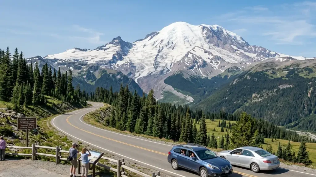
Along the southwest side, the Paradise–Longmire–Nisqually corridor offers repeated pull‑outs and overlooks that frame Mount Rainier directly. Classic viewpoints include the Christine Falls and Narada Falls pull‑offs, where the road drops beside waterfalls that cascade down dark‑rock channels from the mountain’s slopes. Slightly further along, the Ricksecker Point loop provides a short, one‑way drive with several graded turnouts that look directly up the Nisqually Glacier and the west‑facing slopes of the mountain.
Above Ricksecker, the road to Paradise presents continuous, broad vistas as it climbs through open meadow and subalpine terrain. The final stretch near Paradise includes marked pull‑outs such as the Reflection Lakes area, where the snow‑capped summit often mirrors in the still water in early morning. These avenues are especially popular for sunrise and late‑afternoon photography, when the light strikes the mountain’s eastern and southern faces.
Near the Nisqually entrance, the Nisqually Valley and Longmire areas provide foreground views of the river valley backed by the mountain. Longmire’s historic ranger‑station buildings and the Silver Springs area are often used as mid‑route photo stops, with interpretive signage explaining the park’s geology and early‑20th‑century development. These southwest‑side lookouts are typically usable from late May through September, depending on snowmelt at higher elevations.
How does the Chinook Scenic Byway connect to Mount Rainier?
The Chinook Scenic Byway runs from the east side of Mount Rainier up through the Cascade Mountains toward Crystal Mountain and the Snoqualmie region. This route is officially designated as a National Scenic Byway and links Mount Rainier National Park’s Sunrise area with the Mount Baker–Snoqualmie National Forest. Along the way, it passes through the Ohanapecosh old‑growth forest and the Crystal Mountain ski resort corridor, which are themselves major visitor destinations.
The byway’s length is roughly 110–120 miles total, depending on the exact starting and ending points. It traverses both the Nisqually and Sunrise watersheds, so drivers see transitions from moist, moss‑covered forests to drier, sun‑bleached ridgelines. The road includes several named overlooks, such as Tipsoo Lake and Fort Lake, which provide views of Mount Rainier’s northern and eastern shoulders.
Because of its upgraded status, the Chinook Scenic Byway carries interpretive signage and pull‑outs designed for scenic viewing and short walks. These stops are spaced roughly every 5–10 miles along the higher‑elevation sections, allowing drivers to break up the trip and take in different angles of the mountain. The route is commonly used in combination with the Circle Mt. Rainier Drive to create a longer, multi-directional road‑trip loop.
What does the White Pass Scenic Byway offer near Mount Rainier?
The White Pass Scenic Byway follows U.S. Highway 12 from the Nisqually River area near the park’s southwest side up over White Pass into Eastern Washington. This 78‑mile byway is also a National Scenic Byway and offers a long, gradual climb with repeated views of Mount Rainier’s southern and western slopes. The route passes through the Big Bottom Valley, the Nisqually River corridor, and the American River area, all of which frame the mountain in different lighting conditions.
The byway is particularly useful for visitors who want to combine Mount Rainier scenery with access to Riffe Lake, Mayfield Lake, and the Pacific Crest Trail corridor. These water bodies and trailheads provide alternative viewpoints that are less crowded than the core park entries. The road is open roughly May to November, with the highest section near White Pass sometimes patchy in early May or late October.
From a scenic‑drive perspective, the White Pass Scenic Byway functions as a “back” ‑side view corridor. Because the mountain’s western and southern flanks are much more abrupt and glaciated than its eastern side, the views from this route emphasize steep ice‑covered slopes and deep river valleys. This makes the byway attractive for photographers seeking strong, dramatic silhouettes and melting‑glacier detail.
What are the best short scenic loops inside Mount Rainier National Park?
Within the park itself, several short loops maximize roadside views while minimizing hiking. The most famous is the Paradise–Longmire–Nisqually loop, which can be driven in either direction but is often run southbound from Longmire to Paradise to follow the ascent and gain the most dramatic reveal of the mountain. This route is about 20–25 miles long and includes multiple pull‑outs, waterfalls, and meadow overlooks along the way.
Another important internal loop is the Sunrise–White River–Ohanapecosh corridor. This drive connects the Sunrise visitor area with the White River entrance and the Ohanapecosh campground and visitor centre, all along the same Highway 410 corridor. The road here is roughly 20–25 miles and provides long, sweeping views of Mount Rainier’s eastern and northern faces, especially as it climbs toward Sunrise.
A third internal option is the Mowich Lake loop on the northwest side. This route runs from the Mowich Lake entrance along the Mowich Lake Road to the Mowich Lake basin at about 4,500 feet, with several pull‑outs that look back toward the mountain’s northwest flank. The loop is about 15–20 miles round‑trip and is notable for its quieter, more remote feel compared to the more heavily visited south and east sides.
How do seasons and weather affect Mount Rainier scenic drives?
Mount Rainier’s elevation and location in the Cascade Range mean that road conditions are highly seasonal. Most high‑elevation roads inside the park, including those to Paradise and Sunrise, are plowed from late spring to early autumn, typically May to late September. Lower‑elevation byways such as the White Pass Scenic Byway and parts of Highway 706 may stay open longer, often into October or November, but can still close temporarily during storms.
During the summer months (June–August), these drives are generally open, with clear skies offering the best visibility. However, afternoon thunderstorms can roll in quickly, and higher passes may still carry patches of snow or ice early in the season. In autumn (September–October), roads are usually clear but can experience early‑season snowstorms, especially above 5,000 feet.
Winter and spring bring the most dramatic changes. Many passes, including Chinook Pass and Sunrise Road, are closed to regular vehicles and see only plowing for snow‑plough access and emergency use. For scenic‑drive planning, this means that most year‑round routes are limited to lower‑elevation byways such as the White Pass Scenic Byway and portions of Highway 12 near Packwood and Morton.
What practical tips maximize safety and enjoyment on these drives?
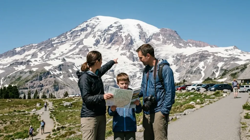
Mount Rainier’s scenic drives are generally safe on paved roads, but elevation, weather, and wildlife require preparation. Drivers should carry extra water, snacks, and a warm layer because services are sparse once you leave the main park entries and highways. Cell‑phone coverage is patchy along many byway sections, so downloading maps and checking National Park Service road‑status pages before departure is strongly recommended.
For wildlife, black bears, deer, and smaller mammals are common along forest edges, especially near dawn and dusk. Drivers should avoid stopping in the middle of the road, keep food locked in vehicles, and obey posted speed limits near wildlife‑crossing zones. At higher elevations, sun exposure and glare off snow can be intense, so sunglasses and sunscreen are advisable even on cool days.
Photographers should plan around lighting rather than only around distance. The southwest side (Paradise–Longmire) is best for morning and late‑afternoon light, while the east side (Sunrise–White River) often renders well in mid‑morning and noon when the sun hits the mountain’s eastern face. Many overlooks have small parking spurs, but these fill quickly on weekends and holidays, so arriving early or mid‑week can significantly improve the experience.
How do these scenic drives fit into Washington’s broader tourism strategy?
Mount Rainier’s scenic drives are part of a larger state‑level emphasis on motor‑friendly nature tourism and byway‑based itineraries. Washington promotes several National Scenic Byways that connect to the park, including the Chinook Scenic Byway and the White Pass Scenic Byway, as part of a regional network of “drive‑through” experiences. These routes help distribute visitors across multiple towns and forest‑service areas, reducing pressure on the park’s most crowded entrances.
From an economic‑impact perspective, studies of national‑park tourism in Washington show that road‑based day‑trippers spend significant amounts at small‑town businesses such as gas stations, diners, and gear shops. Mount Rainier’s accessibility by car from the Puget Sound lowlands makes it a frequent destination for weekend and holiday drives, which supports local economies in communities like Ashford, Packwood, Enumclaw, and Elbe.
Looking ahead, climate‑change projections for the Cascades suggest that earlier snowmelt may extend the open‑season window for high‑elevation roads. Conversely, more frequent extreme‑weather events could increase the risk of road closures due to landslides or flooding. This means that future planning for Mount Rainier scenic drives will likely emphasize improved forecasting, real‑time status systems, and visitor‑education tools to keep the routes safe and accessible.
Which Mount Rainier scenic drive routes are best for photography?
For photography, the Paradise–Longmire–Nisqually corridor and the Sunrise side are consistently rated as the most rewarding. The southwest route offers classic foregrounds of meadows, waterfalls, and small lakes that frame the mountain’s imposing bulk, especially at sunrise and sunset. The Paradise–Longmire stretch includes multiple pull‑outs where the road dips into openings that provide clean, unobstructed views of the summit.
On the east side, the Sunrise–White River corridor provides long, wide‑angle perspectives of the mountain’s eastern and northern slopes. The higher elevation here increases the chance of clear skies and reduces lower‑altitude haze, which benefits telephoto‑lens work. The Ohanapecosh old‑growth forest section also offers vertical‑composition shots of the mountain framed by towering trees and moss‑covered trunks.
For landscape‑photography itineraries, the combination of the White Pass Scenic Byway, the Chinook Scenic Byway, and the Circle Mt. Rainier Drive allows photographers to capture the mountain in four cardinal directions in a single multi‑day trip. Each route offers different foregrounds – from river valleys on the west side to alpine meadows in the east – which multiplies compositional options without requiring long hikes.
How can visitors plan an efficient Mount Rainier scenic drive day?
An efficient day‑trip plan depends on where visitors start, how long they can drive, and what they want to see. For Seattle‑ or Tacoma‑based visitors, a common pattern is to drive early morning on Highway 706 to the Nisqually entrance, then proceed up to Paradise, back down to Longmire, and then loop out via Highway 12 or Highway 410, depending on the chosen byway.
A typical day‑trip template might include:
- Morning: Drive from the lowlands to the Nisqually entrance and then up to Paradise, stopping at Christine Falls, Narada Falls, and Ricksecker Point.
- Midday: Explore the Paradise area viewpoints and short walks, then descend to Longmire for lunch and a brief stop at the historic district.
- Afternoon: Continue east on Highway 123 / 410 toward Sunrise or White River, or west on Highway 12 along the White Pass Scenic Byway, depending on the chosen route.
This pattern typically fills 8–10 hours, including driving, short walks, and photo stops. For a shorter outing, visitors can focus on one major corridor – such as Paradise–Longmire–Nisqually or Sunrise–White River – and still see multiple distinct landscape types and viewpoints.
How do these routes support education and conservation messaging?
The Mount Rainier scenic‑drive network is intentionally designed to support environmental education and conservation messaging alongside recreation. Pull‑outs and visitor centres along the Paradise–Longmire, Sunrise–White River, and White Pass Scenic Byway routes include interpretive signage explaining geology, glaciers, forest ecology, and the history of park management. These panels help drivers connect roadside views to broader concepts such as volcanism, climate change, and watershed protection.
In addition, many of the associated byway‑based promotional materials highlight low‑impact behaviours, such as staying in designated parking areas, packing out trash, and respecting wildlife. These messages are reinforced by ranger‑staffed areas at Longmire and Sunrise, where visitors can ask questions about road‑closure policies, wildlife safety, and trail‑use guidelines. Over time, this combination of physical infrastructure (pull‑outs, signs, centres) and interpretive content helps shape visitor expectations around responsible tourism.
What is the best scenic drive at Mount Rainier National Park?
The best overall scenic drive is the Circle Mt. Rainier Drive because it loops around the mountain and shows multiple ecosystems, viewpoints, and park entrances in one trip. The route combines Highway 706, Highway 123, Highway 410, and Highway 12 and usually takes 4–6 hours without long stops.