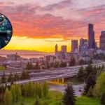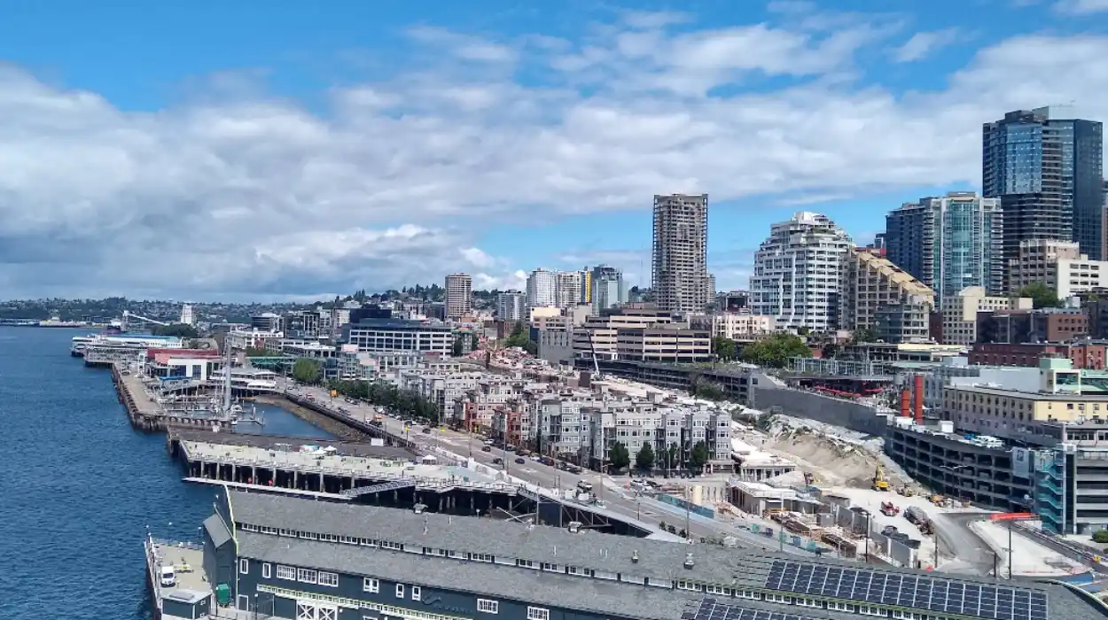
Seattle, Washington, is a major metropolitan hub in the Pacific Northwest of the United States, situated between the saltwater of Elliott Bay and the freshwater of Lake Washington. The city comprises distinct geographic districts, often referred to as a “city of neighborhoods,” each defined by specific historical development, topographical features, and economic specialisations. These areas range from the historic brick-lined streets of Pioneer Square to the maritime-focused Ballard and the tech-centric South Lake Union. As of 2024, the Seattle-King County region receives approximately 40 million annual visitors, generating 8.8 billion dollars in direct spending and supporting over 68,000 jobs in the hospitality sector.
- What is the historical significance of Seattle neighborhoods?
- Which neighborhoods are best for maritime and cultural history?
- What are the top neighborhoods for nightlife and entertainment?
- How do geographic features define Seattle neighborhoods?
- What role does the culinary scene play in neighborhood identity?
- What are the future implications of neighborhood development in Seattle?
What is the historical significance of Seattle neighborhoods?
Seattle neighborhoods developed from distinct 19th-century settlements, such as Pioneer Square in 1852 and Ballard in 1888. These areas were unified by the 1889 Great Seattle Fire and subsequent annexation, evolving from independent timber and fishing villages into interconnected urban districts.
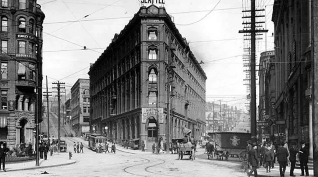
The historical framework of Seattle is rooted in its original settlement at Pioneer Square. In 1852, the first permanent white settlers, known as the Denny Party, selected this location due to its flat terrain and proximity to a deep-water harbor. Henry Yesler established a steam-powered sawmill in 1853, which became the economic engine for the fledgling city. The Great Seattle Fire of June 6, 1889, destroyed 25 blocks of the central core, prompting a massive reconstruction effort. This period introduced the Richardsonian Romanesque architectural style, characterized by heavy masonry and Roman arches, which remains visible in the Pioneer Square Preservation District today.
Other neighborhoods originated as autonomous municipalities before annexation by the city. Ballard, incorporated in 1890, was initially a center for the shingle and lumber industries. It saw a significant influx of Scandinavian immigrants, specifically from Norway and Sweden, who influenced the maritime and fishing culture of Salmon Bay. Similarly, Columbia City was incorporated in 1893 and prospered as a railroad and logging hub until its annexation in 1907. The development of the Seattle, Renton, and Southern Railway in 1890 allowed these outlying districts to integrate with the metropolitan core.
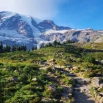
Topography also dictated the growth of residential enclaves. Queen Anne Hill, formed by the Vashon Glacier 13,500 years ago, was initially known as Eden Hill. It was renamed in the 1880s as wealthy residents built homes in the Queen Anne architectural style. The introduction of cable cars and electric streetcars in the late 19th century allowed residents to live on the steep slopes while commuting to jobs in the downtown business district.
Which neighborhoods are best for maritime and cultural history?
Ballard and Pioneer Square serve as the primary destinations for maritime and cultural history in Seattle. These districts preserve the city’s 19th-century origins through the Hiram M. Chittenden Locks and the Klondike Gold Rush National Historical Park.
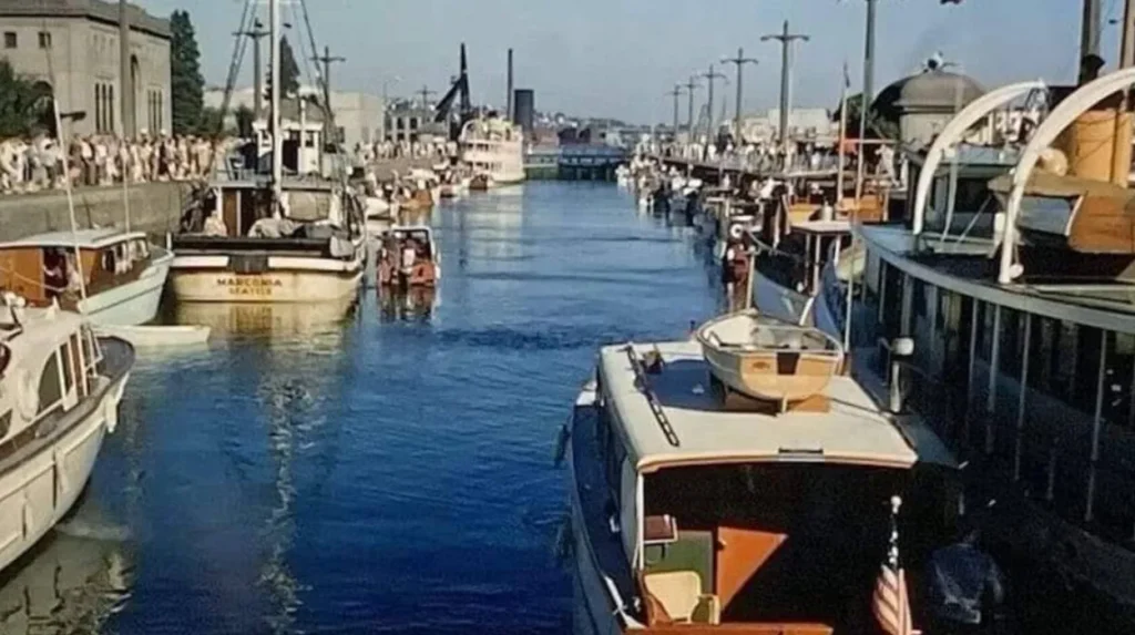
Ballard is the center of Seattle’s maritime heritage, located on the north shore of Salmon Bay. The Hiram M. Chittenden Locks, completed in 1917, connect the salt water of Puget Sound with the fresh water of Lake Union and Lake Washington. This infrastructure allows vessels to bypass the elevation difference of 20 feet (approximately 6 meters). The National Nordic Museum, relocated to a new facility in 2018, documents the history of the 5 Nordic countries (Denmark, Finland, Iceland, Norway, and Sweden) and their impact on the region’s fishing and timber industries.
Pioneer Square functions as the historic heart of the city. The Klondike Gold Rush National Historical Park, located within the Cadillac Hotel building, details Seattle’s role as the “Gateway to the Gold Fields” during the 1897 Alaska Gold Rush. This district also features the Smith Tower, which was the tallest building west of the Mississippi River upon its completion in 1914. Visitors can explore the Seattle Underground, a series of subterranean tunnels and storefronts that were bypassed when the city raised its street levels in the late 19th century to combat drainage issues.
The International District, specifically Chinatown and Japantown, provides a century of Asian-American cultural history. Established in its current location in the early 1900s, this neighborhood contains the Wing Luke Museum of the Asian Pacific American Experience. This institution is the only pan-Asian Pacific American museum in the United States and is a Smithsonian Affiliate. The area’s historical structures, such as the Panama Hotel (built in 1910), preserve the legacy of Japanese immigrants and their experiences during the internment period of the 1940s.
What are the top neighborhoods for nightlife and entertainment?
Capitol Hill and Belltown are the leading neighborhoods for nightlife, music, and performing arts. These areas house high concentrations of independent venues, including the Neumos music hall, the Crocodile, and numerous late-night establishments concentrated along the Broadway and 2nd Avenue corridors.
Capitol Hill serves as the cultural and nightlife epicenter of Seattle. It is historically recognized as the center of the LGBTQ+ community and the birthplace of the 1990s grunge movement. The neighborhood features a high density of music venues, such as Neumos and the Comet Tavern, alongside independent bookstores like The Elliott Bay Book Company. Volunteer Park, a 48-acre (19-hectare) green space designed by the Olmsted Brothers, provides a macro-context for the area, containing the Seattle Asian Art Museum and the Volunteer Park Conservatory.
Belltown, located northwest of the downtown core, transitioned from a low-rise industrial area into a high-density residential and entertainment district. It is home to The Crocodile, a venue that hosted seminal performances by bands such as Nirvana and Pearl Jam. The neighborhood’s proximity to the Seattle Center—a 74-acre (30-hectare) arts and entertainment complex—provides access to the Space Needle, the Museum of Pop Culture (MoPOP), and the Pacific Science Center. In 2024, downtown Seattle, including Belltown, drew over 1.1 million unique local visitors, reinforcing its status as a major social magnet.
Fremont, known as the “Center of the Universe,” offers a more bohemian approach to entertainment. It is characterized by public art installations, including the 18-foot (5.5-meter) Fremont Troll located under the Aurora Bridge and the 16-foot (5-meter) bronze statue of Vladimir Lenin. The neighborhood’s nightlife is concentrated near the Fremont Canal, featuring a variety of craft breweries and small-scale performance spaces. The annual Fremont Solstice Parade, held every June, attracts approximately 100,000 spectators to the area.
Explore More Seattle News
Seattle Festival Applauds Released Terrorist Raed Abduljalil (Seattle, 2026)
Washington millionaires tax sparks Seattle exodus fears in 2026
How do geographic features define Seattle neighborhoods?
Waterways and steep ridges define Seattle’s neighborhood boundaries, creating distinct micro-climates and views. Elliott Bay, Lake Union, and the Lake Washington Ship Canal act as natural barriers that separate districts like West Seattle, Queen Anne, and Ballard.
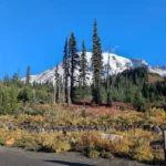
The geography of Seattle is a product of glacial activity, resulting in seven major hills and numerous bodies of water. Queen Anne Hill rises to an elevation of 456 feet (139 meters), providing panoramic views of the skyline and Mount Rainier. This elevation historically separated the affluent “Upper Queen Anne” residential area from the industrial “Lower Queen Anne,” now known as Uptown. The topography influences urban planning, as seen in the steep grades of downtown streets that run perpendicular to the Elliott Bay shoreline.
West Seattle is geographically isolated from the rest of the city by the Duwamish River. This neighborhood features Alki Beach Park, the site of the original 1851 landing by the Denny Party. The area maintains a beach-town atmosphere distinct from the urban density of the mainland. Access is primarily facilitated by the West Seattle Bridge and the King County Water Taxi, a passenger-only ferry that crosses Elliott Bay in approximately 15 minutes.
The Lake Washington Ship Canal is a critical geographic feature that bisects the city into northern and southern halves. Neighborhoods bordering the canal, such as Fremont and South Lake Union, have historically focused on industrial and maritime activities. In the 21st century, South Lake Union has been transformed by the technology sector, becoming the global headquarters for Amazon. This shift has altered the micro-geography of the area, replacing warehouses with LEED-certified office towers and urban parks such as Lake Union Park.
What role does the culinary scene play in neighborhood identity?
Seattle neighborhoods are identified by specific culinary specialisations, such as the seafood-heavy menus in Ballard and the diverse international cuisines in the Rainier Valley. These food cultures reflect the demographic history and economic shifts of each specific district.
Ballard’s culinary identity is rooted in its Scandinavian and maritime history. The neighborhood features a high concentration of oyster bars and seafood restaurants, such as The Walrus and the Carpenter. Additionally, the Ballard Brewery District contains approximately 11 craft breweries within walking distance, including Reuben’s Brews and Stoup Brewing. The Ballard Farmers Market, operating year-round on Sundays, is one of the largest in Washington state, showcasing local produce, meats, and artisanal products from across the Pacific Northwest.
The Chinatown-International District (CID) offers a culinary landscape defined by 3 distinct ethnic enclaves: Chinatown, Japantown, and Little Saigon. This area is the primary location for authentic dim sum, sushi, and pho. Uwajimaya, a large Asian grocery store established in 1928, serves as a central hub for the community. The CID’s food scene is a critical component of its preservation efforts, as many family-owned businesses have operated for multiple generations, surviving urban renewal projects and economic downturns.
Columbia City and the Rainier Valley represent the most diverse zip code in the United States, which is reflected in the neighborhood’s dining options. Visitors can find 4 primary types of international cuisine: East African (Ethiopian and Somali), Southeast Asian (Vietnamese and Thai), Caribbean, and traditional Southern American soul food. This diversity is a direct result of the neighborhood’s history as a landing point for various immigrant and refugee populations throughout the 20th and 21st centuries.
What are the future implications of neighborhood development in Seattle?
Future development in Seattle neighborhoods focuses on transit-oriented growth and increased density through the Sound Transit 3 (ST3) expansion. This multi-billion dollar project aims to connect distant neighborhoods like Ballard and West Seattle to the light rail network by 2039.
The expansion of the Sound Transit Link Light Rail is the most significant factor influencing the future of Seattle’s neighborhoods. ST3, a 54-billion-dollar ballot measure approved by voters in 2016, will add 62 miles (100 kilometers) of new light rail. This infrastructure will facilitate higher-density housing developments around new stations in neighborhoods such as Uptown, Interbay, and the Junction in West Seattle. The objective is to reduce reliance on single-occupancy vehicles and address the city’s housing shortage by creating “urban villages” centered on mass transit.
Sustainability and green space also play a vital role in future planning. The Seattle Waterfront Project is currently transforming the Alaskan Way corridor by replacing the demolished Viaduct with 20 acres (8 hectares) of new parks, paths, and plazas. This project, scheduled for completion in phases through 2025 and 2026, will reconnect the downtown core with the Elliott Bay waterfront. It includes the Overlook Walk, a pedestrian bridge designed to allow people to walk from Pike Place Market directly to the waterfront without crossing surface streets.
Economic shifts continue to reshape neighborhoods like South Lake Union and the University District. The “U-District” is undergoing a significant upzoning process to allow for high-rise residential towers near the University of Washington. This transition aims to accommodate the growing population of students and tech workers. As Seattle prepares to host matches for the 2026 FIFA World Cup, the city is accelerating infrastructure improvements in the Stadium District (SoDo) and Pioneer Square, projecting an economic impact of approximately 929 million dollars.
What are Seattle neighborhoods known for?
Seattle neighborhoods are known for their distinct history, geography, culture, and economic identity. Areas such as Pioneer Square, Ballard, Capitol Hill, and South Lake Union each developed around different industries, immigrant communities, and transportation routes.