
Key Points
- Forecasters warn of an early wildfire season in Washington state due to the driest spring in years.
- No measurable rain at Seattle-Tacoma International Airport (SEA) for a dozen days as of Sunday.
- Only 0.04 inches of rain fell at SEA on April 28.
- Most recent significant rainfall at SEA occurred on April 22, with nearly 0.5 inches.
- Dry spell in Bellingham dates back to April 14, when Whatcom County received nearly 0.4 inches.
- Year-to-date precipitation at SEA is almost an inch below average, despite a wet March.
- Olympia has dropped to nearly three inches below average for the year.
Seattle (Evening Washington News) – May 11, 2026 – Forecasters have issued warnings about an early start to wildfire season in Washington state following one of the driest springs on record. The prolonged dry conditions across key areas, including Seattle-Tacoma International Airport (SEA) and surrounding regions, have heightened concerns among weather experts and emergency officials.
- Key Points
- What Has Caused the Driest Spring in Washington State?
- How Long Has the Dry Spell Lasted at Key Washington Airports?
- Why Are Precipitation Deficits Concerning for Wildfire Risks?
- What Do Recent Rainfall Measurements Reveal Across Washington?
- How Have Year-to-Date Totals Shifted After a Wet March?
- What Warnings Have Forecasters Issued for Wildfire Season?
- Background of the Development
- Prediction for Washington Residents
What Has Caused the Driest Spring in Washington State?
The weather patterns over recent weeks have led to critically low precipitation levels. As of Sunday, it had been a dozen days since the last measurable rain at SEA.
On April 28, only 0.04 inches fell at the airport. The most recent significant rainfall at SEA was on April 22, with nearly 0.5 inches recorded.
For Bellingham, the dry spell dates back even further to April 14, when Whatcom County received nearly 0.4 inches of rain.
These figures highlight a sharp departure from typical spring moisture, exacerbating fuel dryness in forests and grasslands.
Despite a wet March earlier in the season, year-to-date totals at SEA have fallen back to almost an inch below average. Olympia, the state capital, has seen an even greater deficit, dropping to nearly three inches below average for the year thus far.
These deficits have prompted forecasters to alert residents and authorities about elevated wildfire risks.
How Long Has the Dry Spell Lasted at Key Washington Airports?
At Seattle-Tacoma International Airport, the absence of measurable rain for 12 days as of Sunday underscores the severity of the situation.
This follows the minimal 0.04 inches on April 28 and the more substantial 0.5 inches on April 22. Such extended dry periods are unusual for the region’s maritime climate.
In Bellingham, the dry conditions have persisted since April 14, with Whatcom County’s last notable rain event delivering nearly 0.4 inches.
This northern area’s prolonged dryness mirrors trends across western Washington, where spring rains typically replenish soils and vegetation.
These specific timelines at major airports serve as indicators for broader regional patterns, as airports provide reliable, long-term weather data. The shift from a wet March to arid conditions in April and early May has reversed earlier gains in precipitation.
Why Are Precipitation Deficits Concerning for Wildfire Risks?
Year-to-date, SEA remains almost an inch below average, a stark contrast after March’s heavier rains pulled totals closer to normal.
Olympia’s deficit stands at nearly three inches below average, reflecting statewide trends of below-normal spring moisture.
Forecasters attribute these conditions to persistent high-pressure systems that have blocked Pacific storm tracks.
Dry fuels from grasses and underbrush, combined with warming temperatures, create ideal conditions for rapid fire spread. Officials note that even brief winds could ignite spot fires across parched landscapes.
The combination of low humidity, sunny skies, and desiccated vegetation has led to warnings from the National Weather Service and state climatologists. Early wildfire activity could strain firefighting resources before peak summer months.
What Do Recent Rainfall Measurements Reveal Across Washington?
Specific measurements paint a clear picture of the drought’s progression. At SEA, the April 28 event yielded just 0.04 inches, insufficient to alleviate dryness.
The April 22 rainfall of nearly 0.5 inches provided temporary relief but was quickly offset by subsequent clear weather.
Bellingham’s April 14 rainfall of nearly 0.4 inches in Whatcom County marked the end of reliable moisture for that area. These isolated events highlight the inconsistency of spring rains this year.
For the year overall, SEA’s near one-inch deficit and Olympia’s three-inch shortfall indicate a return to below-average totals. These metrics, tracked by official gauges, inform fire danger ratings issued daily by state agencies.
How Have Year-to-Date Totals Shifted After a Wet March?
A wet March had initially boosted precipitation at SEA, bringing year-to-date figures near average. However, the dry April and early May have erased those gains, leaving the airport almost an inch below normal.
Olympia’s larger deficit of nearly three inches below average reflects greater variability in southern Puget Sound areas. Statewide, this reversal has heightened concerns for agriculture, water supplies, and fire-prone ecosystems.
Meteorologists emphasise that while March rains saturated soils, the subsequent dry spell has allowed evaporation and plant uptake to deplete moisture rapidly. This sets the stage for an unusually early wildfire season.
What Warnings Have Forecasters Issued for Wildfire Season?
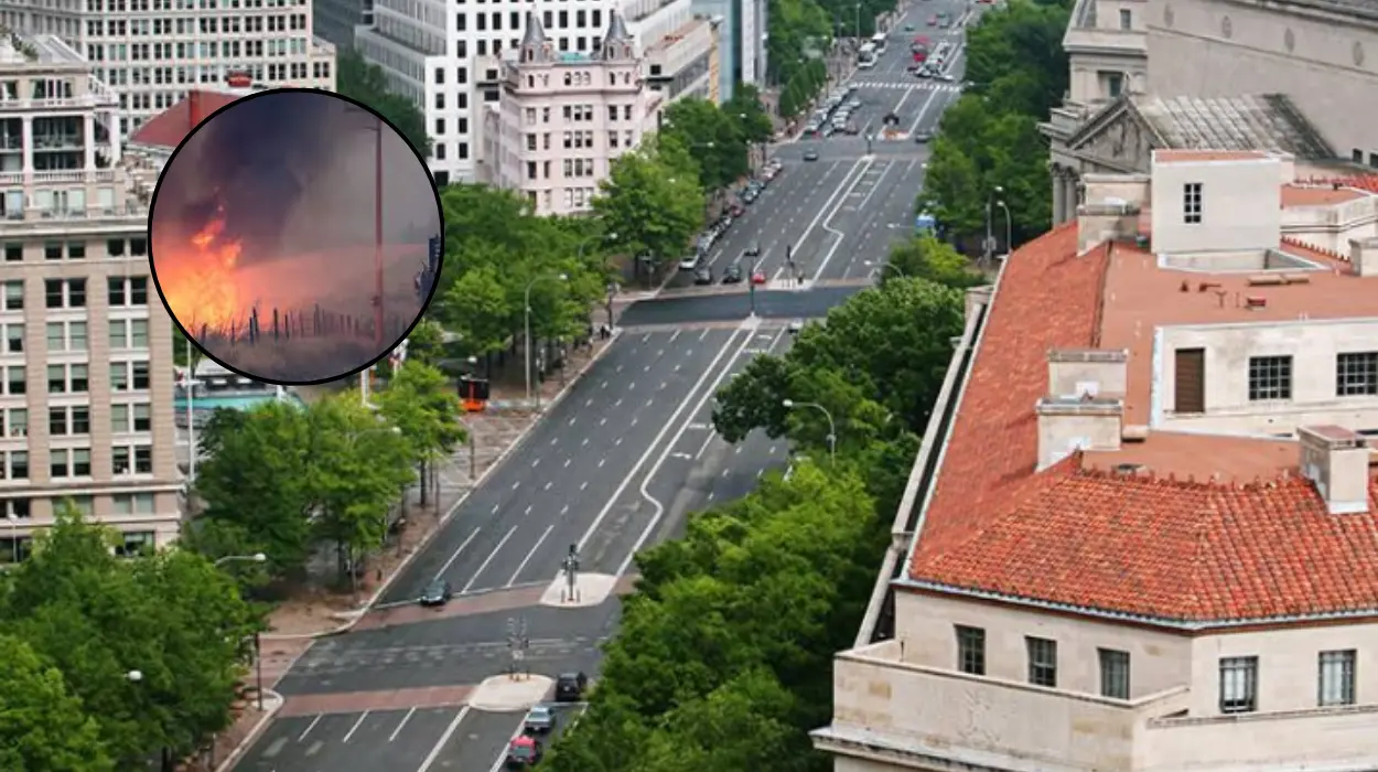
Forecasters warn that the driest spring in years could trigger wildfires well ahead of the typical June or July onset. The combination of dry fuels, low precipitation, and warming trends poses immediate risks to rural and forested communities.
Agencies like the Washington Department of Natural Resources have elevated fire danger levels in several counties. Residents are advised to avoid outdoor burning and prepare evacuation plans.
The dry spell’s duration—12 days at SEA without measurable rain—amplifies these warnings. Officials stress that any spark from equipment, vehicles, or lightning could spark uncontrollable blazes.
Background of the Development
This dry spring follows a period of above-average moisture in prior months, with Seattle recording one of its wettest four-year stretches ending in late 2025. However, shifting weather patterns, including persistent ridging over the western US, have ushered in drier conditions since early April. Climate outlooks from the Washington State Climate Office had predicted elevated chances of below-normal precipitation for April through June, with probabilities around 33-50% statewide. These forecasts, issued in early April, align with the observed trends at SEA, Bellingham, and Olympia. Historical data shows Seattle’s annual average at about 37.5 inches, making the current deficits notable but within the range of variability seen in past dry springs, such as those in the 1990s.
Prediction for Washington Residents
This development can affect Washington residents by increasing the likelihood of early wildfires, potentially leading to evacuations, smoke-related health advisories, and restrictions on outdoor activities. Rural communities near forests may face property threats, while urban areas like Seattle could experience air quality declines from distant fires.
Agriculture in eastern Washington might see irrigation strains from reduced snowpack melt, and tourism in wildfire-prone parks could be curtailed. Power shutoffs for public safety may occur during high winds, impacting daily life and emergency services preparedness statewide.
 1")


