Key Points
- Drastic Pattern Shift: Western Washington is transitioning from a mild, partly sunny weekend into a major offshore, low-pressure storm system.
- Significant Rainfall Forecast: Forecasters project heavy, drenching rain across Seattle beginning on Monday, bringing an abrupt end to the dry spell.
- Temperatures to Plunge: Daytime high temperatures are expected to tumble into the mid-60s on Sunday, continuing a cooler, unsettled regional trend.
- Storm and Lightning Risks: The active weather system carries heightened risks of thunderstorms, lightning, and isolated downpours throughout Monday evening.
- Commute Disruption Expected: Local authorities warn that the incoming wet front will cause slick, treacherous road conditions for the Monday morning rush hour.
Seattle (Evening Washington News) June 20, 2026 – A significant and unseasonably intense meteorological pattern shift is tracking directly toward western Washington, threatening to blanket the metropolitan region in what meteorologists describe as dark and sloppy conditions. Following a weekend characterized by highly variable, unsettled skies, local weather authorities confirmed on Sunday that a substantial drenching system has structured itself offshore and is advancing rapidly toward the coast. The regional forecast indicates that while Sunday retained lingering pockets of mild weather, the atmosphere is destabilising, clearing the path for an abrupt influx of heavy precipitation, gusty winds, and localized thunderstorms that will impact millions of residents across the Puget Sound lowlands starting early Monday morning.
As reported by Chief Meteorologist Tim Larson of the Pacific Northwest Weather Network, the transition will be both swift and severe, with rainfall totals expected to exceed typical seasonal baselines within a compressed twelve-hour window. Larson noted that
“the incoming low-pressure cell is dragging an atmospheric corridor of rich moisture right into the core of the city, which will inevitably yield slick roadways, reduced visibility, and immediate drainage challenges on major municipal thoroughfares.”
This assessment aligns with warnings issued by regional transport coordinates, which have advised local commuters to plan for prolonged travel delays during both the morning and evening rush-hour windows.
What Weekend Weather Elements Preceded This Incoming Storm Front?
Before the anticipated arrival of Monday’s drenching system, Seattle experienced an unsettled, highly transitional weekend that served as a precursor to the broader regional atmospheric shift. On Saturday, a mix of high-altitude moisture and surface heat produced scattered, localized showers along with brief thunderstorm activity across portions of western Washington.
Temperatures peaked near an unseasonably warm 87 degrees Fahrenheit (30.6 degrees Celsius) on Saturday afternoon under the influence of a faint west-northwest wind moving at approximately 5 miles per hour, creating humid conditions that eventually broke into late-afternoon downpours.
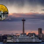
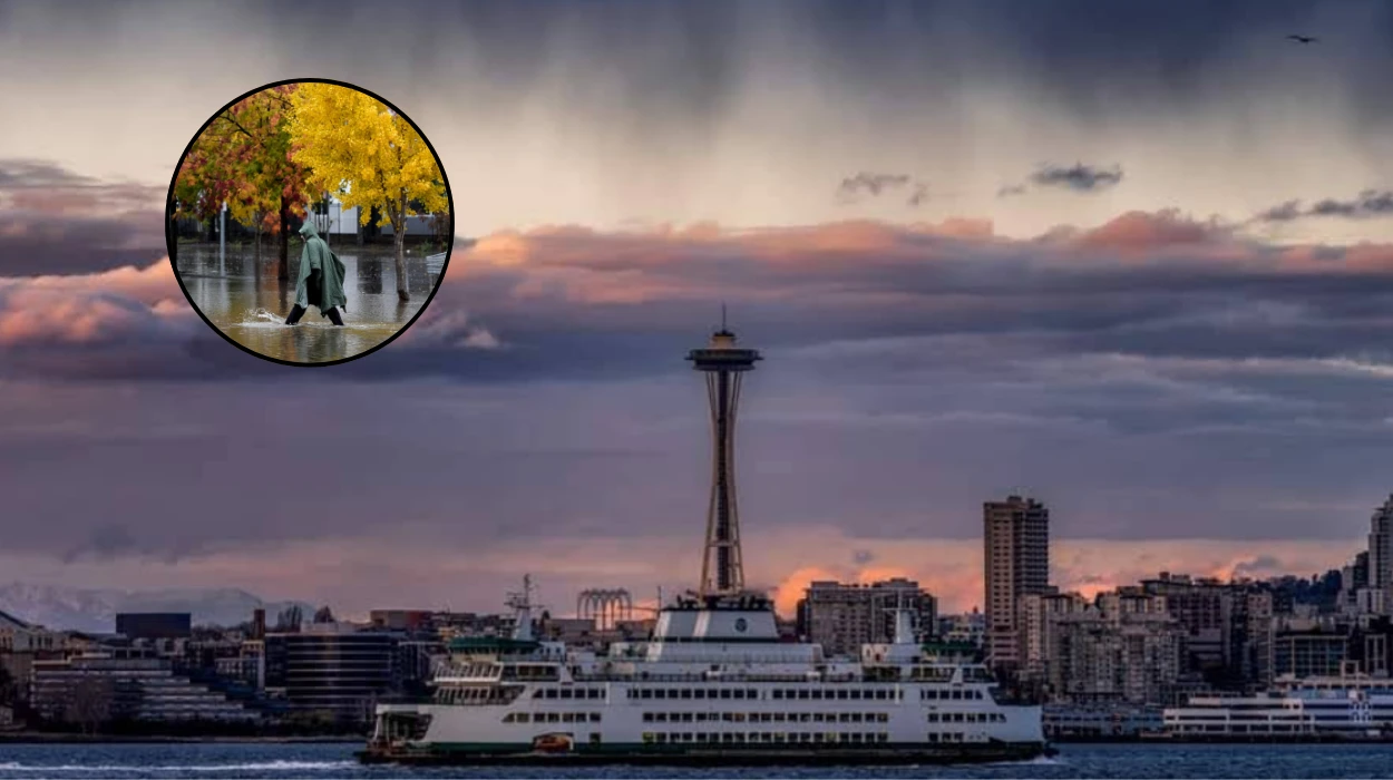
By Sunday, the regional microclimate shifted visibly as a cooler marine air mass began pushing inland from the Pacific Ocean. Sky conditions throughout the day fluctuated between partly sunny and mostly cloudy, accompanied by periodic, passing sprinkles that kept the ground damp without accumulating substantial depth.
The influx of cool ocean air effectively capped daytime high temperatures in the mid-60s across the greater Seattle area.
According to a detailed report published by climatologist Sarah Jenkins of the Western Washington Environmental Journal, this specific temperature drop was a structural indication that the high-pressure ridge which brought warmer conditions earlier in the week had collapsed entirely, leaving the region vulnerable to the incoming offshore storm matrix.
What Specific Risks Do Thunderstorms and Changing Wind Patterns Pose to the Region?
The core threat associated with Monday’s weather progression centers on the development of deep convective cells capable of producing sustained thunderstorms and lightning strikes across King County.
National weather models show that as the primary front collides with the residual warm air trapped in the mountain valleys, atmospheric instability will peak during the late afternoon and evening hours.
This collision is expected to generate active electrical storms, with the highest probability of lightning strikes occurring after 5:00 PM on Monday.
In an analytical broadcast, Senior Forecast Specialist David Vance of the Emerald City Climate Center stated that
“the primary operational hazard on Monday evening will not merely be the volume of water, but the co-occurrence of active lightning and sudden, unpredictable wind shifts.”
Vance explained that while ambient winds are projected to maintain a baseline speed of 5 to 10 miles per hour from the west-northwest, internal downdrafts from localized convective storms could produce sudden gusts exceeding 30 miles per hour. Such variations present an elevated risk of localized property damage, snap tree limbs, and sudden infrastructure challenges in poorly sheltered urban environments.
Background of the Seattle Weather Shift
To understand the severity of the incoming weather pattern, it is necessary to examine the broader atmospheric context of the Pacific Northwest during this portion of the annual seasonal cycle. Historically, late June represents a transitional phase for western Washington, where the region gradually moves away from prolonged spring rain systems toward its statistically driest months of July and August.
However, long-range climate indicators compiled by regional tracking bureaus show that the early summer of 2026 has been heavily influenced by highly volatile, neutral El Niño-Southern Oscillation (ENSO) conditions across the tropical Pacific.
This neutrality has allowed the polar jet stream to dip unusually far south, steering energetic, moisture-laden low-pressure systems directly into Washington State rather than deflecting them north toward British Columbia.
Furthermore, empirical records maintained by regional monitoring stations indicate that Seattle has experienced highly fluctuating rainfall baselines over the past two seasons. While parts of the previous year concluded well below historical precipitation averages, early 2026 saw a notable resurgence in wet weather, including an exceptionally active spring.
This sequence has left regional soils highly saturated, meaning that any sudden influx of heavy, unseasonal rainfall—such as the system projected for Monday—cannot be easily absorbed by the terrain. Consequently, the urban landscape faces a significantly higher risk of immediate runoff, drainage backups, and transient street flooding than would normally be expected during a standard summer transition.
Prediction: How This Development Can Affect the Local Population
The transition to dark, sloppy conditions on Monday is predicted to exert immediate, tangible pressures across multiple segments of the local Seattle population, with the most direct impacts felt by daily vehicular commuters, municipal infrastructure teams, and outdoor commercial operators.
- Urban Commuters and Transit Users: Drivers navigating major state corridors, including Interstate 5 and Interstate 405, are highly likely to encounter sudden hydroplaning hazards and severe delays. The combination of oily surface residue on roads and sudden, blinding downpours during the morning rush hour will likely result in an increased frequency of minor vehicular accidents, compounding transit congestion throughout the metro area.
- Municipal Infrastructure and Utility Teams: Public works departments will face immediate operational strains as storm drainage networks cope with intense, short-duration runoff. Because local soils are already damp from prior weekend sprinkles, municipal crews will need to monitor low-lying urban sectors closely for street-level flooding. Additionally, utility workers will likely be placed on high alert to handle potential power outages triggered by evening lightning strikes and wind-driven tree failures.
- Commercial Outdoor Industries and Aviation: Local construction crews, roofing contractors, and maritime operators along Elliot Bay will be forced to suspend or heavily modify operations due to safety risks associated with active lightning and gusty winds after 5:00 PM. Concurrently, operations at Seattle-Tacoma International Airport (Sea-Tac) may experience compounding ground delays and flight path alterations as air traffic controllers route aircraft around the active thunderstorm cells moving through the Puget Sound airspace.