Key Points
- Immediate Forecast: Seattle and the broader Puget Sound region are experiencing clear, sunny skies with daytime temperatures peaking in the low-to-mid 70s Fahrenheit.
- Atypical Conditions: The prolonged stretch of clear, dry weather represents an unseasonably warm and stable pattern for the Pacific Northwest during this period of late spring.
- Atmospheric Drivers: Local meteorologists attribute the conditions to a persistent high-pressure ridge parked over the region, which is effectively blocking incoming marine layers and Pacific storm tracks.
- Public and Environmental Impact: While the clear weather has significantly boosted outdoor recreational activities, regional environmental agencies are monitoring declining soil moisture levels and early-season wildfire risks.
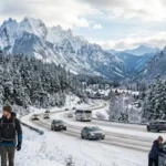
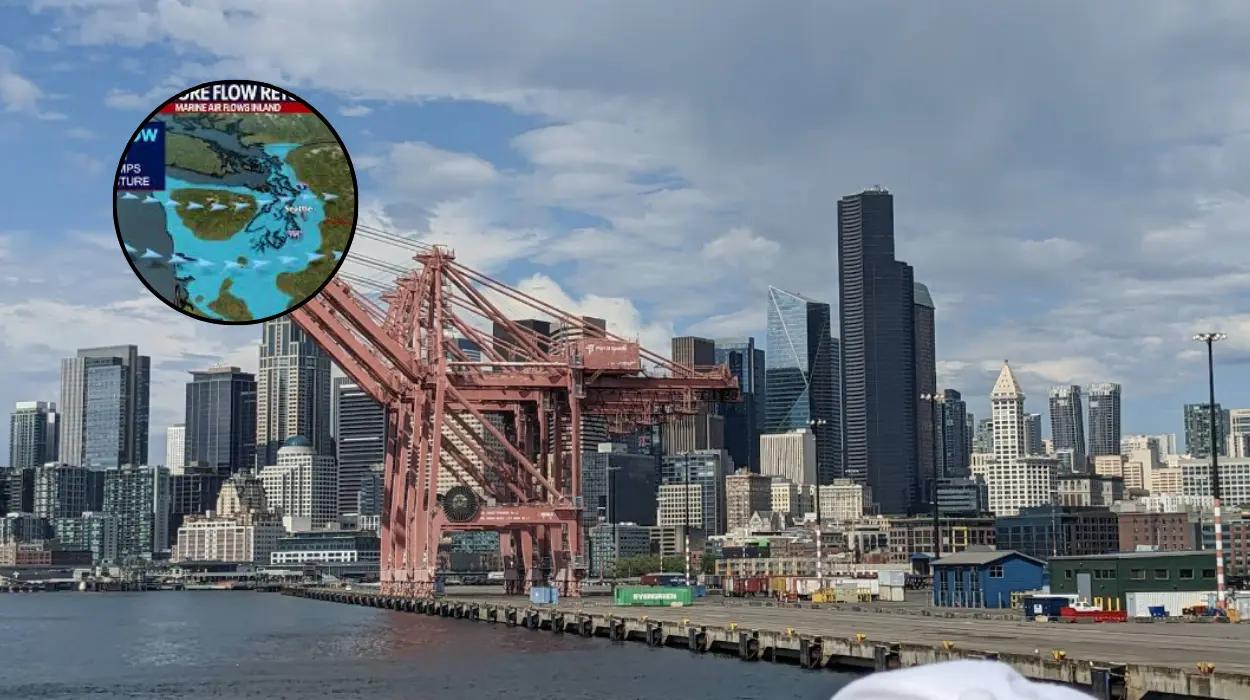
Seattle (Evening Washington News) May 21, 2026.The Pacific Northwest is currently experiencing an extended stretch of unseasonably warm and clear weather, with temperatures consistently reaching into the 70s across the metropolitan area. As reported by local meteorological services at 6:56 AM PDT, the persistent high-pressure system has cleared out the region’s signature morning marine layer, leading to uninterrupted sunshine and daytime highs well above the historical May average for western Washington.
- Key Points
- What Is Causing the Current Warm and Sunny Weather Pattern in Seattle?
- How Are Local Residents and Infrastructure Responding to the Warm Spell?
- Transportation and Commuter Adjustments
- What Do the Specific Meteorological Sources Report About the Outlook?
- Background of the Particular Development
- Historical Averages vs. Current Observations
- Long-Term Climate Context
- Prediction: How This Development Can Affect the Audience
- Impacts on Regional Agriculture and Water Management
- Escalation of Early-Season Wildfire Risks
What Is Causing the Current Warm and Sunny Weather Pattern in Seattle?
The primary driver behind the current atmospheric conditions is a robust ridge of high pressure that has anchored itself over the US Pacific Northwest.
According to senior meteorologists tracking regional climate systems, this upper-level ridge acts as a physical barrier, deflecting the standard track of cool, moisture-laden Pacific fronts northward into Canada.
Consequently, the typical onshore flow—which frequently brings cool air, clouds, and drizzle from the Pacific Ocean into the Puget Sound basin—has been temporarily suppressed.
In its place, a light offshore wind pattern has emerged, drawing warmer, drier air from the interior of the continent toward the coast.
This lack of cloud cover allows for maximum solar heating throughout the day, driving afternoon temperatures rapidly into the mid-70s.
How Are Local Residents and Infrastructure Responding to the Warm Spell?
With daytime temperatures hovering comfortably between 70°F and 75°F, public parks, beaches, and outdoor spaces across Seattle are seeing an unprecedented influx of visitors for this time of year.
Locations such as Alki Beach, Green Lake, and Discovery Park have reported high foot traffic. Local business owners, particularly those operating outdoor dining venues, cafes, and bicycle rental shops, have noted a significant early-season boost in revenue, adapting quickly to a demand layout that typically does not mature until late June or July.
Transportation and Commuter Adjustments
The clear visibility and dry road conditions have generally improved traffic flow during peak commuting hours, eliminating the weather-related delays common to wet spring mornings in the city.
However, transport officials have issued standard advisories regarding increased pedestrian and cyclist traffic along major arterial routes and recreational corridors.
What Do the Specific Meteorological Sources Report About the Outlook?
As documented by weather analysts across multiple regional monitoring networks, the current dry spell is notable for its consistency. Daily observations indicate that relative humidity levels have dropped below standard late-spring averages, falling into the 30% to 40% range during peak afternoon hours.
The wind profile remains relatively calm, with northern to northeasterly breezes averaging between 5 and 10 miles per hour, offering minimal cooling effect.
Meteorologists note that while daytime temperatures are comfortably warm, the lack of cloud cover is causing rapid radiative cooling after sunset. This results in relatively crisp nocturnal conditions, with overnight lows dipping back down into the upper 40s and lower 50s, providing a natural cooling period for urban infrastructure.
Background of the Particular Development
To understand the significance of the current weather pattern, it is necessary to examine Seattle’s historical climate data for the month of May.
Typically, May in the Pacific Northwest is characterized as a transitional month, often colloquially referred to by locals as part of the “Junuary” phenomenon, where true summer conditions are delayed by persistent cool, grey, and damp maritime air masses.
Historical Averages vs. Current Observations
Historically, the average daily high temperature for Seattle in late May sits around 65°F (18°C), with an average of 12 to 14 days of measurable precipitation throughout the month. The current shift to sustained 70°F+ temperatures without intermittent rainfall represents a statistically significant departure from these baselines.
Long-Term Climate Context
Over the past decade, climatologists have observed an increasing frequency of early-season high-pressure ridges across the West Coast of North America. These anomalies are frequently linked to broader shifts in the jet stream configuration.
While single weather events cannot be directly attributed to long-term climate shifts, the repetition of these dry, warm spring intervals aligns with established predictive models that suggest an earlier onset of summer-like conditions and a corresponding contraction of the traditional Pacific Northwest spring.
Prediction: How This Development Can Affect the Audience
The continuation of this warm and dry weather pattern is poised to influence several segments of the local population and regional operations in distinct ways over the coming weeks.
For the general public, the immediate future holds continued opportunities for outdoor exposure, but it also introduces practical considerations.
Homeowners will likely experience an earlier-than-usual increase in household water consumption as they attempt to maintain lawns and landscaping against unseasonable evaporation rates. Additionally, individuals sensitive to seasonal allergies are likely to face an accelerated and prolonged pollen season, as the sustained sunshine and warmth trigger simultaneous blooms across regional flora, spiking the local allergen index.
Impacts on Regional Agriculture and Water Management
From an environmental and resource perspective, the lack of late-spring rainfall could hasten the depletion of soil moisture across western Washington’s agricultural zones.
Water management authorities will be monitoring the mountain snowpack levels closely; while warm temperatures accelerate melting, the absence of fresh spring snowfall means that reservoirs must be managed conservatively to ensure adequate supply for the peak summer months.
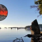
Escalation of Early-Season Wildfire Risks
Perhaps the most critical implication of this development is its impact on forestry and fire management personnel. A prolonged stretch of dry, 70-degree weather in May cures fine fuels—such as grasses, brush, and dead leaves—much earlier in the season than usual.
If the high-pressure system remains entrenched without a return to standard damp conditions, regional fire agencies predict an elevated risk of early-season brush fires and wildfires, forcing an early deployment of monitoring resources and the potential implementation of burn bans ahead of the traditional summer schedule.