Key Points
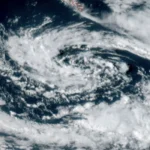
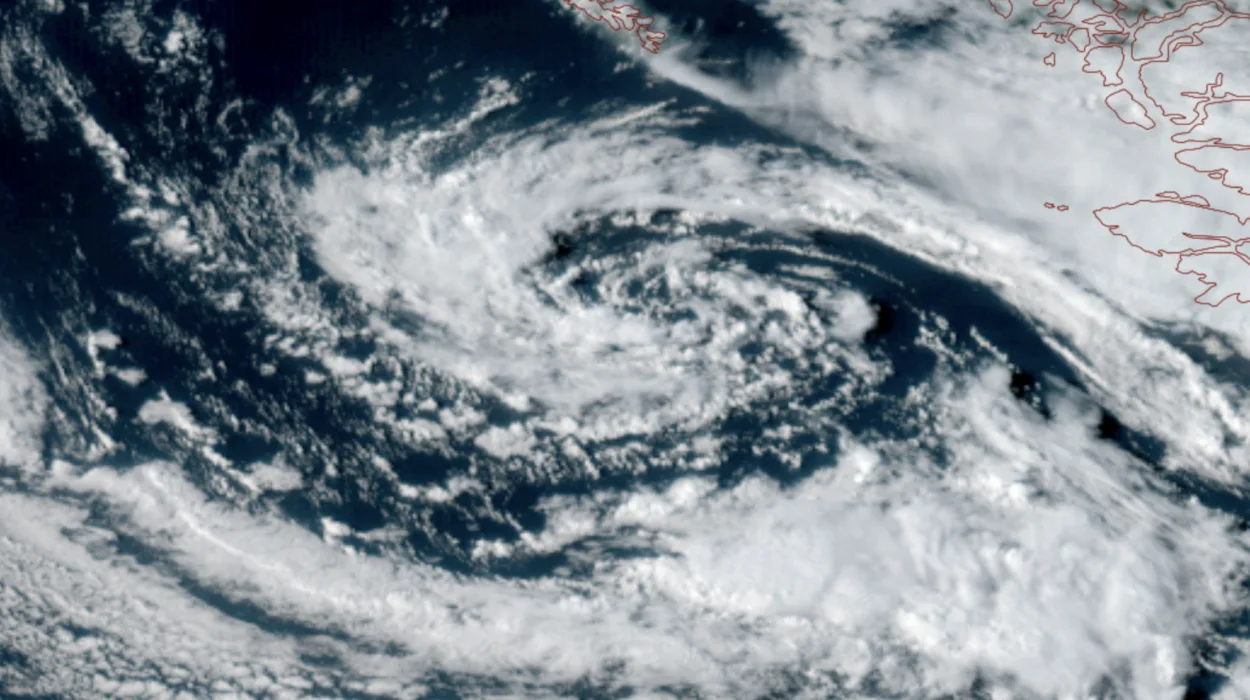
- The storm system showed up in the satellite imagery of GOES-18, and it was characterized by an active, rotating low-pressure area.
- The storm caused a slow cold front to arrive at Western Washington in the evening.
- The winds were stronger in the Northwest interior, with wind speeds reaching from 40 to 45 mph, while in Seattle and Puget Sound, the speeds were weaker, in the range of 30 mph.
- The weather will become erratic with sporadic showers under a cool, unstable air mass.
- There is a possibility of thunderstorms and lightning in the Olympic, Cascade, and Eastern Washington.
- The low-pressure system is expected to slowly move away from the Northwest during Labor Day weekend.
Seattle (Evening Washington News) September 3, 2026 – Active weather has officially returned to the Pacific Northwest, bringing a dramatic visual spectacle from space alongside a sharp transition into meteorological autumn.
A striking low-pressure system began spinning down the British Columbia coast on Wednesday, capturing the attention of meteorologists and regional weather enthusiasts who spent the summer months tracking calmer skies.
The storm system has initiated a sequence of wet, windy conditions that are altering outdoor plans across Western Washington.
As reported by journalist Scott Sistek of Emerald City Weather, the atmospheric disturbance arrived as
“a sight for sore eyes — at least to those of us who missed active weather over the summer”.
The system propagated a slow-moving cold front through the region, which was clearly visible on satellite loops sweeping across Western Washington.
What Are the Wind and Rain Impacts Across Western Washington?
The frontal passage immediately ramped up wind speeds across various sub-regions. According to data highlighted by Scott Sistek of Emerald City Weather,
“The Northwest Interior was the wind champions so far Wednesday with gusts up to 40-45 mph”.
Meanwhile, urban hubs experienced more moderate breezes, with Scott Sistek noting that
“The Seattle/Puget Sound area has been gusting in the low 30 mph range — nothing we can’t handle”.
Following the initial frontal boundary, the region’s weather profile is transitioning into an unstable, showery regime. As explained by Scott Sistek of Emerald City Weather,
“Now that the front has passed, we turn our attention to more of a hit-and-miss shower pattern as the low brings cool, unstable air mass to the Northwest”.
Will the Storm Produce Severe Thunderstorms in Seattle?
While steady precipitation remains a primary factor, the unstable atmosphere carries minor convective risks. Meteorological models indicate that heavy downpours could occasionally escalate, particularly into Thursday.
Regarding the threat of thunder, Scott Sistek of Emerald City Weather stated that
“The thunderstorm risk is pretty low, but I suspect some folks will hear a few rumbles of thunder”.
Furthermore, specialized areas face a heightened electrical threat, with Scott Sistek pointing out that
“Lightning will be more likely in the Olympics and Cascades and in Eastern Washington”.
Residents stepping outside between precipitation bands will experience variable conditions. As described by Scott Sistek of Emerald City Weather,
“In between the showers, the skies will feature plenty of sunbreaks so it’ll be one of those ‘if you don’t like the weather, wait 20 minutes’ sort of days”.
Explore More Weather News
Fall Weather Forecast Hits Pierce County 2026
Seattle Weather Brings Cooler Showers and Mountain Storms 2026
How Long Will the Low-Pressure System Impact Labor Day Weekend?
The stagnant nature of the upper-level low means unsettled conditions will persist for several days, directly impacting holiday weekend plans. Forecasters predict a gradual dissipation of the system’s energy.
Outlining the long-range trajectory, Scott Sistek of Emerald City Weather reported that
“The low is forecast to slowly fizzle in strength, but drift around the Northwest into the Labor Day weekend”.
This positioning ensures that the atmosphere remains volatile. Scott Sistek added that
“That means the air mass will remain unstable through at least Sunday with a risk of showers each day, but as the low slowly loses strength, the number and frequency of showers will diminish”.
Mountainous corridors and Eastern Washington will retain a slight lingering threat of thunderstorms through this period.
When Will Clearer Skies Return to the Region?
Relief from the persistent trough is expected early next week as the system finally ejects eastward.
Providing a timeline for normalization, Scott Sistek of Emerald City Weather noted that
“It looks like the low will be a shadow of itself by Sunday, and it’s expected to release its grip on our weather by Monday or Tuesday next week”.
Looking further ahead toward mid-September events, forecasters are monitoring potential windows of improvement. Scott Sistek observed that
“We may sneak in just enough of a brief drier and warmer break in the middle of next week for the Seahawks home opener, but the long-range models are at least trending in renewing cool and showery toward the end of next week”.
Until then, regional meteorologists will continue tracking the evolution of the system via advanced satellite feeds like GOES-18, ensuring that while the weather may turn damp and unpredictable, it continues to deliver impressive visual phenomena from orbit.