Key Points
- High-intensity morning fog significantly reduced driver and commuter visibility across the Washington, D.C. metropolitan area early Wednesday morning.
- The meteorological phenomenon occurred directly after a series of scattered rain showers swept through the region, leaving the local terrain saturated with moisture.
- Regional atmospheric conditions remained heavily destabilised overnight, keeping temperatures locked in the low-to-mid 70s Fahrenheit alongside elevated dew points holding firm in the upper 60s.
- Relative humidity levels swiftly reached 100 per cent near ground level around sunrise, accelerating the conversion of standing liquid moisture into a thick blanket of radiation fog.
- Commuters navigating major regional thoroughfares faced immediate delays, requiring widespread illumination of vehicle fog lights and reduced speeds during the peak morning rush.
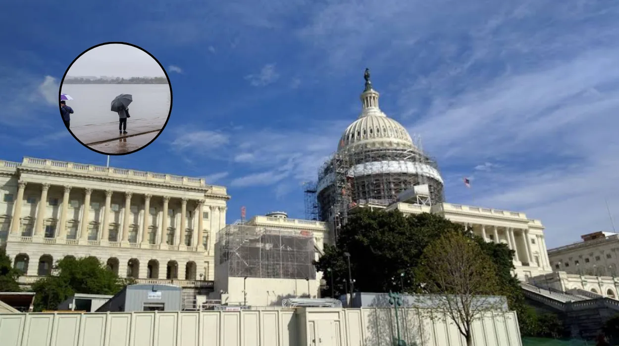
Washington (Evening Washington News) July 8, 2026 – Heavy patches of localized morning fog blanketted the greater Washington, D.C. metropolitan region early Wednesday morning, severely reducing visibility for thousands of daily commuters immediately following a wave of scattered regional rain showers. As reported by the meteorology unit of 7News, the sudden drop in atmospheric visibility developed around sunrise as ground-level relative humidity rapidly peaked at 100 per cent across the District, Maryland, and Northern Virginia (DMV) landscape. Weather tracking data confirmed that the residual moisture left behind on area roadways, grass, and trees acted as a thermal sponge, which subsequently evaporated into the humid overnight air mass to create a saturated, low-lying cloud formation across regional transit corridors.
Why Did Rain Showers Trigger Massive Morning Fog Across Washington?
According to detailed analysis published by the 7News StormTrack weather team, the development of Wednesday’s thick fog was entirely dependent on a precise sequence of environmental factors that altered the lower atmosphere over a 12-hour period.
Meteorologists noted that the scattered showers moving across the capital region during the prior afternoon and evening hours left a dense layer of moisture across local infrastructure, trees, and soil systems.
As night fell, this widespread environmental water began to evaporate back into the lowest levels of the boundary layer.
Because ambient overnight temperatures failed to cool significantly—stagnating instead in the low 70s Fahrenheit—the warm air mass retained an unusually high capacity to hold gaseous water vapor.
How Do Dew Points and 100% Humidity Create Ground-Level Clouds?
A secondary report issued by the 7News forecasting desk emphasized that dew points remaining stubborn in the upper 60s created a narrow thermal window for saturation.
In meteorological terms, when the actual air temperature cools down to meet the dew point temperature, the air becomes entirely saturated, meaning it can no longer hold water in its gaseous form.
With relative humidity levels hitting the maximum 100 per cent threshold near the ground just as the sun began to rise, the excess water vapor rapidly condensed into tiny, suspended liquid water droplets.
This scientific process effectively creates a cloud at ground level, which manifests to the public as dense radiation fog.
What Impact Did Reduced Visibility Have on DMV Morning Commuters?
The physical impact of the fog was felt almost immediately across the regional transport network as visibility dropped to less than a quarter-mile in several low-lying suburban sectors.
Local transit monitors reported that major commuter arteries—including the Interstate 495 Capital Beltway, Interstate 66, and the Interstate 95 corridor—experienced noticeable speed reductions as motorists adjusted to the sudden visual impairment.
7News safety advisories urged drivers to utilize low-beam headlights or specialized fog lights, maintain extended braking distances between vehicles, and prepare for sudden changes in visibility when transitioning between elevated highways and low-lying river valleys near the Potomac.
Background of Regional Fog Developments
The occurrence of dense fog following summer or early autumn rain showers is a well-documented microclimate characteristic of the Mid-Atlantic United States.
The geological topography of the Washington, D.C. basin—which sits low along the banks of the Potomac and Anacostia rivers—naturally traps heavy, moisture-laden air masses when regional wind speeds remain calm overnight.
Historically, when warm-season cold fronts pass through the area, they leave behind high soil-moisture anomalies.
If these fronts are not accompanied by strong, dry clearing winds, the combination of a wet surface and a clearing sky creates an ideal thermodynamic environment for rapid, widespread condensation events.
Meteorological Predictions and Direct Audience Impacts
Looking ahead at regional weather cycles, meteorologists predict that this specific type of moisture-driven fog will continue to manifest with greater frequency as the region shifts through volatile summer and transitional autumn weather patterns. For the general public, this development carries distinct logistical and physiological implications.
Daily commuters can anticipate a higher volume of early-morning transit delays, which will require an adjustment to departure times and an increased reliance on active highway monitoring systems. Furthermore, for regional aviation, these localized saturation events are expected to trigger short-term ground delays and rolling schedule alterations at Ronald Reagan Washington National Airport (DCA) and Washington Dulles International Airport (IAD) during peak early-morning departure banks.
Additionally, prolonged high-humidity settings at ground level directly compound urban air quality issues; the stagnant boundary layer traps ground-level particulates and seasonal allergens close to the surface, presenting ongoing challenges for residents managing chronic respiratory or asthmatic conditions across the metropolitan area.